 |
by Press on (#4YXWZ)
Construction software pioneer iRoofing develops iRoofConnect™, advancing a corporate objective – Technological Inclusion The key product on display when iRoofing exhibits this week at the International Roofing Expo in Dallas is not its newest cloud solution nor its iPhone release. Instead, the big news will be the software company’s accomplishments around technological inclusion. Since iRoofing’s start in 2011, […]
|
sUAS News
| Link | https://www.suasnews.com/ |
| Feed | http://www.suasnews.com/feed |
| Updated | 2026-01-27 11:00 |
 |
by Press on (#4YXX1)
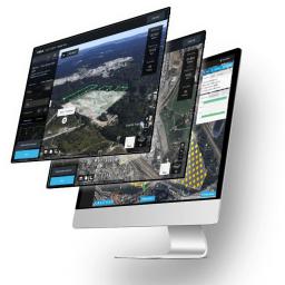
vHive, the only software solution that enables enterprises to digitize their field assets and operations using autonomous drone hives, announced today the release of an AI driven Auto Discovery™ capability for simplifying and shortening data acquisition in communication tower inspections. “Tower companies require a scalable level of automation as part of their digital transformation process. vHive’s AI […]
|
 |
by Press on (#4YWR1)
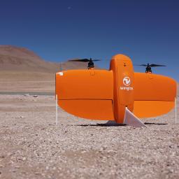
Wingtra introduces high-altitude propellers, which enable unprecedented accuracy and coverage for a professional mapping drone capturing data above 3000 m (9840 ft) above mean sea level (AMSL). Customers in South America, China, Central Europe and other regions featuring high altitudes can now map high terrain at down to 1 cm (0.4 in) GSD. Specifically, the new high-altitude […]
|
 |
by Press on (#4YWR3)
Commercial drones are making rapid inroads into almost every industrial sector – such ‘eyes in the sky’ are turning out to be invaluable for inspecting critical infrastructure, high-value assets, public events, large farms, and even underground mines. The combination of commoditized hardware, intelligent automation software and proactive regulation is serving as a tail-wind for the […]
|
 |
by Press on (#4YWR5)
Terra Drone Europe, a group company of Japan-headquartered Terra Drone Corporation, and the British-Dutch transnational consumer goods giant Unilever have joined forces to explore drone-delivery of ice creams in New York. In a program undertaken at Unilever’s recent annual investor event, Ben & Jerry’s ice cream cups were delivered to a pre-decided destination by drone. The demo was conducted as part […]
|
 |
by Press on (#4YWR7)
Aerodyne Group (“Aerodyneâ€) welcomes North Summit Capital, Arc Ventures and Leave a Nest as key strategic partners and investors. This will power Aerodyne’s entry into key growth markets, namely China, India and Japan. The partnership with North Summit Capital will also contribute towards the deepening of Aerodyne’s technological capabilities in Artificial Intelligence (“AIâ€), machine learning, cloud computing, as well as data technology and […]
|
 |
by Press on (#4YWAJ)
The world’s only ready to fly autopilot and avionics system for VTOL (vertical take-off and land) aircraft! The ALTI AvioX is a fully featured, high quality autopilot, flight control and power distribution system all in one, with an ultra compact package, designed specifically for VTOL aircraft from the ground up. The ALTI AvioX is truly plug-and-play, and supports a […]
|
 |
by Press on (#4YWAM)
DJI, the world leader in civilian drones and aerial imaging technology, offers high-security solutions for governments wishing to use drones in their operations. The DJI Government Edition is an integrated drone solution created specifically for use in high-security situations and is highly customizable to ensure fulfilling all the needs of governments and agencies. It has been tested […]
|
 |
by Press on (#4YV7Q)
The Federal Aviation Administration (FAA) is announcing and requesting comments on its policy for the type certification of certain Unmanned Aircraft Systems as a special class of aircraft under our regulations. Comments must be received on or before March 4, 2020. The FAA invites interested parties to submit comments on the policy described in this […]
|
 |
by Gary Mortimer on (#4YV7R)
Adsys Controls, Inc. has delivered their XSight 1721 next generation video processor to its first customers. The XSight 1721 provides advanced video processing solutions for applications that require reduced Size, Weight, and Power (SWaP). In a form-factor the size of a business card, it provides a multitude of video processing features including target tracking, object […]
|
 |
by Press on (#4YV7T)
Highest quality, excellent customer care and an efficient, sustainable, lean manufacturing process are the focus of the UAS engine manufacturer Sky Power GmbH from Germany. This has now been confirmed with the successful ISO recertification. “The recognition is important for us as an international company†explains managing director Karsten Schudt of Sky Power GmbH. ISO […]
|
 |
by Press on (#4YV7W)
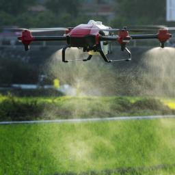
It is of greatest concern that the novel coronavirus (2019-nCoV) has spread through more than 20 countries and become a global health emergency. To address the urgent need for strengthening disease prevention measures, a Chinese agriculture technology company XAG announced on Friday that it would set up a 5-million-yuan special fund on coronavirus response, calling for voluntary […]
|
 |
by Press on (#4YV7Y)
Fortem Technologies, Inc., the market leader of C-UAS security and defense solutions, announced today the addition of TrueView® R30 radar to Fortem’s end to end C-UAS solution. As the newest addition to Fortem’s industry-leading array of radar products for advanced drone detection and threat assessment, the TrueView R30 radar offers unprecedented clutter rejection, making it the […]
|
 |
by Press on (#4YRH8)
Iris Automation today announced it has been selected as the detect and avoid (DAA) provider to ZM Interactive (ZMI) drones, enabling ZMI customers to conduct Beyond-Visual-Line-of-Sight (BVLOS) operations. Iris is the critical missing piece that takes commercial drone operations from theoretical to functional, by enabling Unmanned Aircraft Systems (UAS) to fly Beyond-Visual-Line-of-Sight (BVLOS). The Iris […]
|
 |
by Press on (#4YPXB)
DJI Aeroscope can identify the most popular drones on the market today by monitoring and analyzing their electronic signals to gain critical information. As consumer DJI drones become more popular, there are rising challenges in safety and security for areas such as airports, prisons, nuclear power plants, prohibited military zones and various government sites and infrastructures. Traditional protections […]
|
 |
by Press on (#4YPXD)
Sydney – Advanced Navigation, a leader in Inertial Navigation Systems, announced the appointment of a key executive, John Colvin, as Chief Revenue Officer. This appointment demonstrates the company’s commitment to investing in its leadership talent to foster continued growth. “It’s an incredibly exciting time to join Advanced Navigation right now. The strength of our navigation and positioning […]
|
 |
by Press on (#4YPXF)
CAVCOE is hosting and organizing the 2020 Canadian Automated Snow Plow Competition in Canada. Autonomous snow plows are a next-generation engineering challenge that have tremendous economic and social potential. The aim of this student competition is to provide an opportunity for students to apply their knowledge and skills from the classroom to a tangible real-world problem, and to develop technical and business skills […]
|
 |
by Press on (#4YP1K)
The Government has confirmed that it will be reviewing lower airspace infrastructure during a debate on a new airspace law. In her opening remarks, Baroness Vere of Norbiton (Parliamentary Under-Secretary of State at the Department for Transport) confirmed that the Government will be reviewing controlled airspace, saying that the programme would include “airspace changes that […]
|
 |
by Press on (#4YP1N)
In its broad mission to effectively manage over 500 million acres of land across the United States and its territories, the Department of the Interior has in recent years turned to drone technology to help get the job done. The DOI’s fleet of 810 civilian drones – only about 20 percent of which are DJI […]
|
 |
by Press on (#4YN78)
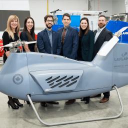
Saint-Joseph-de-Coleraine , January 29, 2019 – Laflamme Aéro, located in the Thetford Mines region, announces the conclusion of a $ 2 million round of financing in which Investissement Québec, Anges Québec and Anges Québec Capital. Investments that are timely for the company which is preparing to market its LX300 drone from 2020, the first aircraft in the world […]
|
 |
by Press on (#4YN7A)
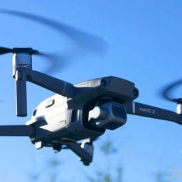
UPS (NYSE:UPS) and Henry Schein, Inc. (Nasdaq: HSIC) today announced an agreement to explore and test a variety of drone delivery use cases. The use cases would examine unmanned aerial vehicles within business-to-business operating models. The initiative to explore drone deliveries will begin in 2020 and will focus on testing the transport of essential healthcare products […]
|
 |
by Press on (#4YN7C)
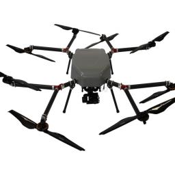
DJI, the world’s leader in civilian drones and aerial imaging technology, is extremely disappointed by the U.S. Department of the Interior (DOI) order released today which inappropriately treats a technology’s country of origin as a litmus test for its performance, security and reliability. This action will ground the entire DOI drone program, which relies on […]
|
 |
by Press on (#4YMWS)
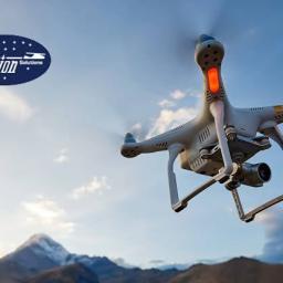
Skyfront, the leading provider of hybrid-electric Unmanned Aerial Vehicles (UAVs), and Silvus Technologies, a leading provider of Multi-Input Multi-Output (MIMO) communications, announced today a partnership that combines Skyfront’s five-hour endurance Perimeter UAV with Silvus’ high-power StreamCaster radios. The combined product, the Perimeter XLRS, can fly for up to 5 hours while maintaining command and control […]
|
 |
by Press on (#4YMWV)
Avion Unmanned, the Unmanned Aircraft Systems (UAS) division of Avion Solutions, Inc., signed a Participating Addendum with the State of New Mexico’s agencies, commissions, institutions, political subdivisions and local public bodies allowed by law. Under New Mexico Statewide Price Agreement #00-00000-19-00041AA, this contract opens the door for Avion Unmanned to provide UAS services to state and local […]
|
 |
by Press on (#4YK9R)
At Swoop Aero, our goal is to revolutionise the way medicine is delivered to everyone, everywhere. Swoop Aero is an aeromedical drone logistics company that has been operational since 2017. In December 2018, Swoop Aero became the first company globally to provide an immunisation vaccine via drone. In 2019, Swoop Aero conducted flight operations in […]
|
 |
by Press on (#4YK4R)
80% of the British public would support the widespread adoption of drones if better safety, security and monitoring measures were in place. Majority of people support use of drones for emergency response (86%), police assistance (79%), and environmental conservation (61%). Vodafone report makes several policy recommendations, including a drone fund for emergency services and NHS […]
|
 |
by Press on (#4YK4T)
The UK’s emergency services are some of the best in the world, working day and night to keep communities healthy and safe. Increasingly they are embracing new technology, such as drones, to help them carry out their challenging jobs more effectively. Today, drones are used when searching for missing persons and for monitoring known areas […]
|
 |
by Press on (#4YK4W)
Cyberhawk is looking for drone pilots with more than 50 logged flight hours (any drone platform) to support our growing global operations. International assignments already secured. Advanced Training provided. Please send your CV to recruitment@thecyberhawk.com
|
 |
by Press on (#4YK0W)
Stand count analytics available for cotton growers in the 2020 growing seasonSentera announced that its stand count analytics product will be immediately available for cotton crops within FieldAgent.™ This extension to Sentera’s stand count tool will help cotton growers and ag professionals make informed replant decisions via a detailed, acre-by-acre view of plant population throughout […]
|
 |
by Press on (#4YK0Y)
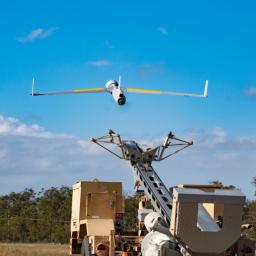
Liteye Systems, Inc. (USA) and Chess Dynamics (UK), a Cohort plc company, have announced the signing of a new strategic alliance agreement between the two companies. The agreement grants Liteye the exclusive right to market a portfolio of Chess products and services in the United States. The strategic alliance provides a robust array of layered […]
|
 |
by Press on (#4YJNB)
Orbital Corporation Ltd (“Orbital UAVâ€, “the Companyâ€) is pleased to announce unaudited preliminary revenue of A$11.4 million for the first six months of the financial year 2020 (“FY20â€). Revenue for the period was underpinned by shipments of Orbital UAV’s initial engine model under its Long Term Agreement (“LTAâ€) with Insitu Inc, a wholly-owned subsidiary of […]
|
 |
by Press on (#4YJ1E)
DroneUp, LLC, an end-to-end drone pilot service provider for aerial data collection, is pleased to announce that it has been named an Unmanned Aircraft System Service Supplier (USS) to provide the Low Altitude Authorization and Notification Capability (LAANC) initiative for the Federal Aviation Administration (FAA). DroneUp’s LAANC capability will be available in-app through Airspace Planner […]
|
 |
by Press on (#4YJ1G)
Iridium Communications Inc. (NASDAQ: IRDM) announced today that Iridium CloudConnect, the first and only satellite cloud-based solution offering truly global coverage for Internet of Things (IoT) applications, is now actively serving customers. This new service combines Iridium® IoT capabilities with Amazon Web Services (AWS) IoT and cloud services extending customers’ IoT reach to the more than […]
|
 |
by Press on (#4YJ1J)
Air Traffic Management and Unmanned Aircraft Bill, giving greater police powers to prevent misuse, has second reading. police will have the power to land, inspect and seize an unmanned aircraft thanks to new legislation new stop and search powers around airports and prisons will help tackle illegal drone use, and those breaking the law could […]
|
 |
by Press on (#4YFZA)
ELTA Systems, a subsidiary of Israel Aerospace Industries (IAI\ELTA), has successfully tested its Drone Guard solution at several large international airports in Europe, Latin America and Southeast Asia. Airport operators globally are actively seeking countermeasures to assist in handling the threat of drones around airport terminals and especially on the runways. The demand for drone […]
|
 |
by Press on (#4YFZC)
Yates Electrospace Corporation (YEC), whose Silent Arrow platform is bringing disruptive innovation to the heavy payload, unmanned cargo delivery market, today announced the design completion and specifications of a wide-body version of its successful GD-2000 cargo delivery drone, with unveiling set for July 20-24, 2020 at YEC booth 4470, Farnborough International Airshow, UK. Developed by YEC based on real-time […]
|
 |
by Press on (#4YFZE)
The first prototype of Delft Dynamics’ DroneSphere is revealed, thanks to students of the Avans University of Applied Sciences, Minor Aerospace Engineering & Maintenance (Breda). This is the first ball-shaped DroneBox in the world, as far as known, and the biggest advantage is its perfect water resistance thanks to a rotating hemisphere. These types of […]
|
 |
by Press on (#4YFZG)
At MAG, we provide and enable real-time situational awareness to help our customers make the world smaller and safer. We are laser focused on serving our customers by providing technical expertise, operational excellence, and flawless execution. Relentlessly driven by our dedication to service and performance, we have become the leading independent provider of manned/unmanned full-spectrum […]
|
 |
by Press on (#4YFZJ)
UK drone specialist Heliguy has unveiled a bespoke DJI Mavic 2 drone cage, which is now available to pre-order and offers a lightweight and collision-proof solution ideal for internal inspection and enhanced flight safety. Designed and built by Heliguy’s expert in-house research and development team, this new robust product will maximise data collection and missions […]
|
 |
by Press on (#4YFRV)
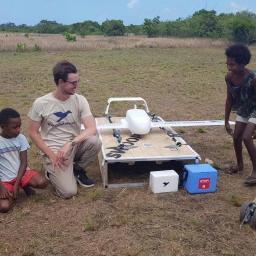
Job Number: 529385 | Vacancy LinkLocations: Africa: MalawiWork Type : Consultancy UNICEF works in some of the world’s toughest places, to reach the world’s most disadvantaged children. To save their lives. To defend their rights. To help them fulfill their potential. Across 190 countries and territories, we work for every child, everywhere, every day, to build a […]
|
by Press on (#4YFRX)
It started with a dream to use robots to revolutionise the way companies operate, and it’s now been four years since they pooled their savings to make that dream a reality, a move that Hafslund Nett calls ‘a quantum leap’. ‘I thought I’d end up in a normal job,’ says Håkon Kjerkreit (30), who hails […]
 |
by Gary Mortimer on (#4YFRY)
In our world, we know Dr Andrew Tridgell as simply Tridge, his groundbreaking work in the software world has been recognised by the Australian Government. He has been awarded the Medal of the Order of Australia in the 2020 Australia Day honours list. This medal is given for service worthy of particular recognition Just one […]
|
 |
by Press on (#4YFS0)
Demonstrating the Ability to Transport Goods in Mountainous Areas with UAV Technology developed through Terra Drone Corporation JAL and Terra Drone reach deal to test UAV technology Full-scale demo flight in the city of Yabu, Japan during spring season of 2020 To verify the feasibility of transporting goods in mountainous areas during an emergency TOKYO, […]
|
 |
by Press on (#4YFMK)
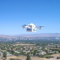
Flirtey, the industry-leading drone delivery service, released today a rare, inside look at the startup company’s headquarters and operations. The five-and-one-half-minute video offers never-before-seen visuals on how Flirtey’s unique inner workings are disrupting traditional logistics, by delivering enhanced convenience to consumers. Flirtey’s cutting-edge technology, creative team, and flexible culture are pioneering the drone delivery industry. […]
|
 |
by Gary Mortimer on (#4YDJB)
James Norrod has been named as our new Chief Executive Officer. Michael Chasen will lead PrecisionHawk’s advisory board and continue to champion efforts to integrate commercial drones into the National Airspace as Chair of the FAA’s Drone Advisory Committee. Mr. Norrod brings more than 25 years of experience leading companies in highly regulated industries, including public and […]
|
 |
by Press on (#4YC2H)
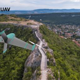
Atmos UAV, the fast-growing Delft-based drone manufacturer that develops high-end VTOL fixed-wing drones for surveying and mapping applications, enters the Balkan region and appoints Vekom GEO as its official distributor in Bulgaria. Through this collaboration, Vekom Geo will offer Marlyn drones to local surveyors, and provide them with support and first-line maintenance. Vekom Geo, a […]
|
 |
by Press on (#4YC2K)
Ten African startups have been selected as finalists in the first African Drone Business Challenge. The finalists represent 9 African countries – Benin, Democratic Republic of Congo, Kenya, Malawi, Nigeria, South Africa, Tanzania, Zambia, and Zimbabwe. Each finalist will participate in a live pitch and award ceremony on Thursday, Feb 6 at the African Drone […]
|
 |
by Gary Mortimer on (#4YBXX)
Gregory Crutsinger (PhD) and the team have released a new online masterclass called the Farm Drone Sensor Showdown, built from years of experience using UAVs in precision agriculture. San Francisco, CA. Scholar Farms, a drone educational consultancy that produces state-of-the- art video training materials for drone mapping, today released their third online masterclass called the […]
|
 |
by Press on (#4YBXZ)
In the not so distant future, more and more drones will be flying around delivering packages, performing utility work, taking real estate photos, and helping with emergency services. When that time comes, how do we ensure those drones can safely fly in our neighbourhoods? That’s the question that Bob Roth, a director with Amazon Prime Air, […]
|
 |
by Press on (#4YBSP)
Applied Navigation is pleased to announce our software licensing agreement with AFRL to provide Vigilant Spirit Control Station to our users. Vigilant Spirit is largely unknown in the commercial world, but it will be a great fit for any autonomous system that needs to get work done on a daily basis. The delineation of roles […]
|