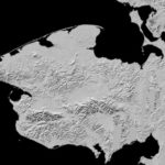
Supercomputing 3D Elevation Maps of Alaska on Blue Waters

Today, the National Geospatial-Intelligence Agency and NSF released 3-D topographic maps that show Alaska's terrain in greater detail than ever before. Powered by the Blue Waters supercomputer, the maps are the result of a White House Arctic initiative to inform better decision-making in the Arctic. "We can't live without Blue Waters now," said Paul Morin, head of the University of Minnesota's Polar Geospatial Center. "The supercomputer itself, the tools the Blue Waters team at NCSA developed, the techniques they've come up with in using this hardware. Blue Waters is changing the way digital terrain is made and that is changing how science is done in the Arctic."
The post Supercomputing 3D Elevation Maps of Alaska on Blue Waters appeared first on insideHPC.