An Interactive Map That Predicts the Best Time for Fall 2016 Foliage in the Continental United States
by Glen Tickle from Laughing Squid on (#1TZA2)
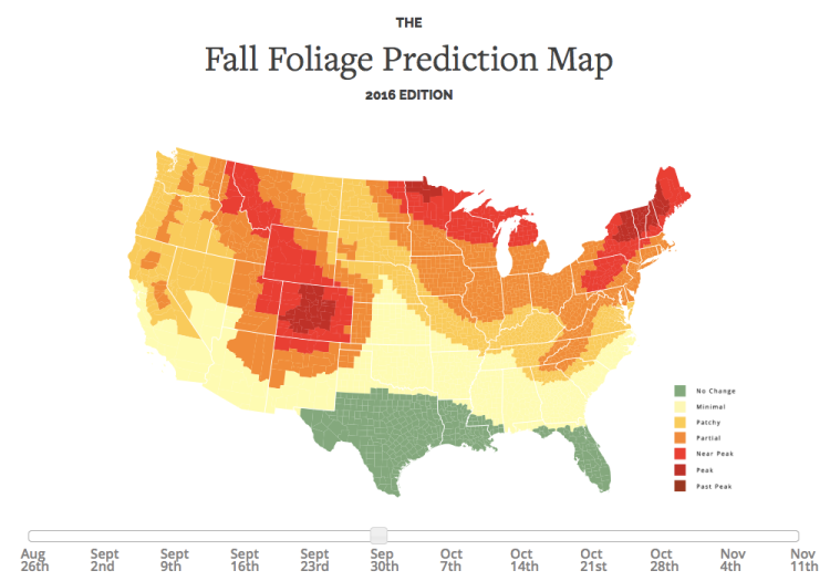
SmokyMountains.com has released its annual interactive map that predicts the best time for viewing fall foliage in the continental United States. Users can use a slider to change the details of the map by week to see when the foliage in their area is expected to peak.
The page also includes an explanation of why leaves change color in the fall, and the chemical compounds that give them their colors.
Related Laughing Squid PostsThe 2016 Fall Foliage Map is the ultimate visual planning guide to the annual progressive changing of the leaves. While no tool can be 100% accurate, this tool is meant to help travelers better time their trips to have the best opportunity of catching peak color each year.