Aviva Stephens: Pedaling my way to the 520 Bridge
EDITOR'S NOTE: Aviva Stephens is a Seattle native and financial professional who discovered the benefits and joys of cycling on her challenging work commute between Ballard and the Eastside. Find more of her writing on Medium and follow her on Instagram at @avivarachelle.
Since bike commuting to and from the Eastside, I have been eagerly awaiting the opening of the new 520 Bridge trail. After years of sitting in traffic due to car accidents, unexpected congestion, and inclement weather, I could not wait to fly past the parking lot of cars on my bike with smile on my face.
The beginningI took the afternoon off December 20 (opening day of the 520 Bridge trail) to enjoy every moment of my glorious ride during what little daylight there was. Fortunately, the 520 bike trail runs right past my office. Below is a pic of the trailhead, SR 520 is just beyond the trees. If you've never been on the trail, it mostly runs alongside SR 520. If not, you've likely noticed a few sparse bike riders to your right while driving eastbound on the highway.
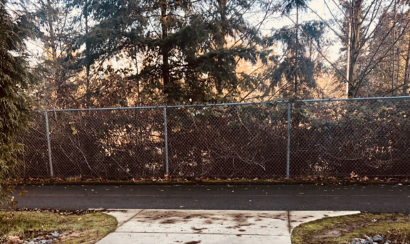
Redwest Campus
While I've ridden parts of this trail around Redmond, I've never taken it all the way to the bridge. So this was an adventure for me. Like many folks who have been waiting for this day, I figured the trail would run along 520 all the way into Seattle. It is called the "520 Trail" after all, right? Not so much. The trail does follow the freeway for the most part, but there are some confusing breaks that can make this ride challenging. In this post I will share my experience with the breaks and offer tips if you look to make the same journey.
The circled section below is where I will focus this post, as it is the most problematic. I tried pulling the directions from Google maps, but the result wasn't quite right. For some reason Google takes you off the proper 520 Trail before it actually ends. I'll go into detail about this later.
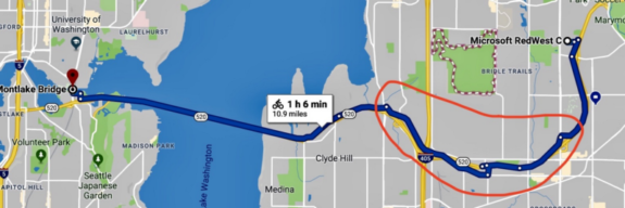
Google Maps: Redwest to Montlake bike directions
Ambiguous intersectionsI hit my first blip a few miles in near NE 29th Pl, but I spotted some confident, friendly riders and followed them back to the trailhead. While this break is just a block, it's confusing, cars are everywhere, and you have to wait for two crosswalk signals"ugh! So pedestrian.
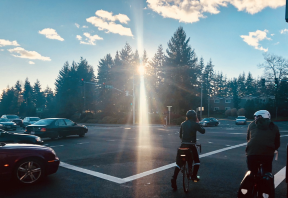
Redmond, NE 29th Pl at 148th Ave NE
The trail head is kitty-corner from where I'm standing. In this situation I would usually get in the left turning lane and pop onto the sidewalk rather than crossing the street twice and waiting on two lights. However, the way the trail dumps you on the sidewalk, getting into the left turning lane is more work than crossing twice. While this obstacle is minor, waiting on the lights to turn is a pain.
Once I got back on the trail it was a down hill breeze, and I thought, "This is gonna be awesome!"
Discovering NorthupHere is the section of the trail circled in the map above, also known as Northrup. I'm not sure if it's a neighborhood or a town, but after my ride I think I know Northup better than Redmond. The light blue line is where I diverged from Google. It's strange because the trail actually continues until the red X. Between the red X and the circle on the left is all street/sidewalk riding, and it's super confusing.
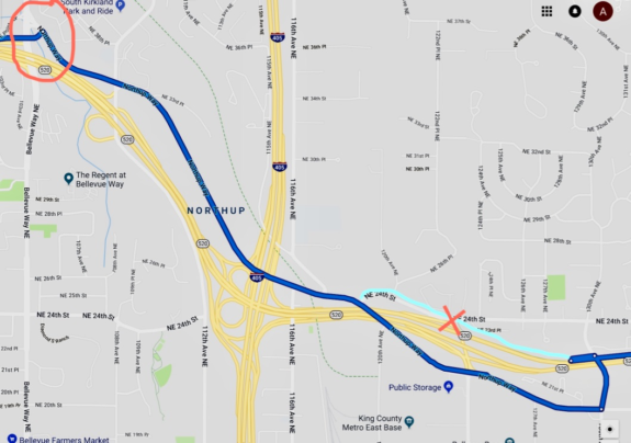
Google Maps: bike directions along highway 520
Here I am at the red X above where the trail dumps me onto the sidewalk of NE 24th St in Northrup. There was a 520 Trail sign, so I guess this piece of sidewalk - including the worn patch of grass on the residential yard to my right where people inevitably ride after crossing the street - is the bike trail.
This is the beginning of a mile and a half break in the 520 Trail.
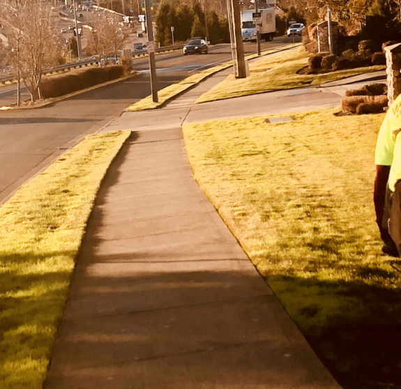
NE 24th Street in Northrup
The ride along NE 24th is narrow and steep, but short. Once I get to the bottom of the hill there's a sharp right turn onto Northup Way, which has a nice, wide and well-signed bike lane for about four blocks. The rest of the ride down Northup Way is a skinny roadside bike lane that felt like it was an old road shoulder line until they painted a bike sign on it. It's only about six or so blocks until the next signs of life, but the road diverges so far from SR 520 that I began to wonder if I was still on the trail.
While writing this post, I was surprised to learn that this section of the trail is actually part of the latest Northup improvements to the 520 trail completed in November 2017. This is disappointing to me because I'm sure this latest development was praised as progress and complete, but my experience was that it felt like the beginning. I fear that the city of Bellevue will pat themselves on the back and fail make future investments in the 520 Trail.
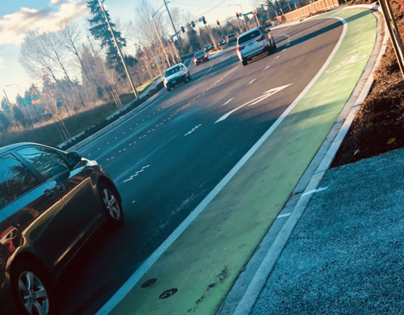
Northup Way & NE 24th Street
After a little self doubt I finally end up at what seems to be the trailhead next to the freeway entrance. This intersection is massive and I have no idea what that sign is trying to tell me, but I see the freeway so I think, "I'll figure it out once I get across the street."
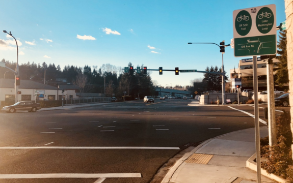
Northup Way & 112th NE Ave
Wrong! I've made it across the street, "What did that sign say?"
I see a bike sign and a bike lane near the freeway entrance, so that must be it. Wrong again. I bravely pedaled up that death trap and promptly got lost. After back pedaling to the sea of signs, I noticed a group of experienced riders in the left turning lane on Northup Way and followed them to the trailhead.
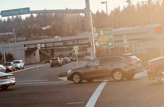
112th NE Ave & Northup Way
Oh yes, the trail. From here on out it was smooth, protected-bike-trail sailing until I got to Seattle. This segment of the trail is a bit hilly, but doable.
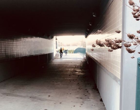
Northup Way just before Bellevue Way NE
Looking back at my Northup journey, the 520 missing link is much simpler to navigate than the signage and Google Maps might indicate. To sum it up, here's my way of navigating Northup missing link: Once the proper 520 Trail ends, make a left on NE 24th St, turn right onto Northup Way, then left onto the 520 trailhead just before Bellevue Way NE. Use any sidewalk, bike lane, road shoulder or traffic lane you are comfortable with to get there. That's it.
The 520 bridgeFinally, I make it to the bridge, and it's breathtaking. This image doesn't begin to express the beauty of the view on this picture perfect day. It was fantastic to see all of the smiling faces, their eyes filled with the opportunity that this trail opening means. The opportunity to take in more fresh air on your daily commute, free yourself from traffic, and experience a unique perspective of the Lake Washington that is usually reserved for the class of folks that can afford boats.
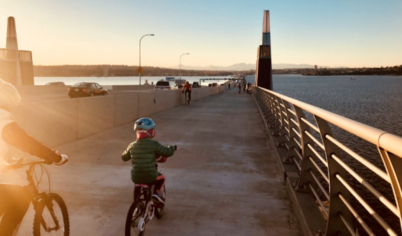
East side of the 520 Bridge
While in awe of the mountains before me and breathing in the fresh crisp air, I quickly noticed the killer cold headwinds. The ride is only around 15 minutes, but the eastbound evening winds are no joke. My toes froze halfway through. Just before I got on the bridge, there was a friendly woman offering toe warmers, but my ego got the best of me, so I pedaled right past her.
SeattleHome sweet home. Pedaling my way into the city via the 520 Bridge was bit of a surreal experience, like shooting through a wormhole in a science fiction flick. It's a strange feeling to take a route so often in a vehicle, and then finally experience it on a bike. It's both familiar and unfamiliar.
Once I arrived at Montlake, I was met by a couple of festive tandem riders looking onto the unmarked residential street in oblivion. Since these are my stomping grounds, I know where to go from here, but it's definitely not intuitive.
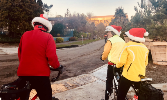
24th Ave E
I'll stop here, but note that navigating to the Burke from the 520 bridge trail is no easy feat. It's about a half a mile of bumpy residential streets, little signage, and cracked sidewalks.
Not quite there yetWhile I'm overjoyed that the 520 Bridge is finally open to bikes, the lack of bike infrastructure on either side of the bridge makes this milestone bitter sweet. So sweet to have the opportunity to cruise across Lake Washington on my two wheeled analog transport. But bitter that getting to the bridge can be downright dangerous for an inexperienced cyclist.
I will continue to celebrate this accomplishment in the Northwest, but I share my story in order highlight that so much more still needs to be done. Hopefully, this story helps you take on this journey and I encourage anyone to share their tips in the comments so that we can all enjoy this majestic ride in the days to come "
"