How Fake Neighborhoods and Mistaken Borders on Google Maps Lead to Real Life Consequences

Half as Interesting explains how fake neighborhoods and mistaken border designations as they appear on Google Maps can have real life consequences. In one extreme example, war between Nicaragua and Costa Rica almost erupted due a mapping misunderstanding. Google had mistakenly placed the wrong borders around Calero Island, making the island appear to belong Nicaragua, but in reality it belongs to Costa Rica. Luckily, the mistake was caught and no war ensued. But the phenomenon of fake neighborhoods has caused confusion in some areas.
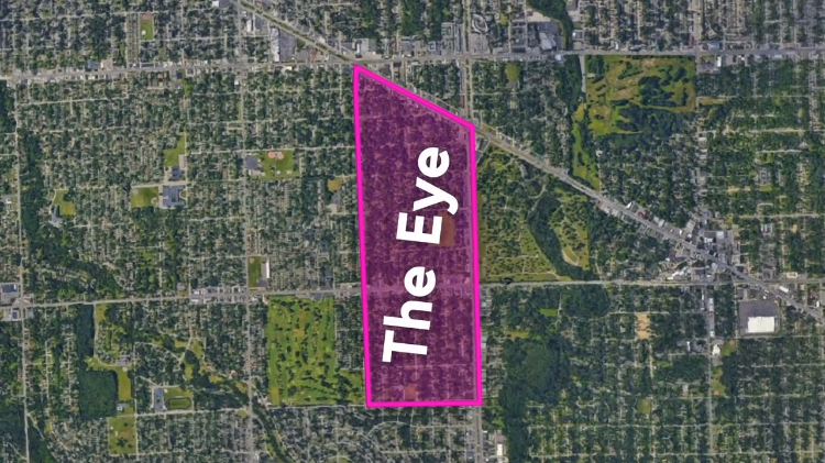
Related Laughing Squid PostsMaps are even more baffling though in Detroit Google Maps refers to this area as "The Eye" even though really nobody has ever referred to this area by that name. A blogger did some detective work"as it turned out "The Eye" was the name of a community watch organization in the area. "nobody's really sure exactly how Google determines neighborhood names but once they do that name essentially becomes official.
- Why the Unnamed Streets of Mannheim, Germany's Town Square Really Confuses Map Apps
- San Francisco Multimedia Gulch Nostalgia via Yahoo Maps
- Marry Me Leslie: Proposal 2.0 Using Google Street View
The post How Fake Neighborhoods and Mistaken Borders on Google Maps Lead to Real Life Consequences appeared first on Laughing Squid.