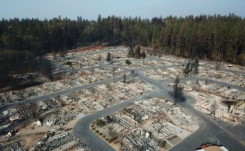
Mapping “Camp Fire” with drones, lessons learnt
 DJI works with 16 first response agencies for disaster response and damage assessment for California's deadliest wildfire The towns of Paradise and Magalia in Northern California, nestled in the foothills of the Sierra Nevada, were once thriving communities with over 27,000 residents. On November 8th, 2018, the "Camp Fire" changed all of that within hours. ["]