How Leonardo da Vinci Created a Bird’s Eye Satellite Style Image of Imola, Italy From the Ground in 1502
by Lori Dorn from Laughing Squid on (#4D1GG)

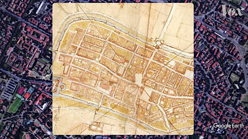
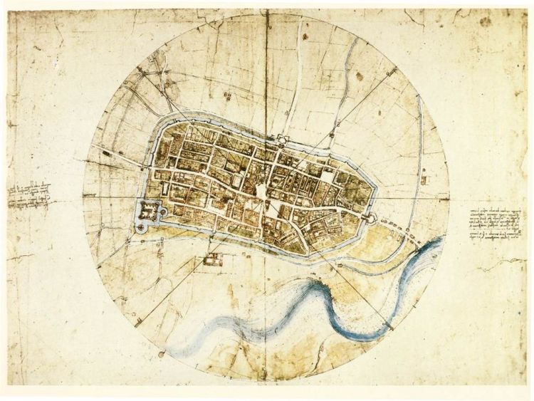
In a delineating episode of Vox Almanac, correspondent Phil Edwards explains why and how the great Leonardo da Vinci created bird's eye satellite-style image of the city of Imola, Italy at the behest of Cesare Borgia in 1502.
Leonardo da Vinci's known for his art and inventions - but also his groundbreaking maps, like this one of Imola, Italy. In this episode of Vox Almanac, Vox's Phil Edwards explores how it was made.
image via Wikimedia Commons
Related Laughing Squid PostsA Look at How Artist Pat Hines Makes Incredible Color Illustrations in Microsoft PaintHow to Make A Mini Leonardo da Vinci Style Catapult Using a Wooden RulerHow the Futura Typeface Escaped Widespread Use by the Nazis and Instead Landed on the MoonFollow Laughing Squid on Facebook, Twitter, Flipboard and Subscribe by Email.
The post How Leonardo da Vinci Created a Bird's Eye Satellite Style Image of Imola, Italy From the Ground in 1502 first appeared on Laughing Squid.
