Google now lets anyone contribute to Street View using AR and an app
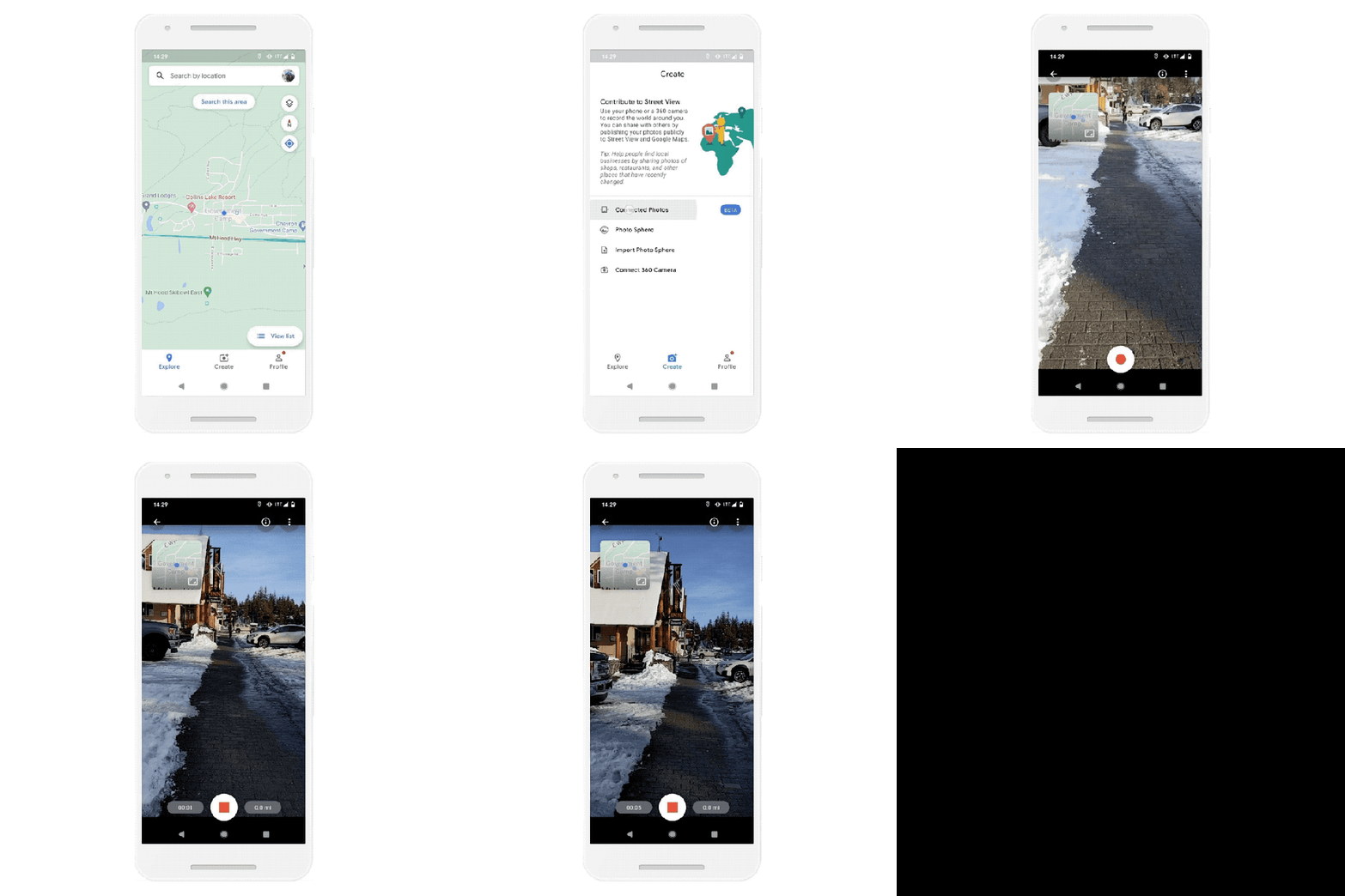
An update to Google's Street View app on Android will now let anyone contribute their photos to help enhance Google Maps, the company announced this morning. Using a connected photos" tool in the new version of the Street View app, users are able to record a series of images as they move down the street or a path. The feature requires an ARCore-compatible Android device, and for the time being, will only support image capture and upload in select geographic regions.
ARCore is Google's platform for building augmented reality experiences. It works by allowing the phone to sense its environment, including the size and location of all types of surfaces, the position of the phone in relation to the world around it, and the lighting conditions of the environment. This is supported on a variety of Android devices running Android 7.0 (Nougat) or higher.
Meanwhile, Google's Street View app has been around for half a decade. Initially, it was designed to allow users to share their own panoramic photos to improve the Google Maps experience. But as phones have evolved, so has the app.
The updated version of the Street View app allows users to capture images using ARCore - the same AR technology Google users for its own Live View orientation experiences in Maps, which helps phones see" various landmarks to help users get their bearings.
After the images are published in the Street View app, Google will then automatically rotate, position and create a series of connected photos using those images, and put them in the correct place on Google Maps so others can see them.
It will also use the same privacy controls on these contributed photos as are offered on its own Street View images (the ones it captured by driving the Street View car around). This include blurring people's faces and license plates, and allowing users to report imagery and other content for review, if needed.

Image Credits: Google
The new system of connected photos won't be as polished as Google's own Street View images, but it does make the ability to publish to Street View more accessible. Now, the image capturing process no longer requires a 360-degree camera or other equipment mounted to a top of car, for example. And that means users who live in more remote regions will be able to contribute to Street View, without needing anything more than a supported Android phone and internet connection.
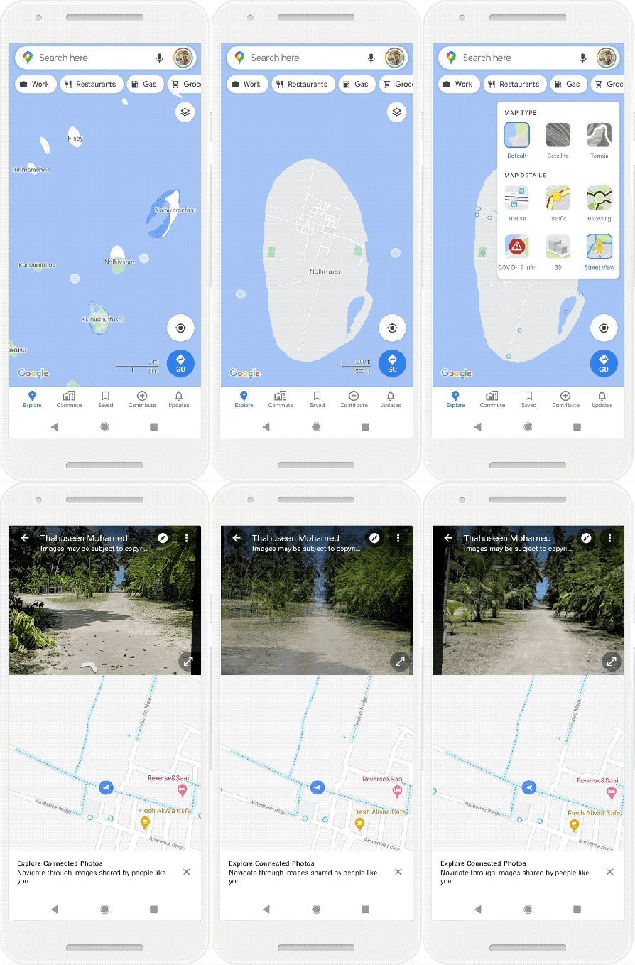
Google says it will still default to showing its own Street View imagery when it's available, which will be indicated with a solid blue line. But in the case where there's no Street View option, the contributed connected photos will appear in the Street View layer as a dotted blue line instead.

Image Credits: Google
The company will also use the data in the photos to update Google Maps with the names and addresses of businesses that aren't already in the system, including their posted hours, if that's visible on a store sign, for instance.
During early tests, users captured photo using this technology in Nigeria, Japan and Brazil.
Today, Google says it's officially launching the connected photos feature in beta in the Street View app. During this public beta period, users will be able to try the feature in Toronto, Canada, New York, NY and Austin, TX, along with Nigeria, Indonesia and Costa Rica. More regions will be supported in the future as the test progresses, Google says.