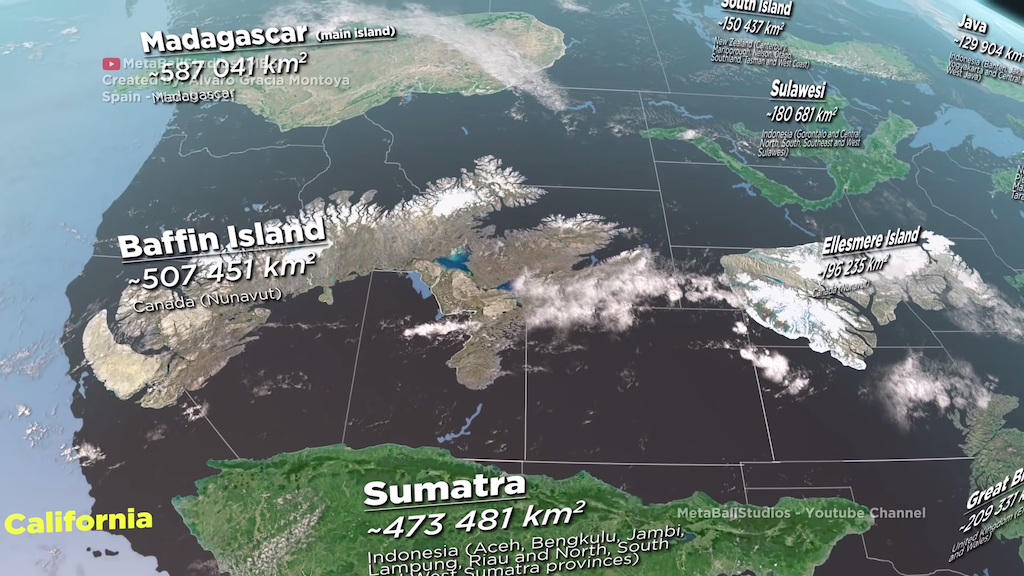
Size of Islands on Earth Compared to North America
by Lori Dorn from Laughing Squid on (#5GCY9)

3D animator Alvaro Gracia Montoya of MetaBallStudios (previously) created a fascinating animation that compares the size of islands around the world by increasing size. The islands were laid over a map of North America in order to offer context of their actual size.
Related PostsA Stunning Drone's Eye View of the Uninhabited North Brother Island on New York City's East RiverKowloon Walled City, 33,000+ Residents Lived Within 6.5 AcresAn Interactive Map Showing the Range of the Solar System If Earth Were the Size of a BasketballCountries That Are Far Larger Than Portrayed on MapsMalls Across America, A Photographic Flashback to the 1980sGorgeous New Zealand Landscape Time-Lapses by Bevan PercivalThere are many islands on Earth, this video shows some of them from the smallest (Hub Island) to the largest (Greenland). The measurements may vary depending on the source. The islands are placed over North America to have a better perspective of their size with respect to the different states.
Follow Laughing Squid on Facebook, Twitter, and Subscribe by Email.
The post Size of Islands on Earth Compared to North America first appeared on Laughing Squid.