‘Your neighbor was killed in a car crash here.’ 200+ yellow memorial silhouettes installed around Seattle
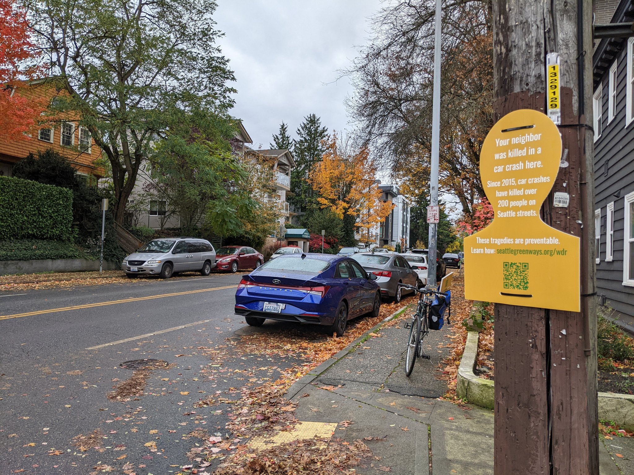 Photo by Seattle Neighborhood Greenways volunteer Eric Mackres.
If you see a yellow silhouette attached to a pole or sign around town, it's there because a person was killed in a traffic collision near that spot in the nearly nine years since Seattle first approved it's Vision Zero goal in 2015. The sheer number of these yellow memorials, numbering over 200, provides a grim status report on the city's progress toward its goal of zero traffic deaths and serious injuries by 2030.
The signs have been installed thanks to a significant volunteer-powered effort led by Seattle Neighborhood Greenways and are part of the annual World Day of Remembrance memorializing victims of traffic violence and calling for change.
In addition to the signs, Seattle Neighborhood Greenways has two community walks planned in two of the city's worst hot spots for traffic deaths: SoDo and Aurora. Details:
11 a.m. Friday, November 17
SODO - SODO Link Station Station11 a.m. Saturday, November 18
Aurora Avenue - Aurora Ave and N 84th Street
This year, Seattle Neighborhood Greenways is specifically targeting the most dangerous kinds of streets in the city. 80% of pedestrian fatalities occur on streets with more than one travel lane in each direction - our wide, busy streets where people feel comfortable driving fast," said Gordon Padelford, Seattle Neighborhood Greenways Executive Director, in a press release. Meanwhile, 80% of people biking are killed on streets without bike lanes."
A disproportionate percentage of recent increases in traffic deaths have been people walking, so that should be an obvious top priority for traffic safety efforts. But World Day of Remembrance is about everyone killed in traffic, including people in cars.
 They also made an interactive version of this map. This data only includes streets under City of Seattle purview. WSDOT and the highway patrol are in generally charge of I-5 and I-90, so most deaths there are not represented in this map.
Looking at a map of traffic deaths, the problem roadways are immediately clear. Aurora Ave, north Rainier Ave S, several locations in SoDo and some spots on MLK Way S in Rainier Valley stand out, though there are plenty of other problem spots.
But if you take a closer look at Rainier Ave S, you can also see some potential good news. This street's traffic death toll once rivaled Aurora, but a traffic safety project that began in 2015 has dramatically reduced deaths and injuries there. You can see where the safety project ended because that's where the red dots (representing real human lives) begin. This is an astounding success story worth celebrating. It is also proof that fixing these dangerous streets is not only possible, but that SDOT already knows how to do it. We should be replicating our street safety redesign projects as widely and quickly as possible.
Below is the full press release from Seattle Neighborhood Greenways:
Seattle Neighborhood Greenways, a local nonprofit advocating for safe walking, biking, and rolling routes in the city recently distributed over 200 orange silhouettes around the city to mark locations where car collisions have killed people since 2015. The installation is part of The World Day of Remembrance for Road Traffic Victims (WDR), an international event on Sunday, November 19th that brings attention to the millions of people who have been killed and seriously injured on roads around the world and the impact these deaths have on our communities.
In 2015, the City of Seattle adopted Vision Zero as a goal and a program to eliminate deaths and serious injuries for all road users by 2030. Unfortunately, that goal continues to be out of reach with the city seeing nearly 30 deaths and 180 serious injuries every year, and 2023 is on track to be one of the deadliest years on record.
While there are multiple factors that are leading to this increase in crashes, street design plays a major role. 80% of pedestrian fatalities occur on streets with more than one travel lane in each direction - our wide, busy streets where people feel comfortable driving fast. Meanwhile, 80% of people biking are killed on streets without bike lanes," said Gordon Padelford, Seattle Neighborhood Greenways Executive Director. The good news is that as we've seen in cities around the world reducing deaths by car collisions is possible. The most important thing local governments, including Seattle, can do is to redesign our streets with safety as the priority. In doing so we can ensure everyone can make it home safely to their loved ones whether they're driving, walking, or riding a bike on our streets."
2024 is an important opportunity for Seattle to focus on safety for its streets. The Seattle Department of Transportation released its Seattle Transportation plan earlier this fall which will guide how the city goes about planning for its transportation network for the next decade and beyond. The initial draft lacks the commitment to redesign our most dangerous streets - Aurora Ave N, MLK Way S, 4th Ave S (SODO), and Lake City Way.
The Seattle Transportation Plan and the next transportation levy must make major safety improvements on our most dangerous streets if we are going to have any hope to reach our city's Vision Zero goal," said Clara Cantor, Seattle Neighborhood Greenways Community Organizer. People in Seattle have said again and again through polling and surveys that they want a safe transportation system where everyone gets home safely. It is time for the city to do something about it."
To bring awareness to this issue three events are being hosted along three of the most dangerous corridors. Below is information about each event. Please contact Josh at josh@seattlegreenways.org for more information or guidance on how to attend.Friday, November 17, 2023
SODO - SODO Link Station Station
11:00 AM - 12:00 PMSaturday, November 18, 2023
Aurora Avenue - Aurora Ave and N 84th Street
11:00 AM - 11:30 AM