E384-LR map 2000 Acres in a single flight
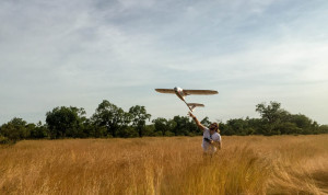 One of the most appreciated features of the E384 is its extremely long endurance without requiring special launch or recovery equipment. Using an E384 with a Sony WX500, users can fly nearly 100 minutes and collect up to 1,000 acres of imagery at 5cm/pixel in a single flight. Some have used this ability to map ["]