Goldberg: Find a peaceful, relaxing ride on South King County and Pierce County trails
EDITOR'S NOTE: Thanks to Eli Goldberg and Bob Edmiston for this ride report. Their guide was written before the opening of the South Prairie to Buckley connection that wrapped up construction last week. So if you want to be one of the first people to ride that new trail section, here's a guide for how to get there without a car.
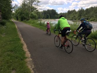
Photo by Bob Edmiston
By Eli Goldberg and Bob Edmiston
It's the Seattle conundrum: you want to enjoy some natural beauty and exercise on your bike. But you dread the chaotic congestion of the Burke-Gilman trail, with spandex-clad bike racers, dogwalkers and rollerbladers all jockeying for a sliver of space.
You feel a twinge of envy for Vancouver and Portland, with their extensive networks of traffic-calmed, tree-lined streets ideal for casual leisure biking.
But you don't have to go far for a peaceful, relaxing seasonal ride.
Did you know that in just 15 minutes by public transit from downtown Seattle you can find a connected network of roughly 55 miles of well-maintained, scenic, and fully paved trails? No car or hill climbing required.
You'll ride through a half-dozen cute and historic downtowns in King and Pierce counties, and enjoy diverse and scenic terrain, with stunning views of Mt. Rainier. In the summer, you can even fill your panniers with fresh blueberries and strawberries with farmstand and U-Pick stops right on the trail. And you'll be far from the craziness of the Burke.
We've put together the below map and route guide, offering up to 55 miles of relaxed trail riding, with about 1.5 miles of less-comfortable on-street riding.
Segment 1: Tukwila to Pacific (Green River + South Interurban Trail) - 17 milesOur journey starts with the Green River Trail and Interurban Trail (south). This straight and flat route primarily traverses industrial scenery, following the former Puget Sound Electric Railway.
Directions:
* Depart on the 150 King County Metro bus via the downtown bus tunnel. It runs every 15 minutes on Saturdays (30 minutes on Sundays). Exit the bus at Interurban Ave S & 52nd Ave S (Tukwila Park & Ride).
* Across the street you'll find the Green River trail. Take it southbound until you reach the Interurban trailhead.
* If you prefer natural over industrial scenery and don't mind a lengthier route, you can also continue on the Green River Trail. It connects back to the Interurban Trail after Kent.
Ready for lunch? The Quarters - just a block off the trail in Auburn - serves authentic Southern food in a vintage home. The conscientious, bike-friendly owner even invited us to take our bikes indoors with us. (Cash-only.)
Segment 2: Pacific to Sumner (Sumner Link Trail) - 6 miles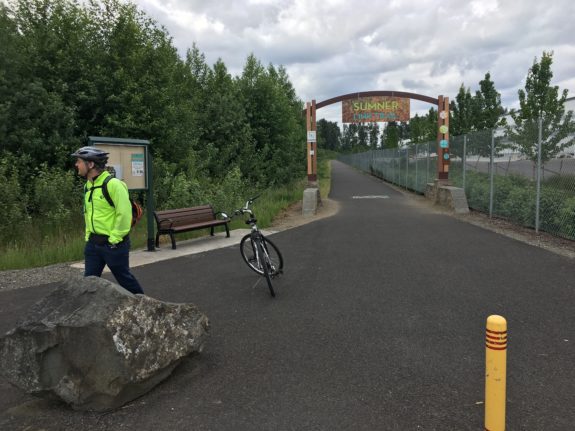
The author at the Sumner Link Trail. Photo by Bob Edmiston
From Pacific, we'll ride to the start of the new Sumner Link Trail, which opened in 2014. This segment offers views of meadows, farm fields, and the water.
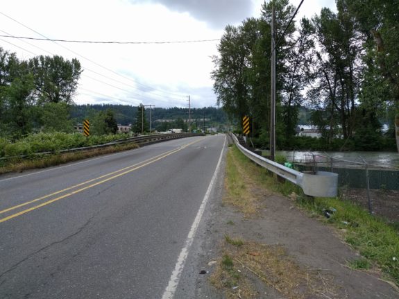
Unfortunately, the Sumner Link Trail lacks an comfortable connection to the Interurban, requiring about a mile's riding on a 35 mph road. You'll also need to take the lane on a narrow bridge for about 10 seconds:
If you're not comfortable with this on-street connection, you can skip it: take the Sound Transit 578 bus directly from Seattle to downtown Sumner and start your journey from there.
Directions:
* At 3rd Avenue SE, take a left, and follow it until you reach Butte Ave SE. It's a pleasant residential street, but turns into a low-traffic 35 mph road upon reaching the Pierce County border.
* When you reach 8th Ave SE, make a left, and continue over the bridge. You'll see the Sumner Link Trail entrance on your right.
Segment 3: Sumner to Puyallup (White River Trail, Puyallup Riverwalk Trail) - 2 milesThis short but scenic segment takes you along the White River to the Foothills trail.
You can also check out downtown Sumner for coffee or a snack. You'll find quaint shops, but sadly, no bike parking or other amenities to entice trail riders.
Directions:
* Continue on the Sumner Link Trail until it reaches the intersection of 142nd Ave E and Puyallup St. Follow the Fryar St. bike lane or sidewalk.
* When you reach Bridge St, cross it. Then make a right on Main St. Continue on Main St. until you see the White River Trail entrance on your right.
* You can also turn left onto Main St, and check out downtown Sumner.
* Once you reach the end of the White River Trail - don't cross the street! Instead, make a right and follow the sidewalk. You'll see the entrance to the Riverwalk trail immediately before Mama Stortini's Restaurant & Bar.
 This is the most scenic segment, featuring uninterrupted views of Mt. Rainier, and many miles of riding alongside the Carbon River through forest and farmland. Don't miss the Scholz Farm stand, offering fresh-picked blueberries, strawberries and more right off the trail.
If you're not familiar with the history of the Foothills Trail, it's a trail that almost wasn't built. Proposed in 1984 by a visionary Buckley physician and a cadre of dedicated volunteers, it was born out of contention, much like our own Burke-Gilman. Opponents collected 22,000 signatures to force a referendum to prevent the trail's construction, citing fears of crime, cost and disruption. It barely squeezed by in a 52-48 vote.
It's a poignant reminder of how the infrastructure we cherish comes not by fate, but through persistent and dedicated community members.
Directions:
* Follow the Riverwalk Trail under East Main and the train tracks. You'll see an unpaved road to your right, which turns into 134th Ave E. Continue on it, and you'll reach the Foothills Trail entrance on your right.
Your ride back to downtown follows the scenic Puyallup river. You'll find a number of restaurants near the Sound Transit station, including a fantastic ramen noodle shop.
Directions:
* Take the Foothills Trail back to the Riverwalk Trail. Continue on the Riverwalk Trail to downtown Puyallup.
* When the Riverwalk Trail ends, continue on 2nd Ave NE. Make a slight right onto Main Ave, which turns into E Stewart a block later.
* Make a left on N Meridian. You'll be at Puyallup Station in a block.
* To return to Seattle, take the hourly 578 Sound Transit bus. It only has two bike racks, so you may want to avoid the last bus of the day. It ends early (8:01 PM) on weekends.
As of summer 2017, this trip ended at South Prairie. But the remaining gaps of the Foothills Trail to Enumclaw are being filled, with the segment from South Prairie to Buckley completed just last week. Another spur is planned directly to Mt. Rainier National Park.
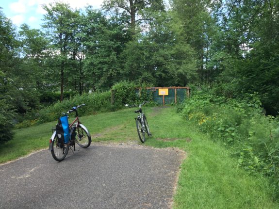
Photo by Eli Goldberg, summer 2017. The trail until very recently ended in South Prairie.
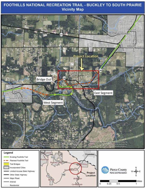
Construction on this connection between South Prairie and Buckley was completed in early December, according to Pierce County Parks.
EDITOR'S NOTE: Looks like I'll have to head down to South Prairie to check out the brand new connection to Buckley, which included rebuilding a damaged bridge. Doesn't sound like a bad way to spend a day"
