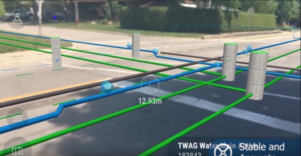
Augmented reality software shows where pipes and other underground structures are
by Andrea James from on (#3WKE9)

Geographic information systems used to be 2-D maps, but new AR technologies are letting users see where pipes and other underground infrastructure is through augmented reality .

Brief video showcasing a few features of the vGIS Utilities system (http://www.vgis.io/). vGIS Utilities is the most advanced augmented reality solution for GIS designed specifically with utilities, municipalities and GIS service providers in mind. The system connects to Esri ArcGIS to seamlessly convert traditional 2D GIS data into powerful, accurate and stable 3D visuals.vGIS is the only system that supports the full spectrum of technologies - augmented reality (Android and iOS), mixed reality (HoloLens) and virtual reality.
The system is deployed in at over 40 sites across the world to bring real-life benefits to municipalities, utilities, locate service providers and multiple other organizations.
" The most advanced AR system for GIS - vGIS Utilities (YouTube / Meemim vGIS)