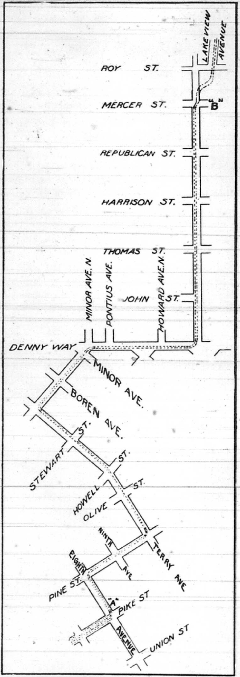
Seattle’s first downtown bike path (1898)
I am briefly emerging from my work on my Seattle bike history book to post this map I found buried deep in the archives of The Argus, a weekly Seattle newspaper co-owned by an early Seattle bicycle booster. It's a map of the bicycle path the city constructed in 1898 to help people connect to the city's bike paths along the east side of Lake Union and through Interlaken Park to Lake Washington.
The bike path was constructed because wagons, horses and livestock kept destroying the dirt roads, making them impossible to bike on. So people biked on the sidewalks, which were already well-used by people walking. So in order to get people off the sidewalks, the city built a bike path, outlawed animals and wagons from using it, then banned bicycling on adjacent sidewalks. By reports it worked...OK. The intersections were still very difficult to cross because of all the deep ruts in the road. Oh, and people kept crashing on the streetcar tracks.
I had never seen this map in this detail before. This is a better route than any downtown-to-Eastlake route Seattle has today. Someone alert the Convention Center expansion team that they need to add a bike route through the center of the building. I'm sure they'll love that idea.
