North U Bridge project is a huge opportunity for a safer and better-connected U District + Survey
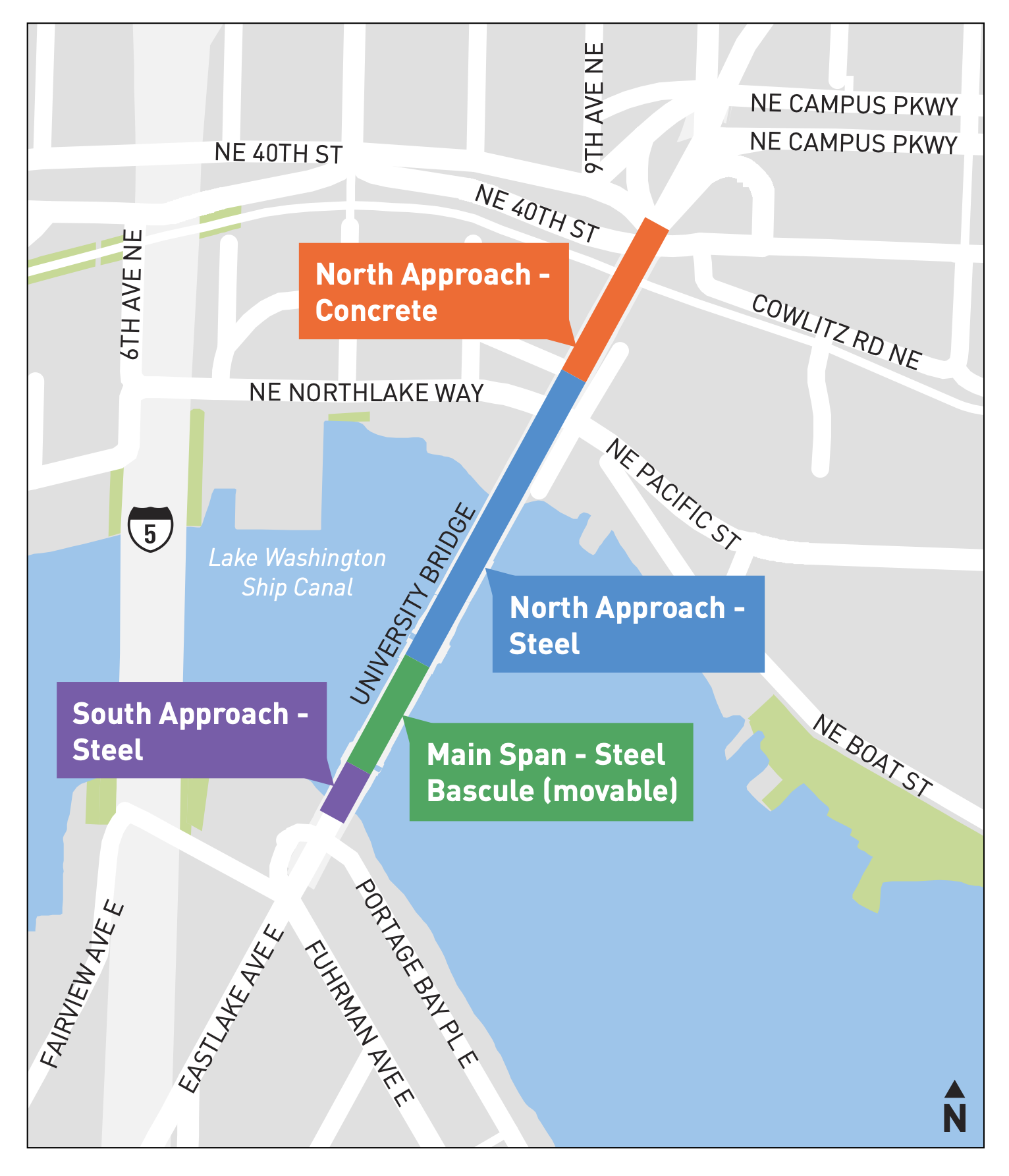 The North Approach is the section in need of rehab or replacement. Map from the project website.
Most of the University Bridge is in decent condition, but the northernmost section between NE 40th and NE Pacific Streets needs major rehab or replacement, according to SDOT. The 1930s concrete structure is at the end of its life, and that may be for the best because it no longer fits into the U District of today.
SDOT is currently conducting an online survey for the project, and you should definitely complete it. In the further thoughts box, I wrote, Remove highway-style interchanges and connect southbound and northbound bike lanes to the Burke-Gilman Trail."
The city currently only has funding to begin a study of the bridge replacement and rehab options. Funding for work will need to come from either grants or perhaps the city's yet-to-be-created 2024 transportation funding package.
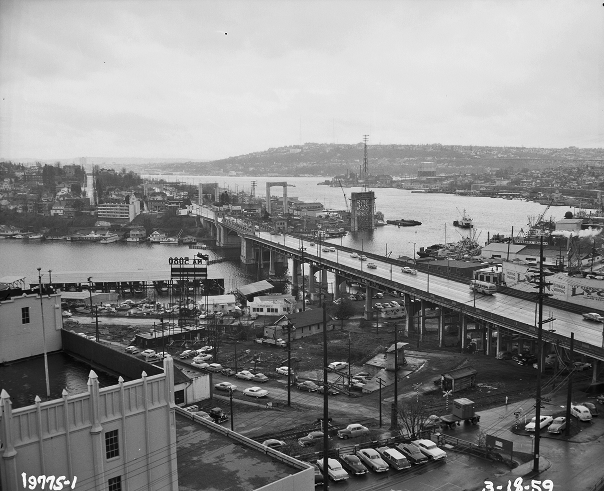 1959 photo of the University Bridge area following completion of an 11th Ave NE widening project. I-5 Ship Canal Bridge supports are visible in the background, though the freeway did not fully open until 1967. Land use around the U Bridge was very different from today. Photo from the Seattle Municipal Archive.
Considering the early stage and undetermined funding source for the work, I would push the city to expand the project scope to also include the area directly north of the bridge structure itself. Remember that these bridge and road connections were designed when there were some major differences compared to today. For example, I-5 did not yet exist, so Roosevelt and 11th were intended to be a north-south backbone roadway for the whole region in a way that simply is not relevant anymore. Another huge difference is that what is now the Burke-Gilman Trail was still an active railroad back then. Because of this, the whole area was designed under the assumption that people would need to avoid what is now a major regional biking and walking trail. The city should be working to build seamless and intuitive connections between the bridge and the trail for people heading in all directions. This project may be the best possible opportunity to rebuild this infrastructure in a way that makes sense for today's U District.
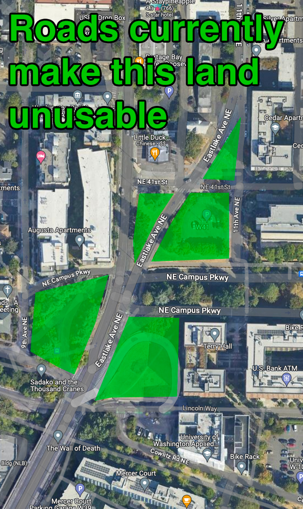 Map from Google Maps, green markup mine.
The area just north of the bridge is also the root of a lot of the U District's traffic, walkability and bikeability problems. The freeway-style quarter-cloverleaf down to 40th has got to go. This is one of the most densely-populated areas in the whole state of Washington, an a freeway cloverleaf has no business being here. There should probably be either housing or a park in that space instead. The gradually-curving road connection to 11th Ave NE is also completely out of place in this densely-populated area. The way it is designed also makes most of a city block completely unusable, leaving behind an awkward triangle of land on one side and a strange lot on the other that is not good for much more than a few parking spaces. We need a radical change to how northbound traffic works here. Let's use this opportunity to get some creative and visionary ideas on the table.
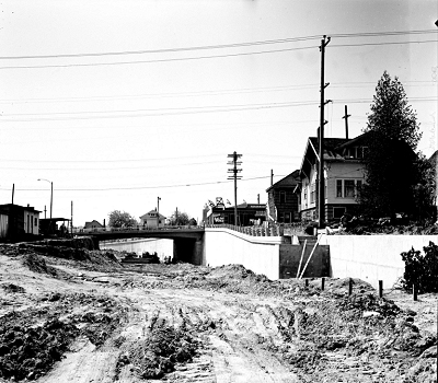
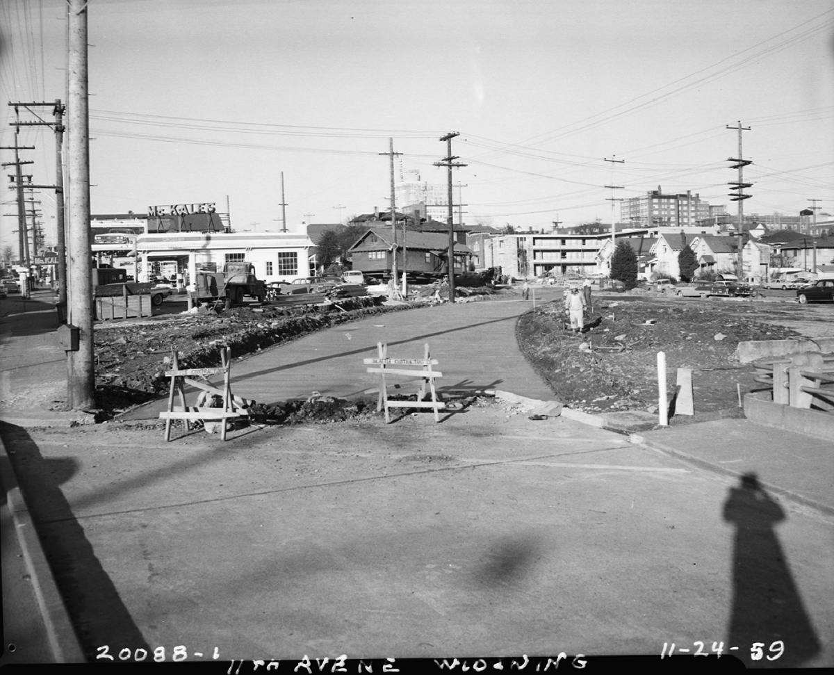 1959 photo of the 11th Ave NE widening project showing the creation of the curving section between the bridge and 11th, which uses up most the space in a city block. Looking northeast from Campus Parkway. Photo from the Seattle Municipal Archive.
Other questions we can ask: Do we still need westbound Campus Parkway to pass under the roadway? It could just stay at ground level like the eastbound lane and then meet Roosevelt/Eastlake at a traffic signal. That would free up an entire parcel of land on the west side of Roosevelt. The current looping under route is well-used by buses, but it also isn't all that fast due to the often slow merge on the bridge. I suspect turning left at a traffic signal could be just as fast for buses.
 1950 photo looking west toward Roosevelt Way from what will soon be Campus Parkway. Photo from the Seattle Municipal Archive.
Getting rid of the Campus Parkway trench could also open up left turns onto 11th Ave NE, which is not a high-traffic street even though it looks like one. It would also improve accessibility by removing the need to climb stairs up to the 11th Ave NE sidewalk. The 2020 Seattle Traffic Report (which uses 2019 data, our final pre-pandemic data) shows that 11th only carried 8,500 vehicles per day south of NE 45th Street and a minuscule 5,900 vehicles per day north of 45th. These counts include people on bicycles (assuming the counter tubes are set up properly). That means 11th carries about 60% as many vehicles as Roosevelt Way NE, its one-way couplet. Yet 11th is designed as a highway-style, double-lane road slicing a curve across the street grid so that people driving do not need to slow down. The city's recent Vision Zero program assessment showed that 80% of people killed by someone driving are struck on a road with multiple lanes in the same direction.
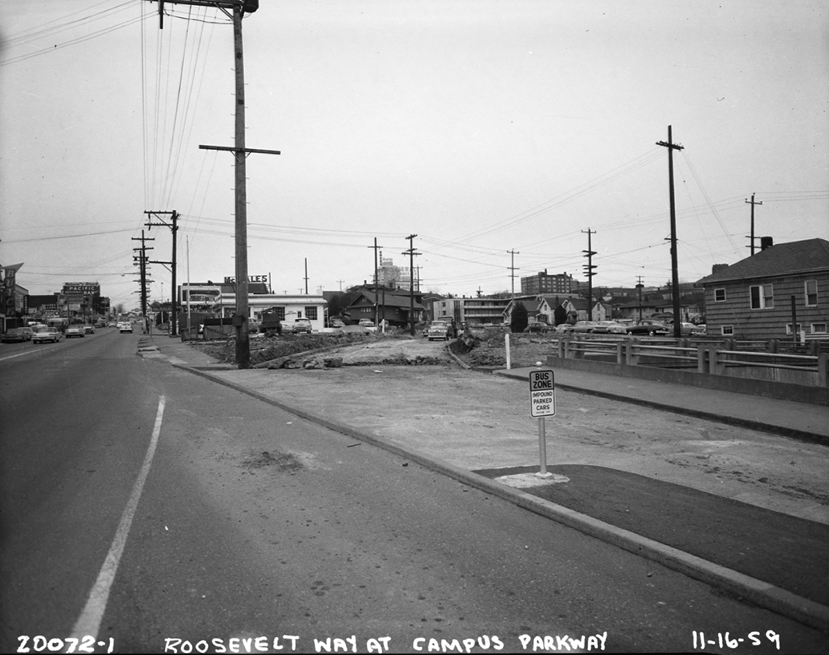 1959 photo looking north from Campus Parkway showing the final days of two-way traffic on Roosevelt as the connection to 11th is under construction. Photo from the Seattle Municipal Archive.
And I would be remiss if I left out my favorite solution: Make Roosevelt Way two-way again. These one-way couplets were a mistake, and they absolutely ruin walkability and bikeability in the neighborhood (I use them every day with my kid and have tried every imaginable route and they are all terrible). 11th in particular is a failure of a street by every measure. Even people driving don't find it very useful, which is why so few people use it. There are very few commercial properties on 11th because nearly all of them are on Roosevelt instead. 11th should be a regular neighborhood street, not a multi-lane roadway. Such a setup would be better both for residents and for Roosevelt Way businesses.
Though the scale of work I'm describing here is clearly much larger than simply replacing a bridge, is also opens up significant new revenue through the leasing or selling of these new lots for development. Our city needs as much housing as we can get in this area, which is well-served by transit. We also need to update our infrastructure to prioritize walking, biking and transit. This could be an opportunity to accomplish both goals at the same time. And hey, it could make for a fantastic vision to help sell the 2024 Seattle transportation measure to voters.