SDOT completes design for North Beacon Hill bike lanes, construction should begin in summer
 Images from SDOT.
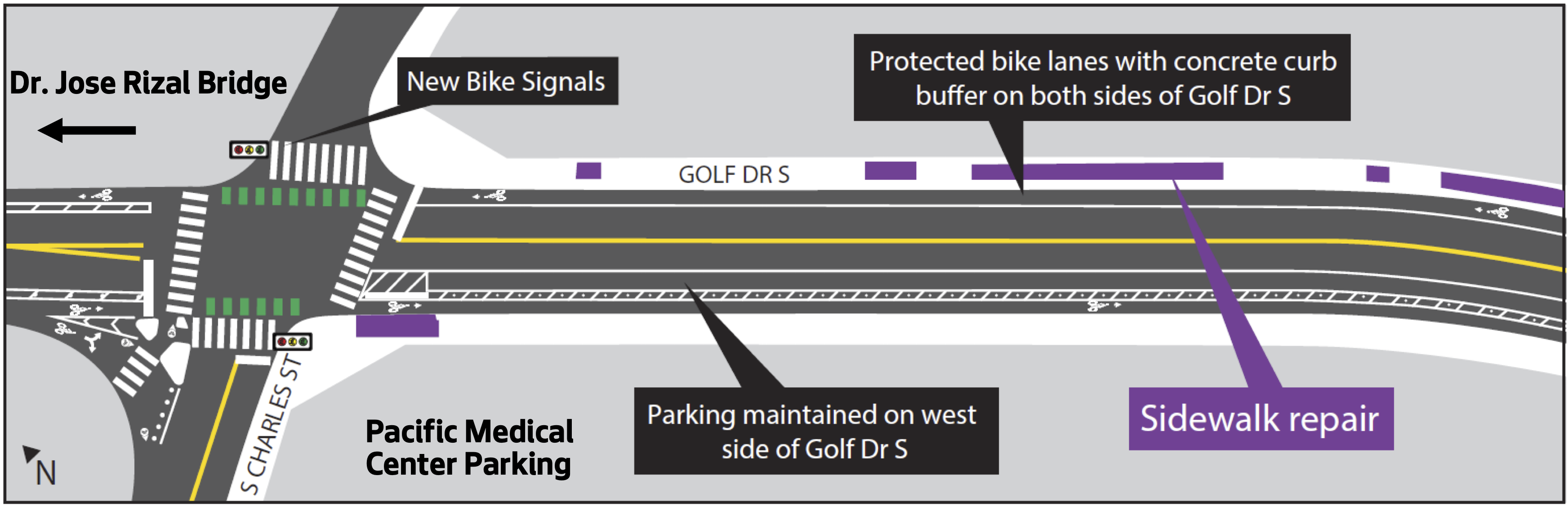
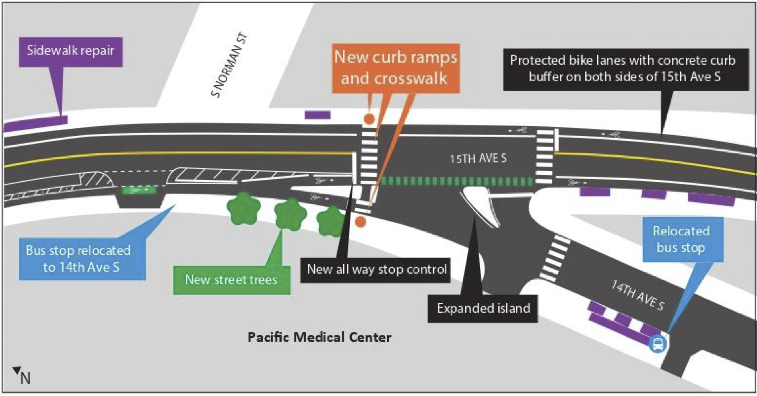
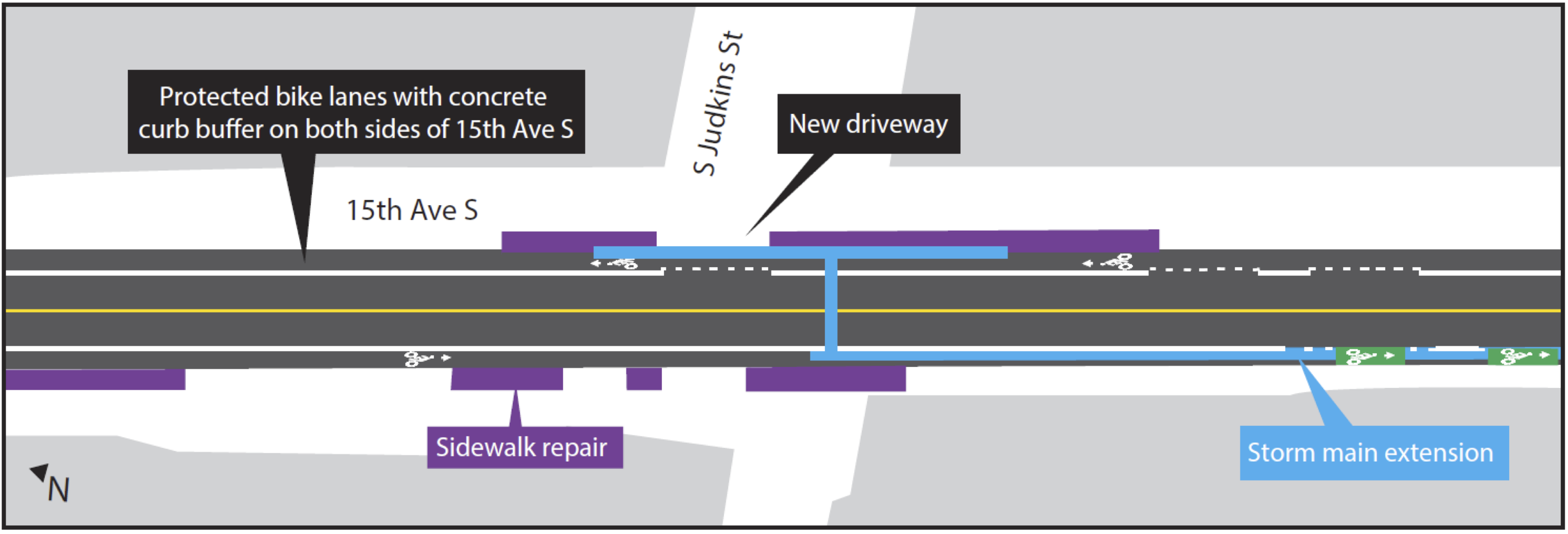
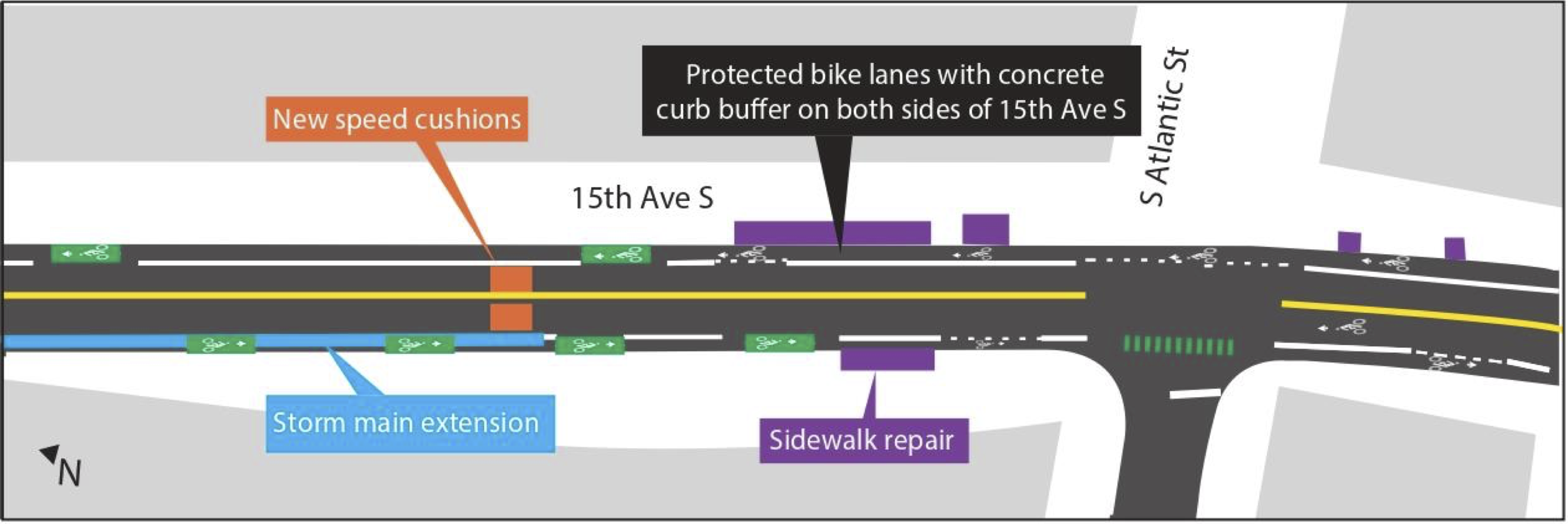
A project to build 1.5 miles of protected bike lanes from the Jose Rizal Bridge to Jefferson Park on Beacon Hill should begin construction this summer, SDOT announced. The department completed design for the project following years of public outreach and is preparing to advertise it to hire a contractor.
The project will finally add a protected bike facility through a neighborhood that has long relied on biking. Though it is hilly, as the name implies, Beacon Hill falls squarely into Seattle's bike commute doughnut, the area just a bit too far from the downtown employment center for a quick and easy walk. North Beacon Hill homes are a 15-30 minute bike ride from center city jobs and destinations using the most direct routes, but those routes require mixing with busy car and bus traffic. So while North Beacon Hill has always had a good number of people who bike, connected and comfortable bike facilities will make biking more appealing and approachable for more people.
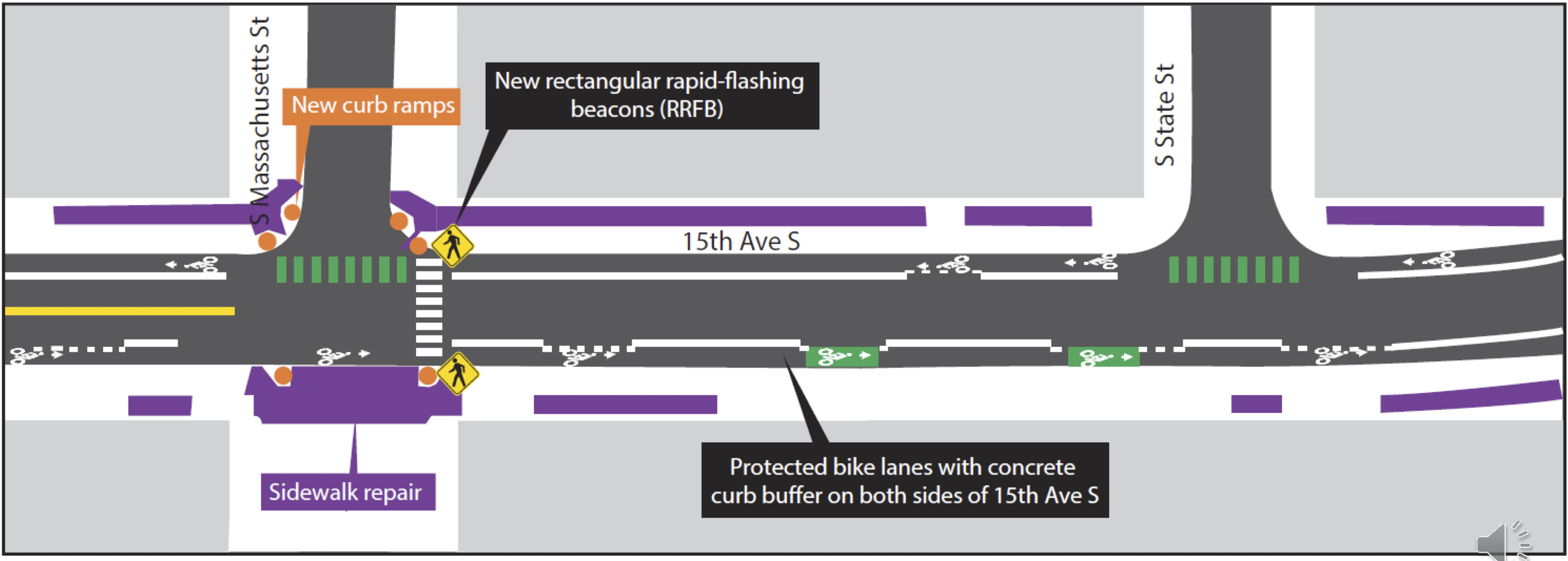
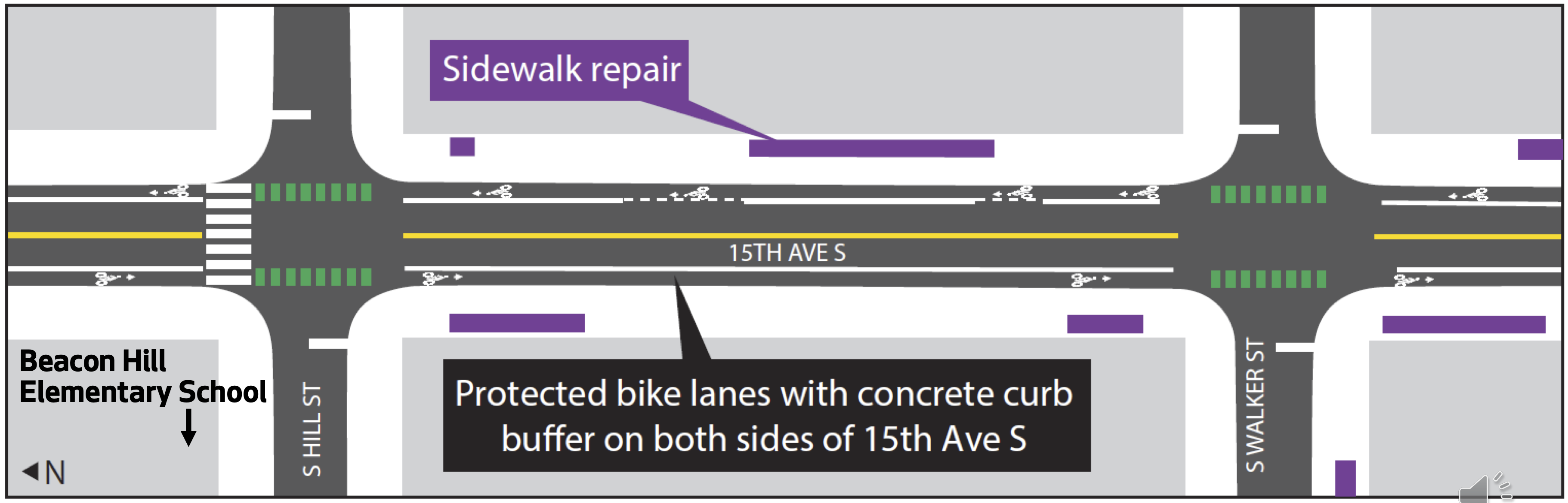
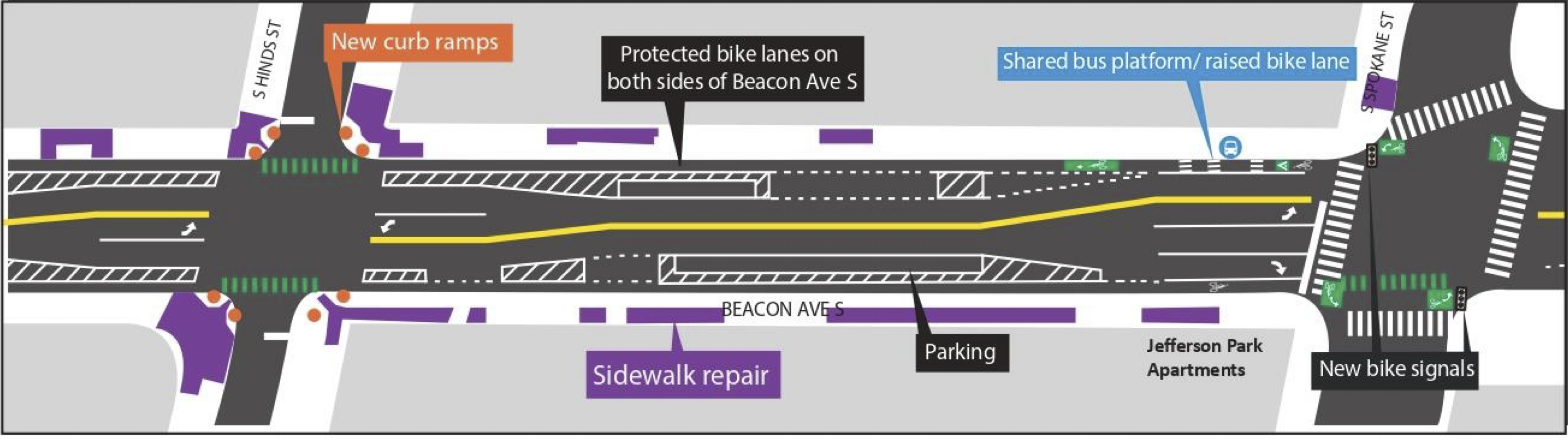
But even beyond biking, the planned design changes should bring significant safety improvements for everyone, including people crossing these 15th Ave S and Beacon Ave S on foot. The designs include 10-foot lanes for general traffic or 11-foot lanes for stretches where there are bus routes. Reducing lane widths calms traffic while also minimizing the time people using crosswalks are exposed to traffic. The design also includes curb bulbs and other crosswalk improvements.
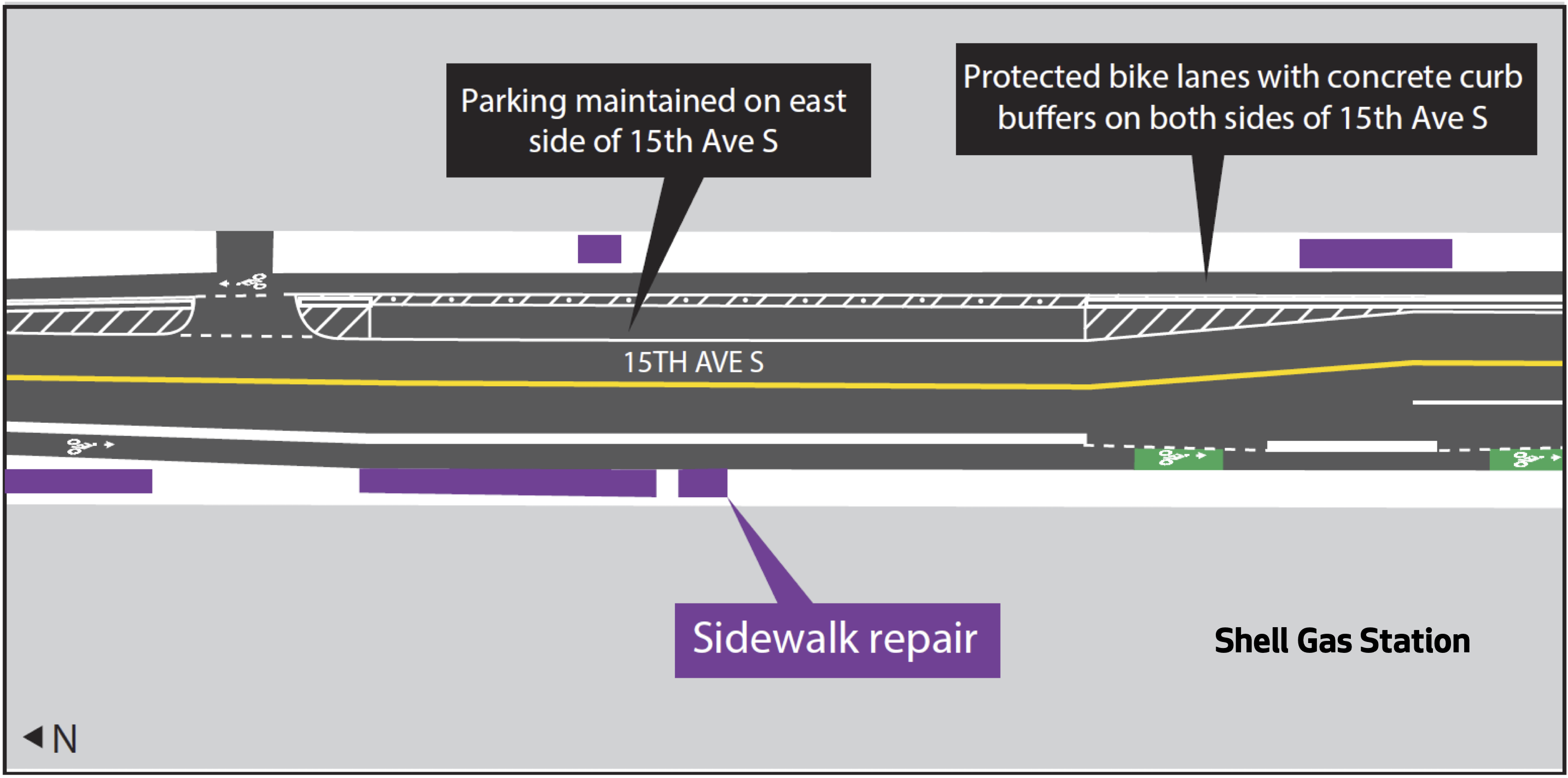
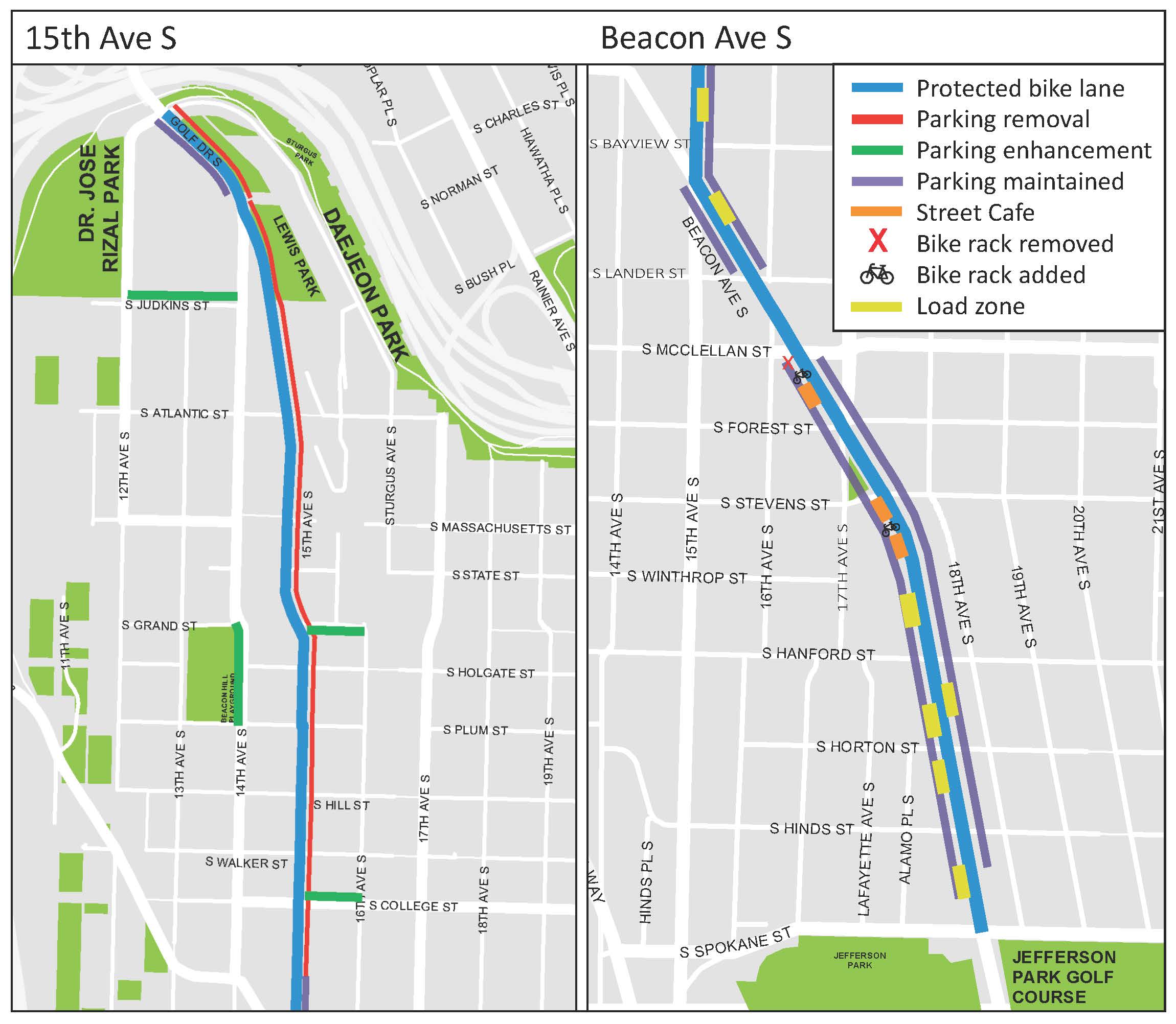
The 15th Ave S section will remove a lot of existing on-street parking, but staff scoured the area to find additional blocks that could be used for parking. They are also planning to remove a short and disconnected section of paint-only bike lane on 14th Ave S to turn that into on-street parking. We argued in a previous post that this is a worthwhile trade-off, though some readers pushed back and said they use it to access the school and the park and are concerned about safety during Beacon Hill Elementary School pick-up and drop-off. Hopefully this is something SDOT is paying close attention to.
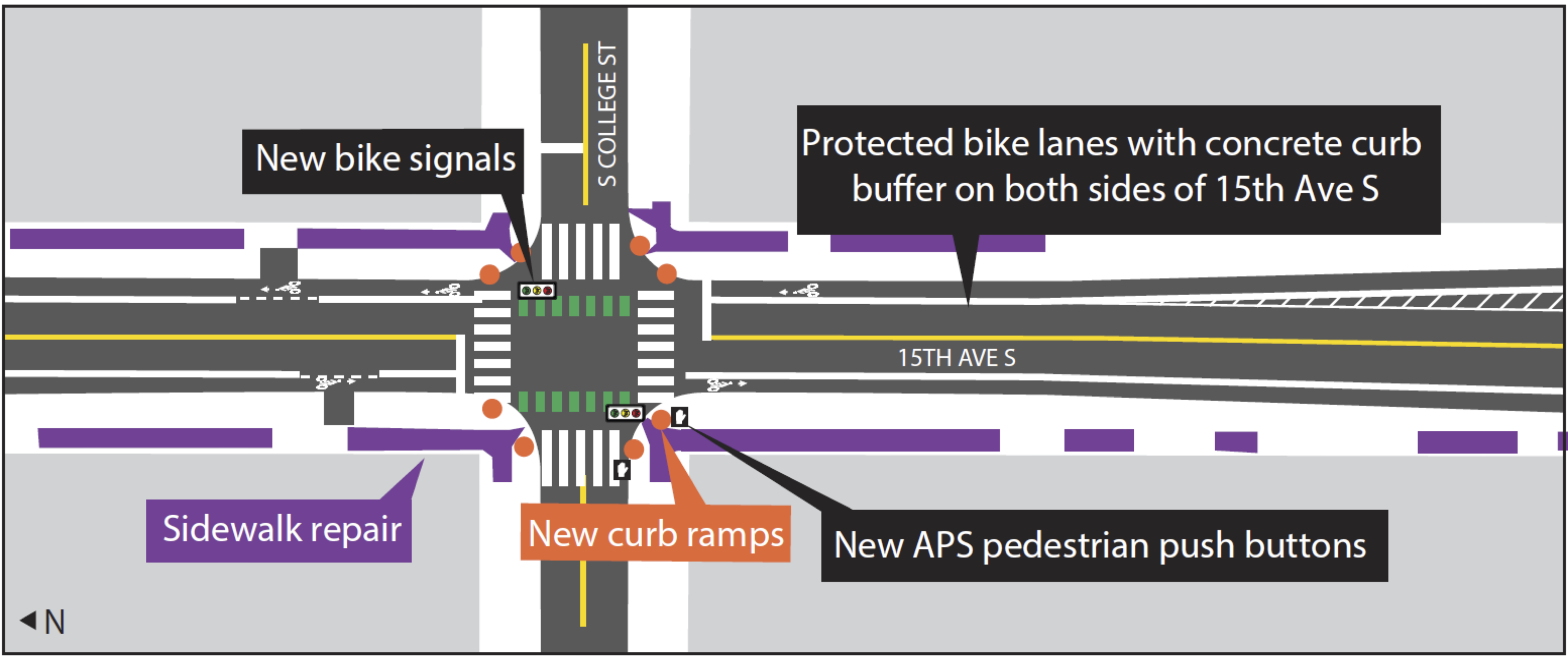
The most complicated part of the whole project is probably the intersection of 15th Ave S and Beacon Ave S. Not only is it at an angle, but it is also the busiest intersection. There is already a partial scramble" walk phase in which all the crosswalks show Walk" at the same time and no car movements are allowed, and this safety project will keep it. People biking will also be able to go straight or make any turning movements they need during this all-crosswalk phase, though they need to yield to people in crosswalks. People biking will also be able to go straight when the adjacent general traffic lights are green, though anyone trying to make a left turn after the all-crosswalk phase ends will need to use a left turn box as is common for many of the city's bike lanes. The tricky part is communicating all this to people on bikes. The signal diagram in the plan appears to show the bike signal turning green whenever straight-traffic in the same direction is allowed as well as when the all-crosswalk phase is active. But how will someone biking know when it is too late in the all-crosswalk phase to start a left turn? Obviously, it would be bad for someone to start a long left turn at the same time that people in cars get their green lights. Also, does a green bike signal conflict with an all-crosswalk phase? A green bike signal tells people biking they have the right of way, so they would reasonably assume that any crosswalks in their path would be showing Don't Walk. This is the first time Seattle has had to figure out how to add bike signals to this unique type of intersection. Does it require multiple sets of bike signals? Should the bike signal stay red during the all-crosswalk phase but be paired with a sign that says something like  May Use Ped Signal"? Or how about a flashing red or flashing yellow bike signal? Are those a thing? My kindergartner suggested rainbow lights that mean everyone should dance, which is at least worth considering. I asked SDOT staff during a recent press briefing how the signals will communicate when people biking can and cannot make left turns, and I will update when I hear back. Below is a technical plot from the 100% design showing the intersection and the signal phase diagram for anyone who wants to try to decipher it or come up with solutions:
On the north end, the new bike lanes will connect directly with the Jose Rizal Bridge bike lanes installed in 2021 as well as the Mountains to Sound Trail. Which reminds me, it would be interesting to install a bike counter on the bridge before these new bike lanes open so we can gather some before" data. Perhaps a nearby employer (someone in the Pacific Medical Center building perhaps?) would sponsor a counter with a display like on the Fremont and Spokane Street Bridges. The old slip lane island at S Charles Street could be a great spot to install a display. Or perhaps one could be hung on one of the trolley wire poles. We desperately need a good south end bike counter, and this bridge is probably the best southend bike route pinch point for getting a consistent measurement.
On the south end, the new bike lanes will end at S Spokane Street, which is a busier street that borders Jefferson Park. Future phases should extend the bike lanes south on Beacon Ave S, but they are not yet funded beyond very early planning. Adding these to the next transportation funding package and making sure they are earmarked for earlier in the funding timeline should be a priority because connectivity to South Beacon Hill and the S Columbian Way bike lanes will be a major gap in the bike network.
SDOT has made no major changes since the 90% design released a couple months ago. Below is an overview of the design concepts from a 90% design presentation (PDF). You can see the 100% design details in the less-user-friendly design plot (PDF):