A closer look at the Eastside Trail plans + Give feedback online
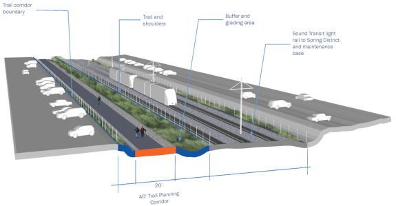
Example of trail section with planned Sound Transit light rail in Bellevue. Images from King County.
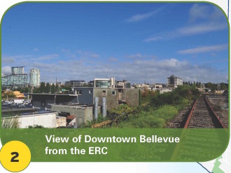
You've never seen Bellevue like this before.
A bikeable and walkable Eastside Trail can't come soon enough.
The rails-to-trails potential for the mostly-defunct Eastside Rail Corridor is immense for growing communities east of Lake Washington. Connecting homes to jobs and new regional trail connections across and along 520, a complete and connected Eastside Trial would simply revolutionize people-powered transportation and recreation in the region on a level we haven't seen since the Burke-Gilman Trail.
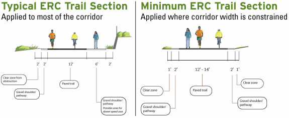
King County is currently working on developing high-level design considerations for a corridor master plan that will guide development of a complete, wide, safe and fully paved trail lined with park-like amenities. At the same time, a parallel effort is underway to remove the rails and create an interim trail much like the amazing Cross-Kirkland Corridor Trail, according to Cascade Bicycle Club's Eastside advocacy coordinator McKayla Dunfey. But that interim trail process is separate from the master plan, which is focused on the final paved vision.
King County recently held a series of in-person open houses on the master plan, and now you can give feedback through an online open house until November 12. The plan should be complete and approved by Fall 2016, so be ready to give feedback several times during the next year.
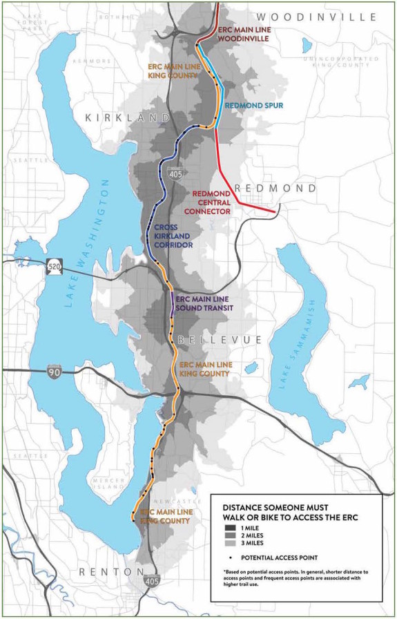
One of the coolest images the trail planners have put together so far is this map showing anticipated demand for various stretches of the Eastside Trail and connecting trails:
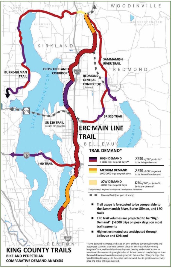 Demand is based on many factors, and easy access to nearby homes and businesses is one of the biggest ones. Sections of trail pinned against the lake by I-405 perform the worst, for example. Sections that connect urban centers, other popular trails and have good access to nearby homes do the best:
One of the first questions they need to answer is: Do we want to develop an easier and more cost-effective trail on the existing railbed or invest heavily in an off-railbed option that preserves the railbed option for unplanned rail transit potential. This is a bit of a wonky choice, but King County is currently gathering feedback. Here's an illustration demonstrating the difference in Renton:
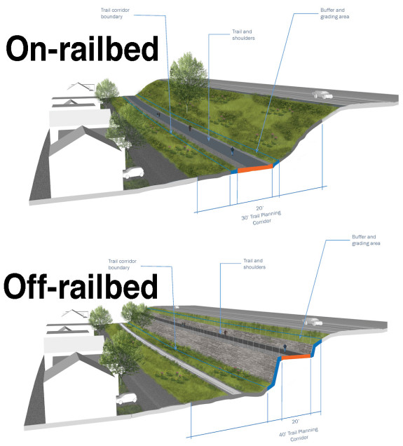 The online open house materials don't include cost estimates for each, but the off-railbed option is sure to be an order of magnitude more expensive (retaining walls like that cost a lot). Unless there is an actual, realistic and timely plan for transit on the corridor, the trail should be sited on the railbed. If we do someday fund transit, we can deal with moving the trail then. But it doesn't make sense to spend a ton of extra cash (or, more likely, delay building the trail because we don't have the money) to preserve a railbed we may never use otherwise.
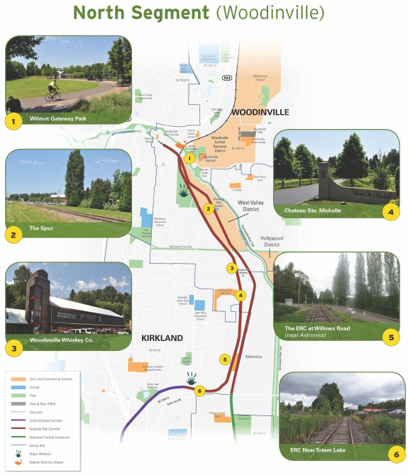
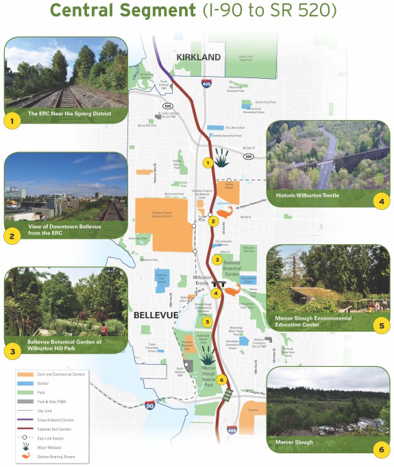
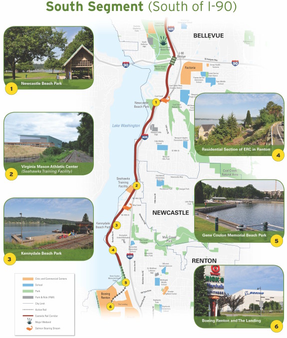
You can weigh in online for each of the following sections:
NorthCentralSouth
You can also tell King County where you think trailside amenities like bathrooms, drinking fountains, access points, parking lots, viewpoints, historic markers and whatever else you can think of should go.
Here's a more detailed look at the corridor:
