Seattle releases unique walking and biking maps for each public school

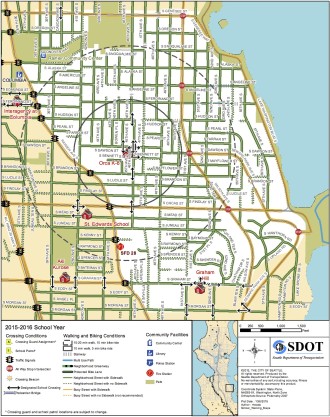
Map for Orca K-8
Earlier this month, we reported on the city's fantastic School Road Safety Plan, designed to help schools, parents, students and the city all work together to end traffic deaths and injuries near schools.
Well, one cool part of that plan was to improve the existing walking maps for each school and add information to help families identify a safe biking route to class. The city released those maps recently.
By marking every single sidewalk and highlighting the best crosswalks, the maps are much more useful for families trying to find the safest and easiest route for their child to bike or walk (though it would be cool to add topographic info for steep hills). The maps also include circles to help you estimate how long it will take to walk or bike to class.
Aside from being good resources for picking a route to school, however, they are also very useful for trying to address your school's unique transportation challenges. As the map for Orca K-8 above shows, most of the school's walk zone (where the District does not provide buses) is within a 20-25 minute walk or 10 minute bike ride.
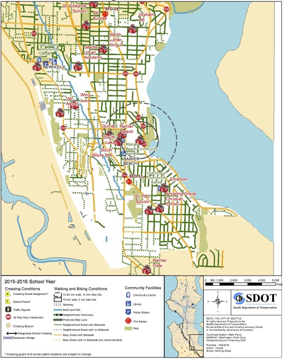
But compare that to Rainier Beach High School, where students are currently protesting the huge walk zones for middle and high schools, arguing that more (or all) students should get free ORCA passes to help them get to class. Look how far many "walk zone" homes are from the 20-minute walk circle around the high school:
 Of course, many students CAN (and do) bike or walk to school in this walk zone. And the school should absolutely do all they can to encourage more students to bike, whether that means helping students get access to a working bike, helping students acquire proper lights for dark months, offering education on how to be safe and confident in traffic, and lobbying the city for safer bike routes throughout the whole school walk zone.
But that's not good enough. This system is not fair to students who live two miles from school and can't afford a car or a bus pass. Showing up to school is one of the most important factors in graduation. We can't let young people fall through the cracks just because they live in a limbo zone in their school's transportation plan.
You can support the students in their cause by signing this petition on the Transit Riders Union's website.
More details on the new walking and biking maps from SDOT:
Earlier this month we launched our new Safe Routes to School 5-Year Action Plan called Safe Streets, Healthy Schools and Communities to support reaching our Vision Zero goal to end traffic deaths and serious injuries by 2030.
As part of this plan, we developed new walk and bike maps for every public elementary, middle, and high school. These maps help parents and students determine the safest ways to walk and bike to school. They show crossing conditions, walking and biking conditions, and community facilities like community centers, libraries, and parks within each school's walk zone. If you are a parent of a student at a Seattle Public School, be sure to check out these maps!
The back side of the map will guide you on how to use the map to plot the safest route from home to school. The maps display which neighborhood streets and busy, arterial streets have sidewalks and which don't, helping you to identify a route to school that avoids busy streets without sidewalks when possible. You can also identify on the maps the safest places to cross busy streets, like adult crossing guards locations, designated school crosswalks, crosswalks with crossing beacons, all way stops, and traffic signals.
Once you've identified your best route, be sure to sit down with your child and go over the walking and biking safety tips included on the back side of the map. For walking, these include looking left, right, and left again at all intersections, making eye contact with people driving before crossing the street, and walking on the left side of the street far from traffic on those neighborhood streets that don't have sidewalks. For bicycling, always wear a helmet, ride predictably and use hand signals, ride in the same direction as traffic, and walk your bike on crosswalks across busy streets.