 |
by Press on (#3NHFB)
DroneDeploy, a drone software startup, and leading drone data platform today launched the Drone software â€DroneDeploy Cloud Service†in Japan and SoftBank C&S will be the distributor. As the only drone cloud software to be distributed by SoftBank C&S, the partnership brings DroneDeploy’s best-in-class software solutions to the Japanese commercial technology market. With DroneDeploy as an industry […]
|
sUAS News
| Link | https://www.suasnews.com/ |
| Feed | http://www.suasnews.com/feed |
| Updated | 2026-07-22 00:15 |
 |
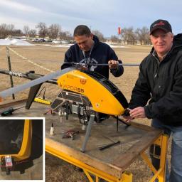
by Gary Mortimer on (#3NGQQ)
Posting on LinkedIn, Jonathan Evans has announced that he is stepping down as vice president of Skyward. My focus and my passion has always been the future. Leading Skyward to the next great milestone—and the next and the next—is what gets me up in the morning. And so it’s my great honor to share that […]
|
 |
by Patrick Egan on (#3NFD7)
Every year people ask what separates the Small Unmanned Systems Exposition from all the rest, what we showcase here is the future. No platitudes or hype just information focused on building businesses and creating jobs. The companion journal is a compendium of articles from Speakers, sponsors and other contributors who have a message of value […]
|
 |
by Press on (#3NF7H)
DJI, the world’s leader in civilian drones and aerial imaging technology, Monday released the results of an independent report scrutinizing DJI’s data practices that concludes DJI drone users have control over how their data is collected, stored and transmitted. The report analyzed drones and software independently obtained in the United States late last year, and […]
|
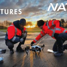 |
by Press on (#3NEM2)
NATS, the UK’s leading air traffic control provider, and Sky-Futures, a world leader in commercial drone-based inspection services and training are holding the official launch of their new partnership on 15th May, 2018. The partnership will change the landscape of drone training in the UK. NATS’ unrivalled airspace and aviation expertise together with Sky-Futures’ industry-leading […]
|
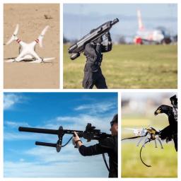 |
by Rob Thompson on (#3NEM4)
The CUAS industry is plagued with problems from the illegal nature of rogue drone pilots to the fact that the equipment is illegal to use for civilians to protect their assets, the industry has many problems. Illegal Operations CUAS equipment is currently illegal to use for civilians and asset owners, people who own venues for […]
|
 |
by Press on (#3NEM6)
Zurich, 24 April 2018: Wingtra, the Swiss professional VTOL (vertical take-off and landing) drone manufacturer, appointed Cyril Halter as the new COO. Cyril Halter will be taking over Wingtra’s operations with a focus on the industrialisation and the ramp up of production to enable forecasted triple digit growth over the next years. Cyril Halter commented […]
|
 |
by Press on (#3NEM8)
DroneShield Ltd (ASX: DRO or DRO.AU) (the “Company†or “DroneShieldâ€), a publicly-traded leader in the emerging industry of drone security solutions, has announced that its products were utilised by the Australian Defence Force for the protection of the ASEAN-Australia Special Summit 2018 in Sydney. The Association of Southeast Asian Nations (ASEAN) is the premier regional […]
|
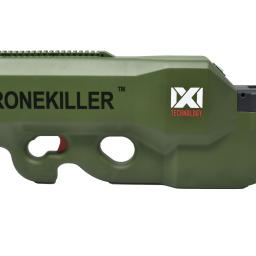 |
by Press on (#3NEHS)
Concurrent with its showing at the Navy League Sea, Air and Space Exhibition in Washington DC this past week, IXI EW, LLC announced today that they have entered into a Product Development and a Licensing Agreement with T-Worx Holdings, LLC (www.tworx.com) based in Ashburn, Virginia. The Product Development and Licensing Agreement provide for the integration of the IXI […]
|
 |
by Press on (#3N87Y)
Aleks Kowalski – Consortiq Does future regulation spell the end for drone training? In the first article of this series, we looked at the background to where we are today and that commercial and economic drivers, from both industry and government, demand drones to be operated beyond existing legislative capabilities. In the next 2 articles, […]
|
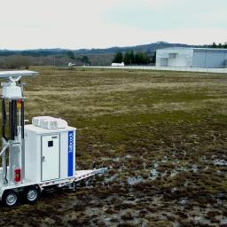 |
by Press on (#3N83Y)
System to provide real-time beyond visual line-of-sight for unmanned aircraft and drone operations Panama City, FL April 17, 2018: DeTect, Inc. (www.detect-inc.com) announced today that it has completed commissioning of a HARRIER GGround-BasedSense-and-Avoid (GBSAA) radar at the Rozas Aerodrome in Lugo, Spain. The system, supplied to Babcock Mission Critical Services España, will provide beyond visual line-of-sight (BVLOS) […]
|
 |
by Press on (#3N840)
Little Arms Studios, a leading developer of professional-grade simulation solutions, announced it has joined forces with renowned Hollywood cinematographer Skip Fredricks to launch an updated version of its Zephyr Drone Simulator that includes the basics of drone cinematography. The two-time Emmy nominated content producer and certified drone instructor has brought his unique instructional perspective to a series […]
|
 |
by Press on (#3N7YP)
Price update includes the Matrice 200, Matrice 210, Matrice 210 RTK and Zenmuse Z30. DJI has today announced reduced prices of a number of products throughout the DJI Enterprise range. Drone operators can now access the Matrice 200, Matrice 210, Matrice 210 RTK and Zenmuse Z30 at rates significantly cheaper than previously quoted. The announcement […]
|
 |
by Press on (#3N5RM)
The executive management of 3W-Modellmotoren GmbH, which acted as production service provider for 3W-International GmbH, filed for bankruptcy during the past week. For this reason, Karsten Schudt, managing director of 3W-International GmbH, is making a statement that the leading engine supplier for UASs is covered concerning this development. “Both companies were independent of one another. […]
|
 |
by Press on (#3N4VD)
Kespry, the leading drone-based aerial intelligence solution provider, today announced new capabilities for significantly accelerating the assessment of roof hail and wind damage for residential, multi-family and commercial buildings. New capabilities include on-site processing of drone-captured roof inspection data, a Virtual Test Square (VTS) to support claims decision-making in minutes, and enhanced automated hail detection, […]
|
 |
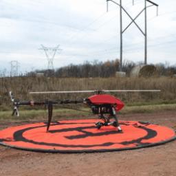
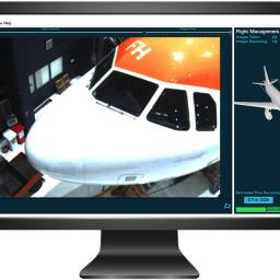
by Press on (#3N42S)
uAvionix Corporation – a leading provider of communications, navigation, and surveillance (CNS) solutions for manned and unmanned aircraft – announced today it has successfully completed testing and demonstration of the DroneAware™ uAvionix UAS Remote Identification solution for NASA’s Technical Capability Level 3 (TCL3) UAS Traffic Management (UTM) system. The tests were conducted in coordination with […]
|
 |
by Press on (#3N321)
Kratos Defense & Security Solutions, Inc. (Nasdaq: KTOS), a leading National Security Solutions provider, announced today that its subsidiary, Kratos Unmanned Aerial Systems, Inc. as part of the Dynetics led team, has been selected for award on Phase III of the Defense Advanced Research Projects Agency (DARPA) Gremlins program. The goal of the Gremlins program […]
|
 |
by Press on (#3N2XS)
Investment Creates Partnership to Develop Powerful UAS Solutions for FLIR’s First Responder Customers and Funds DroneSense for Growth WILSONVILLE, Ore. & AUSTIN, Texas –Apr. 18, 2018– FLIR Systems, Inc. (NASDAQ: FLIR) and DroneSense, Inc. announced today that FLIR has completed a strategic investment in DroneSense, makers of a unique software platform that serves the growing […]
|
 |
by Press on (#3N2XV)
Radioplane, a new player in the drone sphere is introducing a next generation, highly adaptable, modular drone for serious work and adventure. The state of the art Seeker drone is designed to carry many different types of equipment for a multitude of tasks autonomously, automatically and continuously. The Seeker drone is a highly precise flying device that can be programmed […]
|
 |
by Press on (#3N2W2)
The World Games 2021 in Birmingham, Alabama, USA, will include two FAI air sports, it was announced on Sunday. Drone racing and canopy piloting – a spectacular form of skydiving that combines precision and speed – will be on the programme of the multi-sport event. The decision to include the two air sports was made […]
|
 |
by Press on (#3N2W3)
Xcel Energy, a leader in using drone technology to inspect energy infrastructure, will be the first utility in the nation to routinely fly unmanned aircraft beyond the operator’s line of sight when it begins surveying transmission lines near Denver, Colorado. Last week, the Federal Aviation Administration announced it authorized the flights. The FAA’s decision to […]
|
 |
by Press on (#3MZYH)
Altavian, Inc., a U.S. based Unmanned Aircraft System (UAS) engineering and manufacturing firm, today announces the award of a $250M Indefinite Delivery, Indefinite Quantity contract with the US Army. Under the Program Executive Office Aviation, Products Office for Tactical Unmanned Aircraft (TUAS), Altavian will be supporting the largest small UAS program in the world. The […]
|
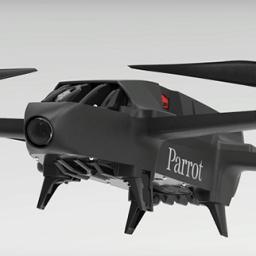 |
by Press on (#3MZW8)
Parrot Bluegrass is an all-in-one, multipurpose quadcopter drone solution specifically designed for farming and agriculture. The Parrot Bluegrass helps business owners remain competitive and produce higher quality crops by providing accurate data which can be used to improve farming practices and agricultural output while being eco-friendly and cost-effective. The drone’s frontal camera gives farmers a […]
|
 |
by Press on (#3MZSC)
Developed by Swiss startup Flyability, Elios is successfully used by one of the most prestigious special law enforcement units in the world, the RAID (Research, Assistance, Intervention, Deterrence), to perform indoor reconnaissance and intelligence in the most complex enclosed spaces. The unique ability of Elios to tolerate collisions makes it ideal for deployment in critical […]
|
 |
by Patrick Egan on (#3MZ2G)
This is your chance to hear first hand from successful drone industry professionals and see live “cage free†demonstrations of applications, products and safety mitigations for drones. If you have an interest in drones or are looking for more information about what they can do or get into the drone business, this might be the […]
|
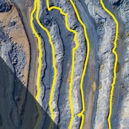 |
by Press on (#3MY7J)
Real-world usage, ROI & adoption feedback from experienced operators Wed, April 18, 10:00 EST / 16:00 CET (GMT+2) Register How drone (UAV) technology is being employed by mine & quarry companies & service providers How drones are being employed at mine & quarry sites worldwide: from volume calculation to slope monitoring & blast analysis How […]
|
 |
by Press on (#3MXY0)
Jon Hegranes CEO & Co-Founder @kittyhawkio With the initial roll-out of LAANC just a few weeks away, we’ve been hard at work integrating native, seamless, and beautiful LAANC functionality into our platform (but more on that later ;). Today we wanted to dig into the numbers and dissect *why* there’s such a fervour around LAANC. What […]
|
 |
by Press on (#3MXWC)
WEST LAFAYETTE, Ind. – A Purdue University researcher led the development of a free, web-based application that will allow those using unmanned aerial systems (UAS) to easily log their flight-related data. The UAS User Log is a digital logbook available around the world to serve those using UAS, or drones, for research, crop production, spray […]
|
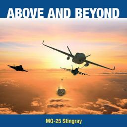 |
by Press on (#3MXTW)
General Atomics Aeronautical Systems, Inc. (GA-ASI) has successfully demonstrated aircraft carrier deck handling to include taxi capability and transition to the launch and recovery phases using a Predator® C Avenger® jet aircraft as a surrogate. As part of the proposed MQ-25 solution, GA-ASI has demonstrated that the new carrier-based unmanned tanker can integrate with the complexities of […]
|
 |
by Press on (#3MW1S)
Some are petitioning Congress to eliminate the Special Rule for Model Aircraft – also known as Section 336. This is a critical moment to let your elected representatives know the importance of the recreational community and the Special Rule for Model Aircraft. The recreational community has played a critical role in the innovations of new […]
|
 |
by Press on (#3MV5E)
CTO Neil Kidd explains why Altitude Angel have invested in building the necessary real-time data processing technology for one of aviation’s most important international systems, and shows us why other big names in the business often get this wrong. He walks us through a real-life NOTAM, set to come in to effect on the 18th […]
|
 |
by Press on (#3MV5G)
DJI, the world’s leader in civilian drones and aerial imaging technology, will support a Mercedes-AMG car at the ADAC Zurich 24-Hour Race at the Nurburgring this year. The sponsorship consists of a picture of the DJI Mavic Air and a prominent logo placement on the roof as well as a logo placement on the bonnet […]
|
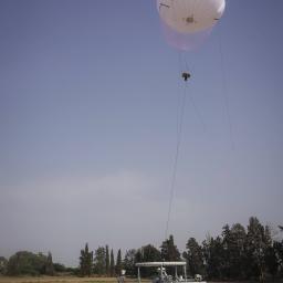 |
by Press on (#3MV4H)
The Israeli-based aerostat company RT LTA Systems Ltd. has signed a leasing agreement with the government of a leading European country, under which the company will provide it’s SkyStar 180 Aerostat system for 6 months. The leasing agreement includes an option to extend the leasing period in additional 30 months, as well as an option […]
|
 |
by Gary Mortimer on (#3MP13)
Dear Sundar, We believe that Google should not be in the business of war. Therefore we ask that Project Maven be cancelled, and that Google draft, publicize and enforce a clear policy stating that neither Google nor its contractors will ever build warfare technology. Google is implementing Project Maven, a customized AI surveillance engine that […]
|
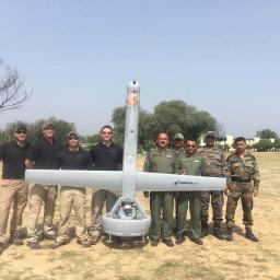 |
by Press on (#3MNYE)
Martin UAV has successfully completed flight demonstrations in India for the Indian Army. Over the last 2 weeks, Martin UAV’s innovative V-BAT aircraft flew in operational test scenarios in both mountainous terrain and Jungle environments. Flying both day and night sorties the V-BAT performed exceptionally well in the challenging conditions. Following the demonstrations, Martin UAV […]
|
 |
by Press on (#3MNV9)
What is BVLOS? BVLOS means Beyond Visual Line of Sight operations for drones. BVLOS is the natural progression for commercial drone operations, but before it can take off the FAA will need to make it safe, so until then everyone is in a holding pattern. The limitation to Visual Line of Sight (VLOS) or Extended […]
|
 |
by Press on (#3MN7N)
Today we’re really excited to announce an important change to our pricing. When we first set up as a provider of drone training in the UK, the landscape was sparse; the choice was limited. This didn’t stop us innovating though. We rapidly established ourselves as one of the UK’s leading CAA-approved training providers. More than […]
|
 |
by Press on (#3MK6X)
Paul Riemens, CEO of the RAI Amsterdam convention centre, has launched the ‘Amsterdam City of Drones’ initiative in parallel with this week’s Commercial UAV Expo Europe. “RAI Amsterdam aims to be more than an event organiser in this context,†says Riemens. “Our goal is to provide a platform for knowledge, contacts and innovation as we […]
|
 |
by Press on (#3MK6Z)
Gilles Labossière, the Executive Vice President and COO of Parrot Group, will focus on further boosting senseFly’s growth and leveraging its professional expertise across Parrot’s wider Business Solutions group Cheseaux-sur-Lausanne, Switzerland, April 12, 2018: senseFly, the industry’s leading provider of professional mapping drones and a commercial drone subsidiary of Parrot Group, today confirmed the appointment […]
|
 |
by Press on (#3MK41)
Partnership unites two leading companies, enhancing and expanding drone forensic capabilities globally Stockholm: April 12, 2018 – MSAB, the global leader in mobile forensics solutions, today announced that the company has partnered with URSA Inc., expanding tremendously on its’ drone forensic capabilities. URSA’s Idetic™ Unmanned tools are designed to collect, integrate, analyze, and present UAV related data. The […]
|
 |
by Press on (#3MHJE)
DroneShield Ltd (the “Company†or “DroneShieldâ€), a leader in the emerging industry of drone security solutions, is pleased to announce that the Fort Worth Police Department has today confirmed that DroneShield’s products were utilised by the Texas State Department of Public Safety, the Denton County Sheriff, the Fort Worth Police Department, the Texas Forest Service, and […]
|
 |
by Press on (#3MFY6)
Ubisense Group plc (AIM:UBI),a global leader in enterprise intelligence solutions, is today announcing a partnership with pioneers of autonomy and creators of innovative aviation software products, MRO Drone, to offer the world’s first ‘Smart Hangar’ solution, combining automated aircraft inspection with automated tool and asset management to improve efficiency and increase productivity for MROs. Developed […]
|
 |
by Patrick Egan on (#3MFY8)
Small Unmanned Business Systems Business Exposition attendees and guests of Epson can come out to Treasure Island on April 26th and get a first hand Epson MOVERIO BT-300 FPV smart glasses and app demonstration between 9:00 am to 3:00 pm. As part of the ongoing collaboration with global drone leader DJI, Epson, providers of the […]
|
 |
by Press on (#3MFYA)
5 projects address strategic needs of regions in talent development, infrastructure development and commercialization that will create higher-paying jobs RICHMOND – Governor Ralph Northam today announced five regional projects funded through GO Virginia (Growth and Opportunity for Virginia) grants totaling $1,115,300. Key members of the Governor’s cabinet, the General Assembly and the business community approved […]
|
 |
by Press on (#3MFV0)
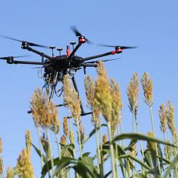
Paper Open access published in Remote Sensing on April 10, 2018. Authors: Ana I. de Castro, Francisco M. Jiménez-Brenes, Jorge Torres-Sánchez, José M. Peña, Irene Borra-Serrano and Francisca López-Granados This study was carried out by researchers from the imaPing group (www.ias.csic.es/imaping) led by Dr. Francisca López-Granados of the Institute of Sustainable Agriculture of Cordoba (IAS-CSIC), […]
|
 |
by Press on (#3MEYM)
Sentera announces the availability of high-fidelity crop stand, weed pressure mapping, spot scouting maps, and free local image stitching within the Sentera FieldAgent™ platform. These valuable, field edge tools are available today to all FieldAgent customers using high-resolution crop imagery. The new FieldAgent analytics help ag professionals leverage early season data for replant decisions, manage […]
|
 |
by Press on (#3MEYP)
Dropcopter, a pollination UAS startup secured $250,000 from Syracuse New York based GENIUS NY accelerator. Their pollination drone service is the first in the world to use automated multirotors to dust almonds, pistachios and cherries, boosting crop set by as much as a tested 15%! They’re offering the service as a much-needed alternative to expensive […]
|
 |
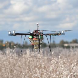
by Press on (#3MEYR)
Michael J. Logan NASA Langley Research Center, Hampton, VA Jay Gundlach FlightHouse Engineering, Portland Oregon Thomas L. Vranas National Institute of Aerospace, Hampton, VA There is an increasing demand for capable and affordable small UAS for a variety of potential mission applications. Some of these applications would notionally require significant improvements in the level of […]
|
 |
by Press on (#3MCHM)
Drone deliveries, drone inspections and even autonomous flying taxis are near term realities, and to make these services safe and efficient ICAO has begun the consultative work needed to establish low-altitude traffic management guidance for domestic unmanned aircraft systems (UAS). Recognizing that an agreed global approach will greatly assist businesses and others in launching their […]
|
 |
by Press on (#3MCHP)
Tools dedicated to precision agriculture help farmers and agronomists optimise the ROI of their crops and improve their daily productivity. This high precision and analysis enable farming experts to make well-informed decisions efficiently. Parrot has recently developed Parrot Sequoia+, a new generation of its multispectral sensor that allows you to automatically calibrate multispectral images using […]
|