 |
by Press on (#3S992)
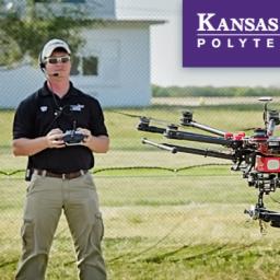
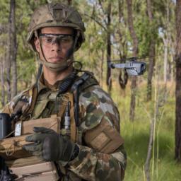
Kansas State University Polytechnic Campus is expanding its program options with a new offering for individuals interested in cybersecurity of unmanned aircraft systems. A graduate certificate in unmanned aircraft systems information assurance is being launched in fall 2018. The certificate provides working professionals and graduate students an educational foundation in an industry important to both military […]
|
sUAS News
| Link | https://www.suasnews.com/ |
| Feed | http://www.suasnews.com/feed |
| Updated | 2026-07-22 02:00 |
 |
by Press on (#3S94M)
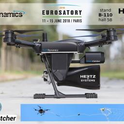
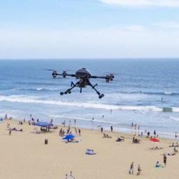
Today it is easy and cheap to buy a drone. Drones have created new ways for smugglers and can be easily used to disturb public order and security. With DroneCatcher this can now be countered in a fully controlled manner. The DroneCatcher system is one of the very few counter-drone systems, which is capable of […]
|
 |
by Gary Mortimer on (#3S8SM)
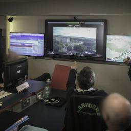
I was sent a press release from UK firm SenSat on Wednesday that quite frankly made many claims that just didn’t stack up. Perhaps it was this line that first made me doubt SenSat from their about profile in the press release. SenSat is pioneering the use of a new technique called Structure from Motion (SfM) photogrammetry […]
|
 |
by Press on (#3S7M8)
Silent Falcon UAS Technologies solar electric, fixed wing, long endurance, long-range Unmanned Aircraft System (UAS) has been selected by Bridger Aerospace for its Call When Needed sUAS Services Contract with the US Department of the Interior. The contract, which is Interior’s first of its kind, will allow the agency to obtain fully contractor-operated and maintained […]
|
 |
by Press on (#3S6NV)
K2 Unmanned Systems, Inc, a U.S. commercial drone manufacturer, flight ops, and training company, announced this week their partnership with Robotic Skies to provide K2 customers the complete customer service experience. K2 Unmanned recently released their new industrial-grade drone, the Knight Hawk. This coaxial octocopter sUAS is equipped with a FLIR Duo pro camera, displaying thermal […]
|
 |
by Press on (#3S6BD)
Propeller Aero, a cloud-based analytics company that visualizes drone survey data to help heavy civil construction and resources operations measure and manage their worksites themselves, announced today a new infusion of $10 million in Series A funding. The round was led by Blackbird Ventures with participation from all existing major investors, and Sequoia China who […]
|
 |
by Press on (#3S5DV)
VStar Systems, a privately held aerospace and defense systems company, has announced its new office located centrally in San Diego. The office officially opened in April and will serve as VStar Systems’ corporate headquarters as well as a lab and production space for ongoing projects. “VStar Systems’ new office will allow us to greatly expand the […]
|
 |
by Press on (#3S5DW)
WASHINGTON – Introducing drone operations into the nation’s airspace can provide substantial benefits to society, such as preventing derailments, inspecting cell phone towers, delivering medical devices to patients in cardiac distress, and assisting firefighters, says a new congressionally mandated report by the National Academies of Sciences, Engineering, and Medicine. However, an overly conservative approach to safety risk […]
|
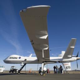 |
by Press on (#3S5DX)
A Detect and Avoid (DAA) avionics system developed by General Atomics Aeronautical Systems, Inc. (GA‑ASI) was the key technology that enabled an unmanned aircraft flight through the National Airspace System (NAS) after taking off from southern California today. The DAA system installed on Ikhana, a NASA-owned Predator® B/MQ-9 Unmanned Aircraft System (UAS), enabled the UAS to meet the FAA’s […]
|
 |
by Press on (#3S4V7)
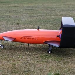
Jetoptera, Inc. and UAVenture realized the first successful demonstration of autopilot capabilities deployed on Jetoptera’s proprietary, unique airframe system. AirRails, developed by UAVenture, was proven on a sub-scale Jetoptera airframe that includes a closed wing and a canard. Autopilot-assisted take off and landing and autonomous mission mode were achieved. The next testing milestone for the […]
|
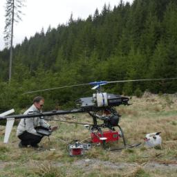 |
by Press on (#3S4D9)
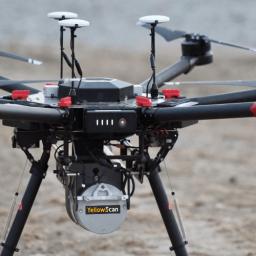
Drones have become ubiquitous the application of photogrammetry and 3D surveying in the last few years. Measurements from these systems have generated 3D models of buildings, landscapes, power lines and many other features. This project takes it one step further by generating extremely high-density point clouds and digital photos using the Scout B1-100 helicopter drone […]
|
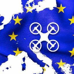 |
by Press on (#3S4DB)
An agreement to revise the powers of the European Aviation Safety Agency (EASA) safety was approved by MEPs in Strasbourg today. For the first time in EU law the new rules introduce provisions on the civil use of drones and have been welcomed by ECR Group transport spokesman, Roberts Zile, as a sensible and pragmatic […]
|
 |
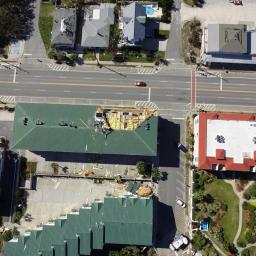
by Press on (#3S4A2)
SenSat successfully completes 12km Beyond Visual Line Of Sight drone flight in complex airspaceus, SenSat were granted to fly drones beyond a pilot’s visual line of sight. SenSats Artificial Intelligence (AI) turns real-time complex data into actionable insight, helping companies to make more informed decisions based on real-world information. The drone Pathfinder programme consists of a […]
|
 |
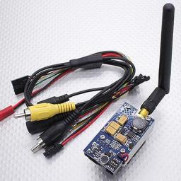
by Press on (#3S42G)
Gap Wireless, a leading distributor of products and services for the mobile broadband and wireless markets, and inUAVi, an innovator in the drone radio frequency (RF) monitor and sensor market, announced today they have entered into a reseller agreement for distribution of inUAVi solutions in Canada and the U.S. Gap Wireless will stock and distribute inUAVi’s Network Quality […]
|
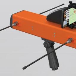 |
by Press on (#3S42J)
Firestorm UAV Inc. (https://www.fsuav.com/) recently announced its position as the sole supplier of an innovative handheld search and rescue sensor intended for all types of field-rescue operations. The mobile TigerStrike Lite hardware pairs with Firestorm’s unique iRDF™ technology to position the company as the foremost expert and manufacturer of mobile ISR search and rescue signal […]
|
 |
by Press on (#3S40B)
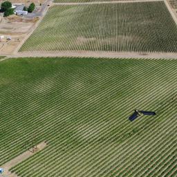
SimActive Inc., a world-leading developer of photogrammetry software, is proud to announce use of its software for precision agriculture in Brazil by Portal Produtos Agropecuários Ltda (Portal). Drone data is transformed into useful and pertinent information for farmers with Correlator3D, leading to optimized yields and reduced costs for the agricultural season. The identification of the […]
|
 |
by Press on (#3S2F1)
The Microdrones md4-3000 has been added to Transport Canada’s (TC) exclusive list of compliant unmanned aerial vehicles. To date, only fifteen manufacturers worldwide have achieved this distinction. Vivien Heriard-Dubreuil, president of Microdrones, explained why this is important, not only in Canada, but internationally. “Professionals across all continents view Transport Canada compliance as a benchmark for […]
|
 |
by Press on (#3S1X8)
Shenzhen, China – June 11th, 2018 – Huawei Technologies Co., Ltd and Unifly N.V have signed a Memorandum of Understanding (MoU) to cooperate in the field of Unmanned Traffic Management (UTM) systems. The MoU covers both research and development, and a joint market approach to Unmanned Aircraft Systems (UAS, or drone) management. The global market […]
|
 |
by Press on (#3S1XA)
As one of the first cities, Hamburg is being welcomed to the Urban Air Mobility (UAM) Initiative of the European Innovation Partnership for Smart Cities and Communities (EIP-SCC) which is supported by the European Commission. This makes the region an official demonstrator region for the implementation of civilian usage of drone and other urban air […]
|
|
by Press on (#3S1JD)
The Federal Aviation Administration (FAA) has published the Remote Pilot – small Unmanned Aircraft Systems (sUAS) Airman Certification Standard (ACS) document to communicate the aeronautical knowledge standards for certification and recurrent knowledge testing for a Remote Pilot Certificate with an sUAS rating. The FAA views the ACS as the foundation to an integrated and systematic […]
|
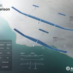 |
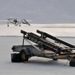
by Press on (#3RZ36)
Premier welcomes Airbus announcement to establish innovative Zephyr solar-powered unmanned aircraft at Wyndham airfield in Western Australia Wyndham will be the world’s first operational site for the launch and recovery of the class of unmanned aircraft known as High Altitude Pseudo Satellites Announcement follows Premier’s March meeting with Airbus executives in the UK Project promises […]
|
 |
by Press on (#3RZ1D)
AUV Flight Services is seeking talented and qualified professionals to support expanding customer test flight operations. Flight operations will be of a Test/R&D nature utilizing VTOL and fixed-wing platforms. The ideal candidate will have a background in UAS operations, manned flight experience, and customer interaction. The candidate must be a self-starter with the ability to […]
|
 |
by Press on (#3RXH7)
FlytBase Inc., the company bringing intelligence and connectivity to the drones, today announced the release of an automated precision-landing solution, FlytDock – the world’s smartest visual target landing solution, compatible with the widest range of drones. Precision landing is a critical requirement for a large number of commercial drone applications, be it autonomous routine patrols […]
|
 |
by Press on (#3RWY4)
ZURICH–Verity Studios AG, the global leader in indoor drone technology, announced today that it has raised $18 million in a Series A funding round, making Verity the world’s most well-funded company in the rapidly emerging commercial indoor drone market. Fontinalis Partners, a venture capital firm focused on next-generation mobility technologies, led the round. Other investors include […]
|
 |
by Press on (#3RWPZ)
The Coast Guard today awarded a contract to Insitu Inc. of Bingen, Washington, for procurement of small unmanned aircraft system (sUAS) capability for the national security cutters (NSCs) June 6. The service contract covers installation and deployment of sUAS for approximately 200 hours per 30-day operational patrol period. Installations of sUAS capability on NSCs are planned […]
|
 |
by Press on (#3RWMW)
Congratulations to three of our GEG inspectors who recently attended the Sky-Futures in-house training course to qualify as UAV inspection engineers. Sky-Futures was established in 2009 and is now one of the world’s leading provider of drone-based inspection services to the global industrial market. Global Energy is keen to expand its service lines to provide […]
|
 |
by Press on (#3RVDN)
Pix4D’s first fully dedicated product for agriculture – Pix4Dfields: created with the input of farmers, agronomists and breeders is now live. We worked with farmers, agronomists and breeders to shape Pix4Dfields. Over the past two months, a select group of beta testers has used the product all over the world. Their feedback not only demonstrates […]
|
 |
by Gary Mortimer on (#3RVDQ)
Just leave this here with a hat tip to our favourite cybersecurity geek. This memo has been being spoken about and seen in chat rooms across the web. SUBJECT: (U/FOUO) Unmanned Aerial Vehicle Systems Cybersecurity Vulnerabilities (U/FOUO) On May 14, 2018 the DoD Inspector General found that DoD has not implemented an adequate process […]
|
 |
Dropcopter and Partner Beak & Skiff Apple Orchard, showcase autonomous pollination of apples in U.S.
by Press on (#3RTV3)
GENIUS NY team Dropcopter and its partner Beak & Skiff Apple Orchard, showcased the first ever autonomous pollination of apples in the country. Dropcopter, which uses a drone to pollinate tree crops, successfully demonstrated its Worker-Bee pollinator at the at the 800-acre orchard, which is home to more than 350,000 trees, in Lafayette, New York. […]
|
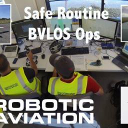 |
by Press on (#3RTPW)
ING Robotic Aviation Inc. has been selected to fly an extensive series of Beyond-Visual- Line-of-Sight (BVLOS) RPAS missions in support of Canadian Oil Sands operations. These missions will be undertaken within a safe flight regime approved and monitored by Transport Canada (TC) as part of the TC BVLOS Pilot Project in the summer of 2018. […]
|
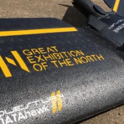 |
by Press on (#3RTPY)
The Great Exhibition of the North 2018 starts next month. The Exhibition is a three-month celebration of the North of England’s pioneering spirit and the impact of our inventors, artists and designers. QuestUAV have been asked to display the DATAHawk as part of the exhibition. This can be viewed at the Hancock Museum from 22nd […]
|
 |
by Press on (#3RTQ0)
Elistair’s Orion drone has been recently deployed in conjunction with Delta Drone to provide surveillance of La Ferté Alais air show. This deployment was in support of the firefighting unit SDIS 91 and the Gendarmerie in order to assist in providing security for the 40,000 visitors. The ISS (Intelligent Security Systems) division of Delta Drone, […]
|
 |
by Press on (#3RTFB)
Iris Automation, a high tech company based in San Francisco developing collision avoidance software for drones to enable them to fly autonomously, was selected by Transport Canada in their beyond-visual-line-of-sight (BVLOS) trial program, unlocking the ability for drones to fly independently on longer range, more demanding missions. The Iris collision avoidance module is crucial in […]
|
 |
by Press on (#3RTFD)
Joe Sullivan, CEO – Aerial Applications Software platforms are taking drones from individual pieces of hardware to full systems that companies can use to do their job better, instantly collaborate with teammates across the world and save lives – but more than anything they are saving companies a lot of money. These platforms have been […]
|
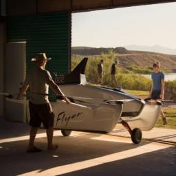 |
by Press on (#3RRRN)
Created as an FAA CFR Part 103 Ultralight the Kitty Hawk Corporation does not require a licence for the pilot or registration for the aircraft. An interesting situation, a manned RPA (for that is what it is) needing less paperwork than a Mavic. For now, the Flyer is constrained to an altitude of 3m and a […]
|
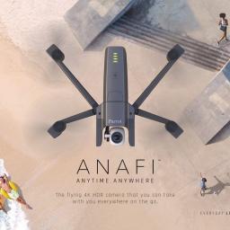 |
by Press on (#3RRRQ)
Today, Parrot, the leading European drone group, announces ANAFI. With ANAFI, Parrot again disrupts the drone universe and redefines the standards with a new-generation drone that is ultra-portable, equipped with a 4K HDR camera, super-efficient and easy to use. For more than two years in Paris, a team of passionate engineers have been designing ANAFI: a drone with new […]
|
 |
by Press on (#3RRDK)
Bonfire Ventures, Boeing HorizonX Ventures, Freestyle Ventures, and The Flying Object Prepare for Takeoff in the Rapidly Maturing Commercial Drone Sector SAN FRANCISCO, Calif., June 6, 2018 — Kittyhawk, the enterprise drone solutions company, today announced it raised $5M in funding, bringing the company’s total capital raised to $6.5M. Kittyhawk raised the capital to further its […]
|
 |
by Press on (#3RR28)
Drone Video Transmitters Could Apparently Operate in Radio Frequency Bands Not Designated for Amateur Use & Transmit at Disruptive Power Levels — WASHINGTON, June 7, 2018—The Federal Communications Commission today proposed a $2.8 million fine against HobbyKing for marketing sixty-five models of devices used to relay video from drones to amateur drone operators which could […]
|
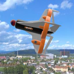 |
by Press on (#3RQQJ)
The Swiss aircraft design company Ray Research AG presents an extremely compact single person aircraft with exceptional characteristics: With a wingspan of only 2.4m (7.9ft) and a length of 2.0m (6.6ft) it is smaller than many cars. It profits of a hybrid propulsion system with 4 electric motors and a combustion engine. But the most […]
|
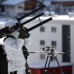 |
by Press on (#3RQQM)
Best-In-Class Detection, Radar, Acoustic and Defeat Technologies to Join Forces and Showcase Solutions at C-UAS Event San Francisco, CA – June 5, 2018 — Dedrone, the market and technology leader in airspace security, announced today that its team of Echodyne Corporation, Squarehead Technologies, and Battelle, has been selected by SOFWERX for the ThunderDrone outdoor demonstration to take place at […]
|
 |
by Press on (#3RQQP)
Founded in 2010, ThirdEye Systems Ltd. is an experienced well-known Research and Development company, specialized in high-end object recognition algorithms within the thermal spectrum, for various needs. With a strong background in both computer vision and drone control, the company’s products are in the IDF service and are successfully used by leading defense companies. The […]
|
 |
by Press on (#3RPND)
FLIR Systems, Inc. (NASDAQ: FLIR) today announced the Black Hornet® 3 nano-unmanned aerial vehicle (UAV) for use by global militaries, government agencies, and first responders. The Black Hornet Personal Reconnaissance System (PRS) is already the world’s smallest combat-proven nano-Unmanned Aerial System (UAS), and FLIR’s next generation Black Hornet 3 nano-UAV adds the ability to navigate […]
|
 |
by Press on (#3RPH2)
DJI, the world’s leader in civilian drones and aerial imaging technology, and Axon (Nasdaq: AAXN), the global leader in connected law enforcement technologies, today announced an exclusive partnership, within the digital evidence management industry, to sell DJI drones directly to public safety and law enforcement agencies worldwide through the new Axon Air program. The partnership was announced at the […]
|
 |
by Press on (#3RP5V)
PAE ISR, LLC selects Sagetech Corporation’s MX transponder product line for the Resolute Eagle, a long endurance, 210 pound unmanned aerial system (UAS). The MX transponder line allows PAE ISR to use a single form and fit across its entire UAS fleet, regardless of mission. This line of transponders includes a civil variant, MXS, which […]
|
 |
by Press on (#3RNKK)
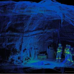
Inkonova’s Batonomous received the first commercial service purchase order for a scanning mission using the Batonomous system (autonomy for aerial robotics without light or infrastructure -GPS, beacons, video, etc..) from LKAB Malmberget. The PO came after a prior demo of the system there in late February this year, the demo was conducted in Gällivare in Northern Sweden, beyond the Arctic […]
|
 |
by Press on (#3RNGB)
Swiss Post, the Insel hospital group, and drone manufacturer Matternet have started a commercial BVLOS drone transport service in the Swiss capital city of Berne. The drones are connecting the Insel university hospital and Tiefenau hospital, located 4 km (2.5 miles) apart, carrying lab samples and urgently needed medication. The route is located entirely inside […]
|
 |
by Rob Thompson on (#3RMAS)
The CUAS Coalition is proud to announce our attendance of the Senate hearing of S. 2836, the Preventing Emerging Threats Act of 2018: Countering Malicious Drones,†on Wednesday, June 6, 2018. The CUAS Coalition for over a year now has been working with legislators to create laws that will help civilians use counter drone equipment to […]
|
 |
by Press on (#3RM0Q)
L3 MAS announced on May 31, 2018, that it has teamed with Israel Aerospace Industries (IAI) to form Team Artemis to offer the state-of-the-art Artemis Unmanned Aerial System (UAS), based on IAI’s Heron TP, for the Royal Canadian Air Force’s (RCAF’s) remotely piloted aircraft system (RPAS) program. The Artemis UAS is a mature and highly […]
|
 |
by Press on (#3RKT8)
(Editors note, Annie Joannette of Transport Canada sent the following message just after this was published – IN-FLIGHT Data and senseFly are not part of the four organizations selected by Transport Canada for these drone trials. – I am going to keep this press release up and allow you to form your own opinion Dear Reader GM 21:40 GMT) […]
|
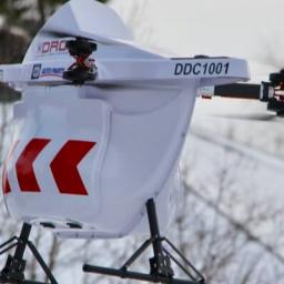 |
by Press on (#3RKAX)
Drone Delivery Canada (“DDCâ€) (TSX.V:FLT – OTCQB: TAKOF), is pleased to announce that Transport Canada has selected DDC to participate in the department’s Beyond Visual Line-of-Sight Pilot Project (the “Pilot Projectâ€). The Pilot Project will advance its Beyond Visual Line-of-Sight (“BVLOSâ€) capabilities in Canada and will further DDC’s capabilities in the Moosonee and Moose Cree First Nation communities in Northern Ontario, Canada commencing […]
|