 |
by Press on (#2JX9A)
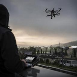
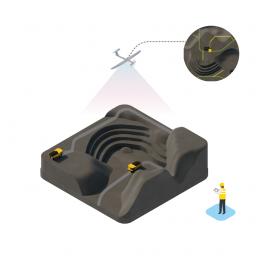
Rheinmetall AG has won two important first orders for protecting sensitive government infrastructure from aerial drones. In Switzerland, the central prison in Lenzburg and the inter-cantonal penitentiary in Bostadel have contracted with the Düsseldorf-based high-tech group to install drone detection equipment known as the Radshield system. Consisting of an array of video cameras, infrared sensors […]
|
sUAS News
| Link | https://www.suasnews.com/ |
| Feed | http://www.suasnews.com/feed |
| Updated | 2026-07-20 13:15 |
 |
by Press on (#2JX29)
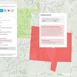
From 14th April, the U.S. FAA will introduce 133 ‘Security Sensitive Restrictions’, applicable to drones. These sites are immediately available for our community to view within our mobile apps and online safety map, ahead of schedule, so you can plan your flights accordingly. For our developers and partners, all of these security sensitive restrictions have […]
|
 |
by Press on (#2JWNM)
Industrial SkyWorks Inc., the leader in drone-based building, and oil and gas infrastructure inspections, announced the release today of its new software application Blue VU, which enables remote-inspection of assets, saving time and money, all while increasing worker safety. Toronto, Ontario 4th April, 2017 Industrial Skyworks is pleased to announce the official launch of […]
|
 |
by Press on (#2JWMH)
Hyperspectral imaging is one of the fast moving areas of research and industrial development in remote sensing. In this special issue of IEEE JSTARS, we aim at gathering high-level contributions dealing with the acquisition and processing of hyperspectral data. By hyperspectral data, we mean signals acquired by spectrometers as well as images acquired from airborne […]
|
 |
by Press on (#2JWJY)
Petr LnÄ›niÄka was working as filmmaker when aerial footage became a hot commodity. “In 2011 it was something pretty new and unusual and we actually had to have it,†recalls Petr. “But at that time in Czech Republic, there was basically no one to supply us with quality footage.†So he started filming himself. With […]
|
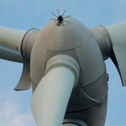 |
by Press on (#2JVPZ)
Pro-Drone, S.A., a leading organization in automated drones for wind turbine’s blade surveys, announces its first licensing agreement with Brazilian wind energy specialist Arth-Wind to provide quality and safe inspections of wind blades to the Brazilian market. Arth-Wind is a company with a group of professionals with more than 9 years of experience in the […]
|
 |
by Press on (#2JTWA)
Today, the German company TeAx Technology is unveiling its latest product development for the global, thermal drone market: ThermalCapture Fusion Zoom, the most lightweight dual camera with an RGB zoom factor. “This is just another major step forward for the global drone industry and those, who are dealing with thermal imaging technologyâ€, Michael Thoss, VP […]
|
 |
by Press on (#2JRFJ)
On behalf of DJI, the global leader in developing and manufacturing innovative drone and camera technology for commercial and recreational use, we would like to invite you to the UK launch of the Matrice 200 Series drone. The DJI M200 Series has received global recognition as a long-awaited cost-effective industrial solution for professional users to perform […]
|
 |
by Press on (#2JQWM)
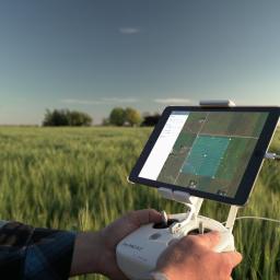
Sentera today announced the availability of its precision agriculture solutions at over 350 retail locations across North America. By broadening the reach of Sentera’s precision agriculture offering, agronomists, crop consultants, and growers can leverage critical normalized difference vegetation index (NDVI) data starting day one of the 2017 growing season. Early adopters immediately see the benefits […]
|
 |
by Kirk Greninger on (#2JQRC)
This year’s Expo is rounding out with some great new speakers, we have legal experts, intellectual property law experts, industry analysts, drone journalists, search and rescue experts and educators. Check out the sUSB Expo 2017 speaker lineup and register ASAP the expo is only weeks away. The following is a note and some background from […]
|
 |
by Press on (#2JQ33)
DroneShield Ltd (ASX:DRO) (“DroneShield†or the “Companyâ€) is pleased to announce a sale of its FarAlert andWideAlert acoustic drone detection system to the security integrator Pemira Technology & Solutions Pte Limited (“Pemiraâ€), which focuses on customers throughout Asia. The sale follows the Company’s first sale of the product for use by a European security integrator […]
|
 |
Dover International Speedway to Host USA Race of the IDRA Drone Racing Series in 2017, 2018 and 2019
by Press on (#2JQ35)
The International Drone Racing Association (IDRA) has announced a new partnership with Dover (Del.) International Speedway. The IDRA will hold its USA event at the track famously known as “The Monster Mile†June 2-4, 2017, in conjunction with their NASCAR tripleheader race weekend. The event will be free and open to the public to watch […]
|
 |
by Gary Mortimer on (#2JQ0M)
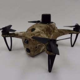
A spin-off from Embry-Riddle, Eagle Flight Research Center (EFRC), Heurobotics has created a tail-sitting VTOL. Full marks in the cool factor department. It’s big and only has a 20-minute endurance. Which well, you are an sUAS News reader I will let you decide for yourself. It is being pitched at the yet to be proven Ag market. […]
|
 |
by Press on (#2JNN4)
The Federal Aviation Administration (FAA) plans to release the first set of unmanned aircraft systems (UAS) facility maps on April 27. The maps will depict areas and altitudes near airports where UAS may operate safely. They will help drone operators improve the quality of their Part 107 airspace authorization requests and will help the FAA […]
|
 |
by Press on (#2JNDJ)
Yuneec APV launched live stream capabilities for its Breeze “Flying Camera†drone. Users can now live stream to Facebook, YouTube, or your preferred output, making the product even more convenient than before. Whether users are interacting in real-time with their followers, sharing the game-winning play or connecting with their friends and family abroad, Breeze lets them tell their […]
|
 |
by Press on (#2JN14)
General Atomics Aeronautical Systems, Inc. (GA‑ASI), a leading manufacturer of Remotely Piloted Aircraft (RPA) systems, radars, and electro-optic and related mission systems solutions, today announced the successful airborne demonstration of a Radar Warning Receiver (RWR) on a GA-ASI Predator® B/MQ-9 Reaper® Block 5 aircraft. The company-owned Predator B operated from GA-ASI’s Gray Butte Flight Operations […]
|
 |
by Press on (#2JM82)
Terra Drone Corporation’s ground-breaking innovations captured attention at Queensland’s Myriad Festival, with founder and CEO Toru Tokushige outlining the company’s vision for growth in the Sunshine State. Held at the Brisbane Powerhouse from March 29-31, the landmark tech and innovation event established for “creators, connectors and collaborators†attracted more than 2,000 attendees, with the support […]
|
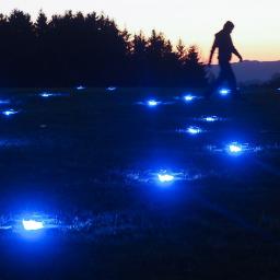 |
by Press on (#2JM3C)
Lady Gaga, Justin Timberlake and the Red Hot Chili Peppers are among the superstars who’ve been booked for Rock in Rio 2017, one of the world’s largest annual rock music events. And this year, in addition to the class acts on stage, the entertainment lineup also includes a Rock in Rio premiere: a drone show […]
|
 |
by Press on (#2JKP8)
UAVAir, the UK’s leading CAA approved drone training academy, is tackling the question that is on everyone’s minds – should drones be left to the professionals? As the drone industry reaches a regulatory ‘tipping point’, with proposals of stricter safety rules and tests for all drone owners, many are left wondering what the future might […]
|
 |
by Press on (#2JJEX)
Beck’s, the largest family-owned retail seed company in the United States, announced today a collaboration with Indiana State University to train pilots to operate Unmanned Aerial Vehicles (UAVs) within the new legal structure established by the Federal Aviation Administration (FAA). Under the partnership, Beck’s will have 50 pilots FAA certified to assist customers with scouting […]
|
 |
by Press on (#2JGNG)
All drone operators in the USA would do well to read Jonathan Rupprecht’s latest missive, I will be sure to ask him all about it on Tuesday 21:00 GMT on our YouTube channel. Depending on the type of TFR, you can get punished in three different ways for a TFR violation: (1) you can be […]
|
|
by Gary Mortimer on (#2JE8C)
Do not drone over these new FAA restrictions, they have warned you! My first thought was that security levels have been upped in response to recent events in Syria. A FAA spokesman reached out to sUAS News and said, “The FAA and DoD have been working for several months on an agreement to put these […]
|
 |
by Press on (#2JE4F)
Construction professionals understand that daily visualisation of a job site helps minimise construction delays, prevent clashes between as-built and as design, eliminate the need for rework, facilitate stakeholder communication and align schedules. But how can they achieve this? Within one complete solution combining hardware and software, the Pix4D Crane Camera enables BIM and Project Managers […]
|
 |
by Press on (#2JDYZ)
DEA General Aviation company, Germany’s RotorSchmiede returns to AERO Friedrichshafen, the global show for general aviation this week (5th to 8th April) hard on the heels of the first flight of its single-seat, ultra light Co-axial VA115 helicopter. On March 27th, 2017 the fully instrumented VA115 prototype (D-MPVA) successfully demonstrated its agility and precision during […]
|
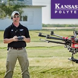 |
by Press on (#2JDQE)
SALINA — The nationally ranked unmanned aircraft systems program on Kansas State University’s Polytechnic Campus is taking its Part 107 preparation course on the road and heading south. Designed to help professionals successfully complete the Federal Aviation Administration’s new remote pilot in command certification, Kansas State Polytechnic is offering a UAS commercial pilot training course […]
|
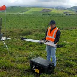 |
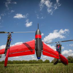
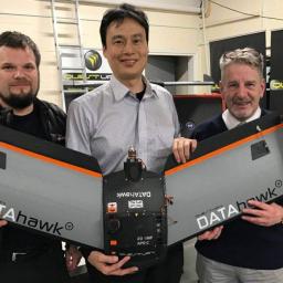
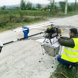
by Press on (#2JDMM)
One of QuestUAV’s research partners has been running a series of test flights with a 2kg fixed-wing DATAhawk in the Andes, for cadastral mapping and the calculation of municipal taxes. The following case study is the result of trial flights to evaluate the performance of the DATAhawk aircraft at heights above 3000m ASL. Read on […]
|
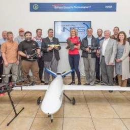 |
by Press on (#2JCV5)
Henderson, NV) Praxis Aerospace Concepts International (PACI) has expanded their services from commercial to federal and signed a Cooperative Research and Development Agreement (CRADA) with the Nevada National Security Site’s (NNSS) management and operating contractor, National Security Technologies (NSTec). With this CRADA, PACI has added a new division within that can handle federal accounts and […]
|
 |
by Press on (#2JCT3)
Award winning short “At the End of the Cul-De-Sac†entirely filmed with a drone – in one shot NEW YORK, April 5, 2017— A short film, heralded by TIME Magazine as one of the 6 Most Innovative Drone Films of the Year, premieres today as a Vimeo Staff Pick. Directed by Paul Trillo and produced […]
|
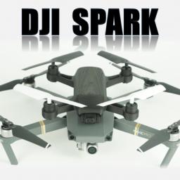 |
by Gary Mortimer on (#2JB5Y)
It’s not out yet and it has been copied! Or should I say the DJI Spark has been studied and a fairly accurate sizing model made! Well done that man, for me you have won the drone internet today! If you want to read the how to, it’s here. You can even download and print […]
|
 |
by Gary Mortimer on (#2JB3V)
In January the FAA gave us a total number of, 20488 active Part 107 Remote Pilots. By the beginning of April, that number had risen above 30k. The rise is not as rapid as some might have thought. Two data points are not enough though, the year’s tally will be revealing. Patrick Egan quite rightly suggests […]
|
 |
by Press on (#2JAZG)
Laserpas, an international Remotely Piloted Airborne System (RPAS) operator, has announced the completion of its first project in Romania. The company’s unmanned system was used to survey 308 kilometres of power lines. The project team discovered 50 kilometres of undocumented lines and other inaccuracies in data, as well as various security threats. Working for […]
|
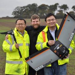 |
by Press on (#2JAE8)
Roctech- Topcon, QuestUAV’s Chinese reseller recently surveyed the Yanqing District, located North West of Beijing, China as part of a UAV demonstration. The team used QuestUAV’s Q-100 DATAhawk drone to survey the area and processed their images using the Pix4DMapper software. About Roctech-Topcon Beijing Topcon Business & Trade (BTBT) are a Positioning Business, which uses high-precision […]
|
 |
by Press on (#2J9ZH)
Liz Stalford, a commercial multi-engine, seaplane and instructor pilot with extensive experience in both military and commercial unmanned aerial systems, has been named FAA UAS Warm Springs Test Range Manager by Tribally owned Eagle Tech Systems. Stalford has worked on both manned and unmanned aircraft, equipped with multispectral HD sensors (cameras) for situational awareness by […]
|
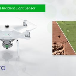 |
by Press on (#2J8VG)
Sentera today launched updates to its Incident Light Sensor (ILS) for use on NDVI-Upgraded DJI Phantom 4, Phantom 3, and Inspire drones. For several years, research customers have used the Sentera ILS to measure the color spectrum of incident light from the sun. Now these capabilities have been seamlessly integrated into Sentera’s sensors and AgVault […]
|
 |
by Press on (#2J8RP)
Goebler-Hirthmotoren GmbH & Co. KG (Hirth Motors) has been working with MartinUAV on a new propulsion system for their V-BAT transitional vertical take-off and landing (VTOL) to improve operational endurance and to add heavy fuel capability. MartinUAV successfully flew this new gasoline engine on February 28th and demonstrated hover and transitioned to horizontal flight. The […]
|
 |
by Press on (#2J8RR)
Luck Stone, the construction aggregate division of Richmond-based Luck Companies, plans to accelerate its growth in Unmanned Aircraft Vehicle (UAV) technology through a new partnership with Airware, a leading national and global provider of commercial enterprise solutions for capturing and analysing aerial data. As an early adopter of UAV technology, Luck Stone now owns a […]
|
 |
by Press on (#2J80F)
Flyability has been awarded most innovative technology by the bulk storage industry during the Storage Tank Awards ceremony organized by Tank Storage Magazine in the context of the StocExpo Europe tradeshow. Swiss-Based drone company Flyability has been awarded most innovative technology by a panel of judges from across the sector for its collision-tolerant drone. Flyability […]
|
 |
by Gary Mortimer on (#2J7Y6)
Oh dear, another platform that is at least a year behind the crowd. A snappy name as well, the PD6E2000 – AW – CJ1. I believe, and the name would suggest it, that this is a Pro Drones platform. So not really a Canon drone as is being reported elsewhere but a drone Canon has bought […]
|
 |
by Press on (#2J7EX)
We are looking for a technically skilled Business Developer to join our growing team in San Francisco. Pix4D is a producer of internationally renowned software products that are making drone mapping for professionals more powerful and accessible than ever. As part of our team, you will support the sales team dedicated to B2B sales and […]
|
 |
by Press on (#2J7CB)
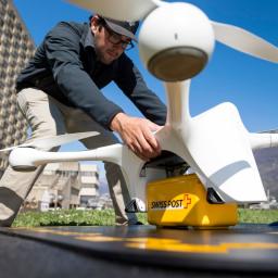
Since mid-March, Swiss Post, the Ticino EOC hospital group and drone manufacturer Matternet have been successfully conducting initial drone flights in Lugano. In the future, modern delivery drones will transport laboratory samples between two EOC hospitals. Now, the Federal Office for Civil Aviation (FOCA) has given the project the green light. The idea of a […]
|
 |
by Press on (#2J76V)
The BCN Drone Center and Arabian Gulf University have organised the 1st edition of the UAV Remote Sensing & Photogrammetry Course exclusively for the GCC region: United Arab Emirates, Qatar, Bahrain, Kuwait, Oman and Kingdom of Saudi Arabia. During two weeks, a set of distinguished speakers have presented multiple use cases centred around business and society. […]
|
 |
by Press on (#2J74T)
Temporary assignment is available immediately – completion date December 2017 Job Summary The UAS (Unmanned Aircraft Systems) Program Coordinator is responsible for providing program support and assists with the management of AOPA’s initiatives to grow the drone pilot community. The coordinator must be able to communicate and collaborate with internal and external stakeholders including AOPA […]
|
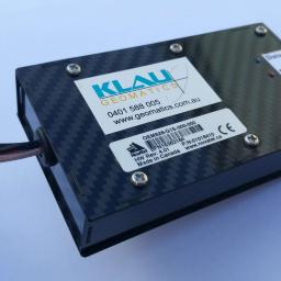 |
by Press on (#2J73P)
Klau Geomatics, an innovative Australian technology company, has announced a new PPK system for the DJI Matrice100. Support for other DJI models will be added progressively in the near future. The DJI implementation continues from the success of the system in enabling a wide variety of manned aircraft and drones to become precise survey grade […]
|
 |
by Press on (#2J515)
Shield AI, a San Diego based startup whose mission is to save lives with artificially intelligent systems, has raised $10.5M in a Series A round led by Andreesen Horowitz. The funding will be used to accelerate the development and deployment of artificially intelligent products that will protect service members and innocent civilians on the battlefield. […]
|
 |
by Press on (#2J517)
DroneDeploy, the leading drone data platform for businesses, is now connected with the John Deere Operations Center. Just in time for the critical spring planting season, the integration allows users to synchronise their DroneDeploy and MyJohnDeere™ accounts to view and analyse drone-generated field maps in combination with other important crop data in Operations Center. Individual […]
|
 |
by Press on (#2J3CN)
Europe’s only rotary and fixed-wing UAV (Unmanned Aerial Vehicle) provider UMS SKELDAR has appointed Axel Cavalli-Björkman as the new CEO effective from 1 June 2017. Axel Cavalli-Björkman joins UMS SKELDAR – the Swedish-Swiss joint venture between Saab AB and UMS AERO Group – as CEO from his role as Vice President, Head of Tactical Solutions […]
|
 |
by Gary Mortimer on (#2J36T)
Makers of the popular brand of MAVLINK and DJI compatible drone ADS-B, uAvionix, have released a Remote Identification white paper. Expect ADS-B and surrounding technology to be a hot topic in the next 18 months. Whilst opening the recent FAA UAS Symposium, FAA Administrator Michael Huerta announced a new Aviation Rulemaking Committee (ARC) on Remote […]
|
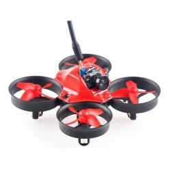 |
by Press on (#2J23E)
Aerix Drones announced the release of the new Nano FPV Indoor Drone Racing Package. This “Tiny-Whoop†inspired set includes everything you need to start enjoying the thrill and excitement of drone racing in your home. The ready-to-race (RTR) drones are safe to fly indoors, but fast enough to be seriously fun The Nano’s rotors are […]
|
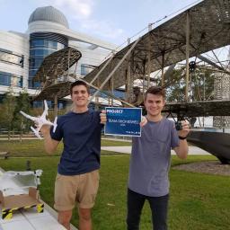 |
by Press on (#2J1QH)
Project Arduino, now in its fourth year, challenges engineering students to use their skills to create a Thales-inspired Arduino based concept and video. After an extremely tough competition this year, the name of the winning team was announced live on YouTube and Sina Weibo. This year Project Arduino was bigger than ever before, 47 universities […]
|
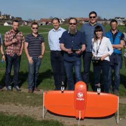 |
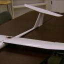
by Press on (#2J158)
Wingtra has announced that the WingtraOne is now available in Europe. WingtraOne successfully completed its beta program, and the company is now launching the finalised product. The WingtraOne will be available in China from May 2017 and from April 10th they are visiting the US to meet with our future distribution partners. Wingtra believes that […]
|