Story 2014-07-11 3QD QGIS versus ArcMap

QGIS versus ArcMap

by
in ask on (#3QD)
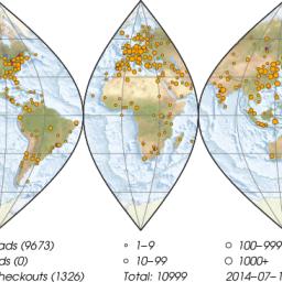
story imageThe QGIS Project released the latest 2.4 version of their free and open source QGIS geospatial information system software a week or so ago (codename Chugiak). The 2.4 changelog lists a number of new features that indicate the QGIS software is increasing in data analysis and map composing sophistication, i.e., moving beyond its traditional strength as a geospatial data management interface. One new feature that seems especially exciting is the multi-threaded rendering which allows users to continue to interact with the map views while re-rendering of the map is ongoing.

Anyway, I've been using QGIS almost exclusively in my own research for the past five years or more -- although I have been preparing final figures and maps using Generic Mapping Tools scripts because of perceived limitations with previous iterations of the Map Compositor functionality in QGIS. However, my place of work and many of my colleagues continue to use the commericial ArcGIS suite of software for GIS and Map preparation tasks and so, out of necessity, I am constantly switching back and forth between the two.

I remain convinced that for many people's workflows, QGIS is a hugely competitive product because it is free and supports a wide range of GIS activities. QGIS functions are only getting more numerous and sophisticated with time.

I thought I would take the 2.4 release of QGIS as an opportunity to ask the Pipedot community if they had any ongoing experience switching from ArcGIS to QGIS or supporting both platforms concurrently? As well, what points of comparison would Pipedot contributors emphasize in considering the QGIS versus ArcMap question? Thanks!
Reply 5 comments

ArcGIS vs. Qgis (Score: 2, Informative)

by Anonymous Coward on 2014-07-12 19:13 (#2FF)

I think they're both great programs but they're both flawed, too.

ArcGIS is better organized. The geoprocessing toolbox is well set up, and the search function makes it simple to find what you need quickly even if you don't know where it is. It has more users as well, so when you search for how to do something you're much more likely to find your question already answered. Its the industry standard so pretty much every GIS professional is going to know how to use it. Like I said though, it has its flaws. Its slow. It crashes and freezes way more frequently than any modern program should. This isn't just my install either, everyone I know who uses it feels the same way. Its like an old version of word. Save frequently or risk losing work. The license server bullshit is ridiculous. (I really can't stress enough how much of a pain in the ass that can be. For a program that costs as much as ArcGIS it should be flawless.) It is also absurdly expensive. The base package is expensive, and if you really want to have a fully functioning program you need to have a full license which is really absurdly expensive.

QGIS on the other hand is free, doesn't have that license server overhead, and I feel it is a bit snappier and more responsive than ArcGIS. It also doesn't crash or freeze anywhere near as often. ( I won't say never but I can't think of any time it has crashed on me.) Every new version comes closer and closer to matching ArcGIS in the number of things it can do and its ease of use. 2.2 really took a big leap forward, I think. (I'm still on 2.2, haven't switched to 2.4 yet.) It still isn't organized as well as it could be though. They've got all of the native tools under either raster or vector, which is nice, but they're aren't many native tools. The rest are under processing -> toolbox and then organized by which subprogram they're from (GRASS, SAGA, etc). It would be best if they just put everything under the raster or vector tabs and made which subprogram they're from transparent. That being said, as of 2.2 you no longer have to be able to work with GRASS' absolutely byzantine data model in order to use its tools which is awesome. Its really just how things are organized and documented at this point. If they continue to integrate everything and organize it a bit better they'll really have one hell of a program. I already prefer QGIS over ArcGIS for much of my work.

If you've already got ArcGIS bought and paid for they're is no reason not to run both. QGIS is free, so use it where it works better. If you haven't already paid for ArcGIS, hold off until there is something you're sure you need it to do that you can't do in QGIS. QGIS is really as ready for prime time as ArcGIS at this point and a hell of a lot cheaper to run and setup.

Cheers,
-WW

As a side note, I can login, and I have, but it doesn't seem to recognize that I've logged in on most of the site, which is a pain. I don't know why.

Re: ArcGIS vs. Qgis (Score: 1)

by rocks@pipedot.org on 2014-07-13 00:03 (#2FY)

@WW, Thanks for taking the time to type this thoughtful response... I thought your point about organization of functions in ArcGIS being better than in QGIS is spot on and I hadn't really thought about it before -- this is exactly the kind of insight I was looking for, so thanks. You are right, the ArcGIS Toolbox is a great interface for finding tools and it will be interesting to see how QGIS tackles this as the prebuilt functionality increases... there is also the growing plugin community for ArcGIS which adds great features after the fact as well.

Been too long (Score: 1)

by zafiro17@pipedot.org on 2014-07-12 20:46 (#2FM)

I used Arcview pretty intensively back in 2000-2001 when my work machine was running Win2000 and my home machine Win98. I remember it being pretty intensive on the hardware, overly complex, and I sensed the company was trying desperately to lean the world towards proprietary data formats a la AutoCAD (how could they resist? AutoCAD's format domination is hard to resist). I also didn't learn it well enough to be able to claim any sort of mastery of it.

Shortly after - I was on SUSE Linux by then, and looking around for counterparts to the apps I'd gotten used to using - I discovered QGIS through something like Freshmeat, I think (which is why I'm still nostalgic for that place). I contacted the lead developer and asked to join as a volunteer document writer guy, and they took me on. Then I got too busy to be of much use, and bailed out. I got a sense the project was extremely well-run and headed for greatness, but was going to bump up against the proprietary data formats and jealously guarded import/export routines that most open source programs face.

Nowadays I'm convinced we desperately need open mapping data. When you have famous peoples' homes disappearing off of Google maps, the writing is on the wall for the limits of corporate-owned data.

Re: Been too long (Score: 1, Informative)

by Anonymous Coward on 2014-07-12 22:13 (#2FQ)

ArcGIS does have a proprietary .gdb (geodatabase) format but it really isn't used for data sharing so that doesn't seem to be a huge deal. Shapefiles are an open well documented format and lots of data is shared that way. There are lots of other open ways to share data as well, such as GeoJSON. I really don't feel that proprietary data formats and import/export problems are holding QGIS back. I believe it relies on OGR to do a lot of its data conversions and that can work with just about everything.

If its large amounts of open data you're looking for then head over to OSM.org. They use they're own format that doesn't interact to well with anything else, but it is open.

Cheers,
-WW

Re: Been too long (Score: 1)

by rocks@pipedot.org on 2014-07-13 00:08 (#2FZ)

The ESRI geodatabase format does add a lot of automatic triggering and linking behaviour that gets lost with shapefiles though... I know that the spatialite format was gaining a lot of traction in the opensource GIS world for a portable geodatabase format and ESRI was resisting implementing it as an import/export format as recently as a year ago (I haven't looked into it more recently than that). I am just glad that the ESRI file geodatabase format is now relatively easy to use with ogr, QGIS, and other open source GIS tools.