Google Maps unveils its first-ever augmented reality interface
by Sam Machkovech from Ars Technica - All content on (#3PQJ1)
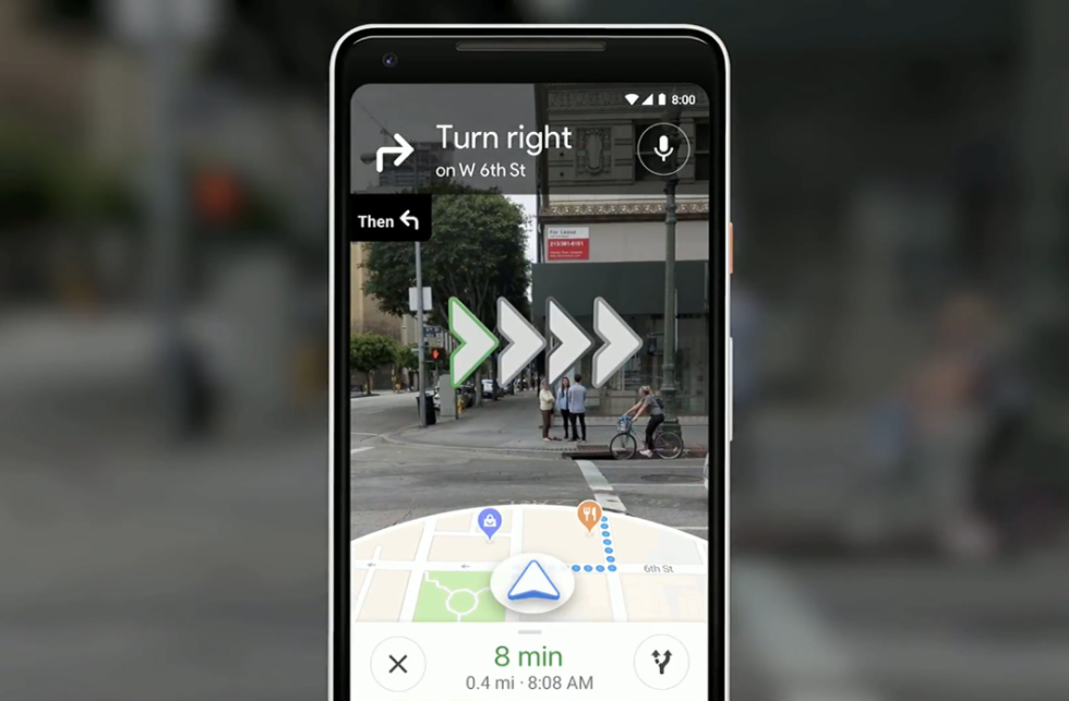
Google used its Tuesday I/O keynote to unveil a pretty killer new feature that may one day come to Google Maps: camera-assisted walking navigation.
"Here's how it could-will look like," Google VP Aparna Chennapragada told the I/O crowd when unveiling a sample interface that combines Google Maps' 2D interface with the view from your smartphone's camera lens. A small semisphere of map data appeared at the bottom of the interface, while the camera perspective included bold images of where to turn and go-and floating panels that show information about businesses in your direct view.
Read 3 remaining paragraphs | Comments