Declassified photos from U2 planes are helping archaeologists unlock the past

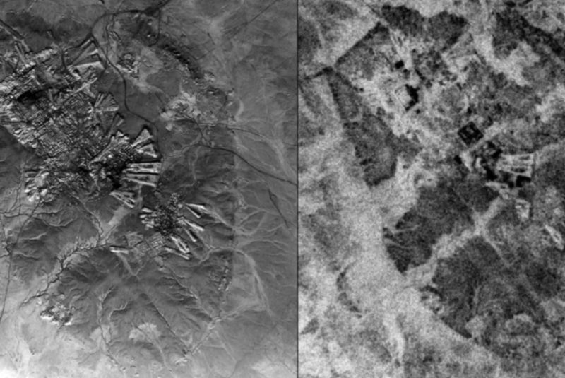
Enlarge / Comparison of the resolution of U2 aerial photography (left) over Ur, Iraq, from October 30, 1959, versus CORONA satellite imagery (right) taken May 4, 1968. (credit: E. Hammer and J. Ur)
During the 1950s and 1960s, US spy planes made regular flights across Europe, Central Asia, and the Middle East, photographing the terrain to track military targets. A chunk of the Middle Eastern photographs were declassified in 1997, and now those airborne images are helping archaeologists track changing features in the landscape that in many cases are no longer visible today, according to a new paper published in Advances in Archaeological Practice.
Co-author Emily Hammer is a landscape archaeologist at the University of Pennsylvania, meaning she studies how humans in the past were organized with respect to their environment and landscape: where people were living, where their roads were, where their irrigation canals were, and so forth. But it's not always possible to see more large-scale features on the ground, so aerial photos and satellite imagery are a critical tool for landscape archaeologists.
"It's like an impressionist's painting," said Hammer, in that there is no discernible pattern when viewed up close. "Just like stepping back from the blobs of paint on an Impressionist painting reveals the full picture, [aerial and satellite imagery] lets you stand back and see larger patterns that tell us about how humans relate to their environment in the past."
Read 9 remaining paragraphs | Comments