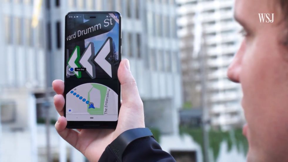
Google Maps AR Navigation comes to iPhones and Android devices

Google Maps AR, in action. [credit: The Wall Street Journal ]
Google Maps is finally rolling out its augmented reality walking navigation to a wider audience. The feature was announced at Google I/O 2018 (yes, '18), entered private testing in February, and launched for Pixel phones at Google I/O 2019. Now, regular people will have access to AR navigation, as the feature is launching in beta on Android devices and iPhones.
The AR navigation feature is called "Live View," and it's meant to help kick off your walking navigation. GPS is great for pinning your location on a map, but nothing about GPS determines which direction you are facing. To help with this, phones have built-in compasses, which are supposed to nail down your heading, but mobile compasses, especially in Android phones, kind of suck. Compasses work by detecting the Earth's magnetic field, and while that is fine when you have a regular analog compass, building a compass into a smartphone means surrounding it with electronics and several actual magnets, which can make an accurate reading tough to obtain. When you're walking out of the Starbucks and just want to know if your first step is to the left or right, watching your compass helplessly spin around in a circle is not helpful.
So Google Maps Live View throws all that compass stuff out the window and instead handles directional heading with cameras and sensors. Google calls the system "VPS," or "Visual Positioning System." Your phone's GPS narrows down your location, you point your camera at the world, and Google matches the camera footage to the plethora of visual data it has from things like Street View. This gives VPS your position and heading in 3D space, assuming Google has the data for your location. And that makes it a lot more accurate than a compass.
Read 2 remaining paragraphs | Comments