Turn-by-turntables: How drivers got from point A to point B in the early 1900s

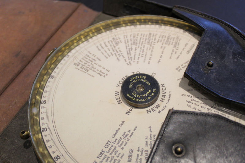
Enlarge / The Jones Live Map was an early 20th century attempt at turn-by-turn navigation. (credit: Seal Cove Auto Museum)
It's easy to take modern GPS navigation for granted; it's no longer a novelty. Not only is it offered on the dashboard of your car, it's on every smartphone in everyone's purse or pocket. But if you think in-car navigation systems started with Garmin in 1991, guess again.
The more savvy amateur car historians might think in-car navigation began with the Etak Navigator. The brainchild of engineer Stan Honey and financier Nolan Bushnell (the cofounder of Atari), Etak was launched in 1985 without use of the US Military's Global Positioning System-the addition of GPS wouldn't happen for another decade. Yet Etak paved the way for the systems that followed, using digitized maps stored on cassette tapes since they could resist a bumpy car ride or the heat of a car interior on a hot day. Information was posted on a vector-based CRT screen. Each tape held 3.5MB of map data. A windshield-mounted electronic compass mated to wheel sensors to determine the vehicle's speed and direction. Two models were offered: the 700, with a 7-inch screen for $1,595, and the 450, with a 4.5-inch screen for $1,395. Map cassettes cost $35 each. Initially offered only with San Francisco-area maps, Etak soon offered other major metro areas, with installation provided by local car stereo and cell phone shops.
Initially successful, sales inevitably slumped. In 1989, Etak was purchased by News Corporation for $25 million, followed by Sony Corporation and others before being absorbed into Tom Tom.
Read 27 remaining paragraphs | Comments