There’s a big hurricane headed toward Texas, and it’s a nightmare forecast

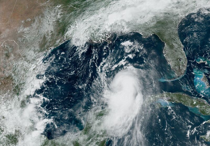
Enlarge / Satellite image of Hurricane Laura at 1pm ET on Tuesday as it crosses the Gulf of Mexico. (credit: NOAA)
It seems increasingly likely that Hurricane Laura will continue to intensify on Tuesday and Wednesday before making landfall along the upper Texas coast, or possibly southwestern Louisiana, early on Thursday.
Of all the many named storms in 2020-and we are on the "L" storm already with the early September peak of the Atlantic hurricane season still looming-this one has the potential to wreak the most widespread devastation yet. This is because Laura will likely become a major hurricane before landfall, reaching Category 3 status, and could potentially strike the populous Houston metro area.
That happens to be where I live, in a home about 15 miles from the coast. And as a meteorologist, all I can think is here we go again. Just three years ago to this very date, Hurricane Harvey brought record flooding to the Houston community and its surrounding areas. It became the worst flood storm in US history.
Read 10 remaining paragraphs | Comments