Google promises “spectacular” city GPS improvement with 3D building data

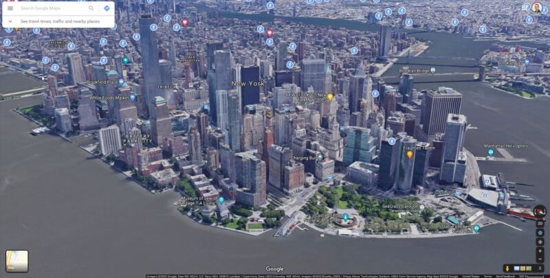
Enlarge / It's pretty hard getting line-of-sight to several GPS satellites down there. (credit: Google Maps)
Getting a solid GPS location in a city can be tough thanks to all the tall buildings. Skyscrapers reflect the GPS signal and can make your location data go crazy, but now, Google says it can correct for this and give users a much more accurate location. Google is working on an update that will leverage Google Maps' 3D building data to calculate how buildings interfere with GPS, and it says Android's new "3D mapping aided corrections module" can correct for GPS bounces.
A quick refresher on how GPS works: your position is triangulated by satellites in space. Your phone receives a signal from a GPS satellite, consisting of the position of the satellite and a very precise timestamp. The GPS time stamp tells the phone how long the signal took to reach you from space, and then you just multiply that by the speed of light to get your distance from the satellite. If you get a signal like this from multiple satellites, you can narrow down your position on Earth to a few feet.
All of these fancy space calculations work great, provided you have an open view of the sky. GPS triangulation assumes your signals are taking a straight shot from the satellite to your phone, but that's not always the case. In a city, giant glass-and-metal skyscrapers can reflect the GPS signal on its way down from space. If your GPS signal includes a ricochet, your "time x speed-of-light" equation suddenly doesn't equal your distance from the satellite, a leg of your triangulation triangle is longer than it should be, and your GPS coordinates aren't accurate anymore. This can mean your location is suddenly on the wrong side of the street-or the wrong block.
Read 4 remaining paragraphs | Comments