We’re entering a pretty strong El Niño—here’s what that means for a US winter

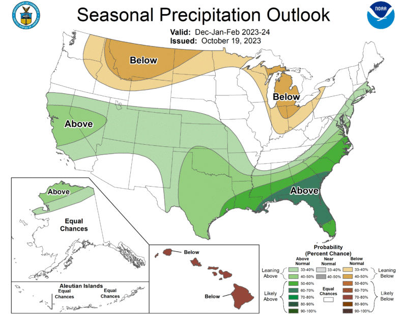
Enlarge / The 2023-2024 US Winter Outlook map for precipitation. (credit: NOAA)
As its name implies, the jet stream is essentially a river of fast-moving air in the atmosphere at about the altitude where airplanes fly. It is typically a few hundred miles across, and jets can indeed save a lot of fuel if they can fly within this air current, generally from west to east.
Jet streams also have significant implications for our weather on the ground, as they more or less steer storm systems that affect the mid-latitudes. That is, they in large part determine whether parts of the United States-which lies almost entirely in the mid-latitudes between the tropics and poles in the Northern Hemisphere-will see stormy or serene weather.
As always with weather, the situation is complex. But one of the more useful signals in a forecaster's arsenal is the El Nino-Southern Oscillation in the tropical Pacific Ocean, which vacillates between warmer sea surface temperatures (El Nino), cooler ones (La Nina), and neutral conditions. This broad pattern has widespread weather implications, including the location of the jet stream.