Key questions about Hurricane Irma on Saturday
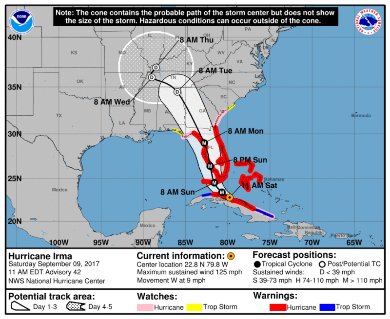
Enlarge / Saturday, 11am ET official forecast track for Hurricane Irma. (credit: National Hurricane Center)
Note, this story was updated at 11am ET on Saturday with key forecast data. The questions highlighted below remain unanswered.
As of Saturday morning, Hurricane Irma is moving westward, with its center just inland over the northern coast of Cuba. It is nearing the western periphery of a ridge of high pressure, which should force it into a northwest turn soon. Although the forecast models have been struggling with precisely when this turn is likely to occur, we have pretty high confidence it will turn west-northwest later today, and then northwest tonight. The Florida Keys will be hit very hard later today and Sunday.
The more westward track over Cuba has weakened the storm's maximum winds to 125mph, and additional weakening is possible before Irma moves back into the Straits of Florida later today or tonight. This movement will also keep the center of Irma away from the greater Miami area, sparing the heavily populated southeastern coast of Florida from the worst effects of winds and storm surge. Hurricane force wind gusts are still likely, but they will probably not cause widespread damage in Miami.
Read 9 remaining paragraphs | Comments