Apple Maps gains airport maps for O‘Hare and several others
As part of iOS 11, Apple announced plans to add airport and mall interiors to its Maps app. A few early examples of that rolled out earlier this year, but now the airport lineup has greatly expanded. New airports are already available in the app.
Oakland International (OAK), Miami International (MIA), Minneapolis-St. Paul International (MSP), Baltimore-Washington International (BWI), Portland International (PDX), and McCarran International in Las Vegas (LAS), as well as two airports in Chicago-O'Hare International (ORD) and Midway International (MDW)-have been added. These are in addition to San Jose International (SJC) and Philadelphia International (PHL), which were in beta versions of iOS 11.
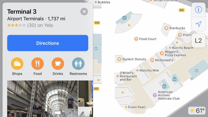
When you find an airport on the map, you'll see indicators for each terminal. Tapping a specific terminal will zoom you in to a view of that terminal's floor plan, with markers representing various stores and shops, as well as gate numbers and security checkpoints. Markers for restaurants and shops can be tapped for more information. The airports are searchable, too.
Read 2 remaining paragraphs | Comments