ICESat-2 successfully starts lasering Earth, telling us about it
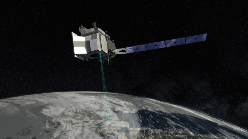
Enlarge / That's no moon-it's an artist's conception of ICESat-2 in orbit. (credit: NASA)
On September 15, NASA's ICESat-2 satellite left Earth on the last Delta II rocket. Happily, the satellite is providing a successful send-off to the Delta II, as it has started its important mission without incident. On Wednesday, NASA showed off the first data beamed down: measurements of Antarctica's glacial ice.
Like its predecessor, ICESat-2 is a laser altimeter that can very precisely map surface elevations. These satellites were designed with changing surface elevations in mind-chiefly the declining sea ice and ice sheets of the polar regions. The original ICESat had a seven-year run that ended in 2010. Without ICESat-2 ready to go, NASA turned to similar instruments onboard planes to collect what data they could in the meantime-an intensive project titled Operation IceBridge.
Compared to some other Earth-observing satellites, the principle at work here is pretty simple, though the engineering that makes it work is approximately miraculous. The satellite shines a laser pulse at the Earth and measures how long it takes to reflect back. Do the math (speed of light and all that) and you have the distance between the satellite and the ground. With precise knowledge of the satellite's position, you can map surface elevation around the globe in great detail.
Read 4 remaining paragraphs | Comments