Just in time, a trough arrives to pull Dorian away from Florida

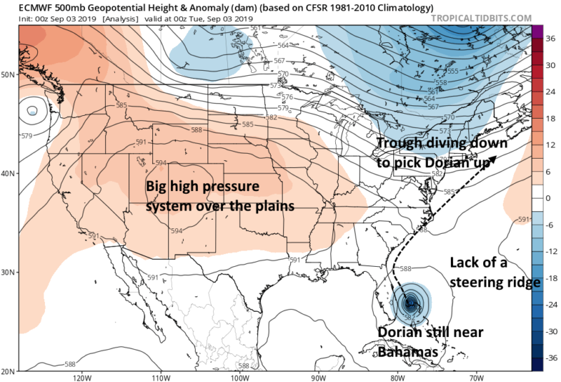
Enlarge / This annotated map shows some of the steering currents that will guide Dorian north this week. (credit: Tropical Tidbits/Ars Technica)
Hurricane Dorian has absolutely battered the Northern Bahamas over Labor Day weekend, bringing fierce Category-5 winds, devastating storm surge, and up to 30 inches of rainfall. The storm's westward movement began to stall out late on Saturday, as a ridge of high pressure over the Atlantic began to break down. In the absence of any steering currents, Dorian pounded the tiny islands ceaselessly on Sunday and Monday.
Now this upper-atmosphere weather pattern is beginning to change, and, albeit slowly, Dorian is beginning to turn northwest away from The Bahamas and toward the Continental United States. At 11am ET Tuesday, it was moving 2mph to the northwest, according to the National Hurricane Center.
It has been unclear for days how close Dorian would get to Florida and the rest of the United States, but now it seems likely that a trough of low pressure moving across the upper Midwest and northeastern United States will be strong enough, and fast enough, to keep Dorian away from the Sunshine State. We still have downstream concerns about the Carolinas, however.
Read 5 remaining paragraphs | Comments