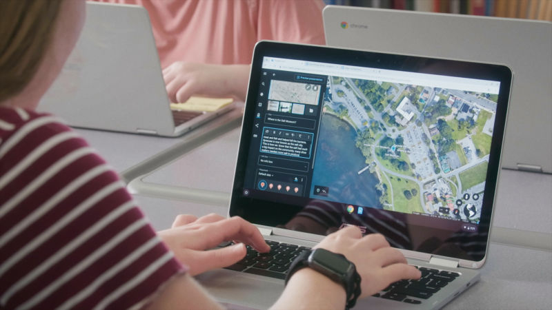
Google Earth gets content creation tools for geography-focused presentations

Enlarge / A Google Earth presentation in action. (credit: Google)
Google Earth is getting a new content creation feature set. You'll now be able to make presentations using Google's vast 3D Earth imagery and point-of-interest information. It's sort of like a geography-focused Powerpoint.
Back in 2017, Google Earth was completely rebuilt from a desktop application to a WebGL-based browser app at earth.google.com/web. Starting today, on the left side of the website, you'll see a new "Projects" button, which will let you create a presentation. Just like a Google Doc or Sheet or Slide, these Google Earth Projects get saved as files on your Google Drive.
And like a normal presentation, you can create slides and attach text, images, and videos. Since this is Google Earth, though, all the text and images get overlaid on top of Google's terabytes of Earth imagery. You can pick from Google Earth's 3D views or Street View, set the camera just right, and capture a view. As you click through slides in your presentation, Google Earth will smoothly fly from point to point as your slides pop up.
Read 1 remaining paragraphs | Comments