It’s 2020, so of course two tropical storms are coming to the Gulf of Mexico

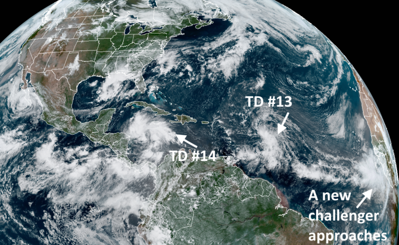
Enlarge / The African wave train has swung into motion for 2020. (credit: NOAA)
This Atlantic hurricane season has set all kinds of records. Most notably, we have already run through the "K" name, with Tropical Storm Kyle forming on August 14 off the coast of the Carolinas. This beat the earliest ever "K" storm, the highly memorable Katrina in 2005, by 10 days.
For all of the names being thrown about, however, most of these systems have been "fish storms," remaining out to sea. And only two have developed into hurricanes, Hanna and Isaias, and neither of these progressed beyond Category 1 status. Scientists use a metric called Accumulated Cyclone Energy to measure the overall activity of a season, factoring in duration and intensity of storms. By this standard, 2020 has been quite active, but not extremely so.
But now we're coming to the heart of the Atlantic hurricane season, which tends to ramp up in late August. This is when the tropical region between Africa and the Caribbean Sea typically reaches its most favorable for development with warm seas and fair winds. This allows for a "train" of storms to develop as atmospheric waves move off the western coast of Africa.
Read 4 remaining paragraphs | Comments