Texan city to deploy intelligent traffic system from Velodyne Lidar

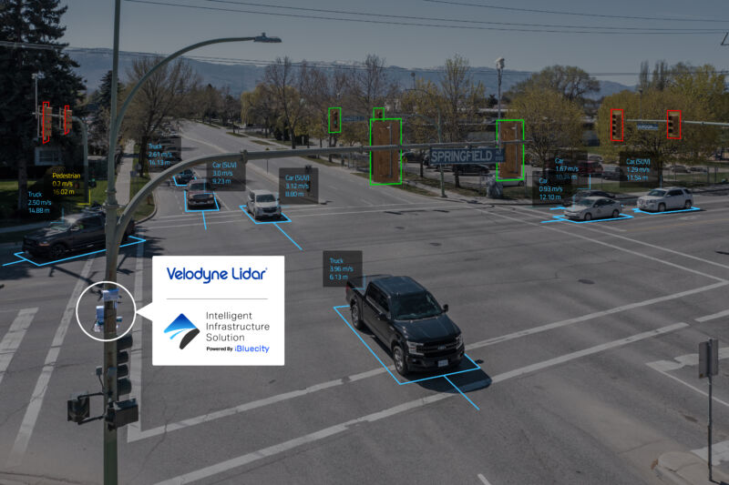
Enlarge / Velodyne lidar sensors will create a real-time 3D map of this dangerous intersection in Austin to help the city make its roads safer. (credit: Velodyne)
American roads have never been especially safe compared to those in other countries. But the pandemic made things worse, with shocking rises in crashes and deaths of both drivers and pedestrians in 2020 despite a decrease in the number of miles Americans traveled. Reducing this catastrophic casualty rate is a goal of the autonomous vehicle industry, which often cites a (probably misleading) statistic claiming that 94 percent of all fatal crashes are due to human error.
But some of the technology companies driving the AV revolution are also interested in improving traffic infrastructure. On Wednesday, Velodyne Lidar announced that it will deploy a lidar-based traffic-monitoring system to a dangerous intersection in Austin, Texas, as part of its Intelligent Infrastructure Solution.
The system will create real-time 3D maps of roads and intersections, replacing the current combination of inductive loop detectors, cameras, and radar. Velodyne has joined Nvidia's Metropolis program and will use Nvidia Jetson AGX Xavier edge processors to interpret the lidar data.
Read 2 remaining paragraphs | Comments