Google Maps brings traffic-light and stop-sign icons to navigation

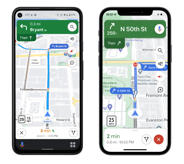
Look at all those details! Maps will show traffic lights, stop signs, and building outlines in navigation mode. (credit: Google)
It might be hard to believe, but there are still some incredibly useful features that can be added to Google Maps. The latest addition brings traffic-light and stop-sign icons to navigation mode.Traffic lights have appeared in Google Maps in some areas since 2020. Not everyone had access to them, though, and they never seemed to show up while navigating. Now, lights and stop signs will appear on everyone's routes while navigating. That should give users a better feel for how their trip will go and when they should turn. Google says many more normal map details will soon be visible in the navigation view, including building outlines and areas of interest.
While a ton of details pop up on the regular map, navigation mode previously stripped out most of them, and the spaces between roads have usually been blank. For cities with a high level of Google Maps details, you'll also start to see the specific shape and width of a road, including medians and islands.
Read 2 remaining paragraphs | Comments