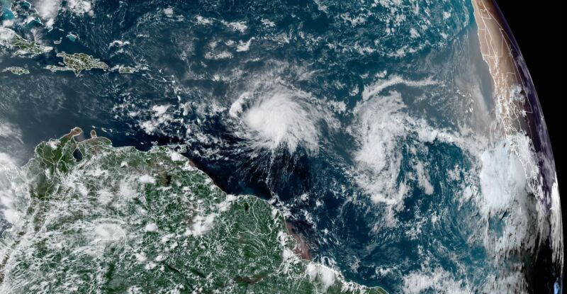
The Atlantic tropics are on fire—it already looks like August out there

Enlarge / A satellite image taken on Wednesday afternoon shows the "African wave train" out in force. (credit: NOAA)
To put it mildly, there are some extremely disturbing trends happening on planet Earth with its weather and climate right now.
For example, the thickness and extent of the Antarctic sea ice is off-the-charts low. Based on current measurements, taken near the winter solstice in the Southern Hemisphere, the sea ice extent is far below any previous year for which data is available, going back to 1981. The current extent is two standard deviations below the mean.
Closer to where I live, in Texas, the state is sweltering due to a dome of anomalously high pressure situated over northern Mexico and the southern part of the Lone Star State. This has been pushing temperatures to record highs across the state. On June 18, for example, the border town of Del Rio recorded a high of 111 Fahrenheit, smashing its old record for the day by 5.