Story 3NJ Google buys satellite imaging company Skybox for $500 million
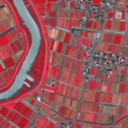
Google buys satellite imaging company Skybox for $500 million

by
in space on (#3NJ)
story imageReally cool news about a recent acquisition by Google . Skybox provides high-resolution photography from space and its imagery -- if made widely accessible -- could facilitate many new spatial-analytic studies going forward as daily time steps appear feasible with the Skybox satellite network.

From the company website is this advertisement for their startup origins: "2009, Founders wrote the first Skybox business plan as part of a Stanford graduate entrepreneurship course, Spent 6 months working out of John's living room, Secured Series A financing of $3M from Khosla Ventures, Moved into a windowless 3,000 sqft office in Palo Alto, Began to attract, court, and hire the smartest people they knew to join the vision..."
Reply 6 comments

Coastal change and flood risk assessment (Score: 1)

by rocks@pipedot.org on 2014-06-11 22:22 (#222)

Strike me as potentially good applications for this imagery.
Imagine being able to collect high resolution time slices for before and after big storms and all.

Re: Coastal change and flood risk assessment (Score: 1)

by rocks@pipedot.org on 2014-06-11 22:24 (#223)

@rocks

What a good thought sir, funny I was thinking the same thing... or is that a sense of deja vu... or self-reflection...

if a comment falls on a news aggregation sight (Score: 1)

by rocks@pipedot.org on 2014-06-11 22:25 (#224)

and nobody is there to reply...

did it really make a sound...

Re: Coastal change and flood risk assessment (Score: 2, Interesting)

by bryan@pipedot.org on 2014-06-12 02:22 (#226)

I was half-expecting that they would use their fleet of street view cards to start launching quadrocopters with aerial cameras. With satelites, even the expensive ones can only go down to a foot or so of resoultion while a fleet of quadrocopters with megapixel cameras could map every last inch of everyone's backyard.

Re: Coastal change and flood risk assessment (Score: 1)

by rocks@pipedot.org on 2014-06-12 11:52 (#22F)

That's an interesting point... I think the quadrocopter approach would have difficulty reproducing images of the whole Earth in a timely fashion, however. It could be used for longitudinal studies of specific areas though...

We are being bred for slavery (Score: -1, Troll)

by Anonymous Coward on 2014-06-11 23:22 (#225)

They are dismantling the sleeping middle class. More and more people are becoming poor. We are their cattle. We are being bred for slavery.

They are dismantling the sleeping middle class. More and more people are becoming poor. We are their cattle. We are being bred for slavery.

They are dismantling the sleeping middle class. More and more people are becoming poor. We are their cattle. We are being bred for slavery.