 |
by Press on (#3CSQ0)
SkySpecs, the leading automated infrastructure inspection company, announces an $8 million Series B financing led by Statkraft Ventures together with UL Ventures and Capital Midwest with follow-on investments from Venture Investors, Huron River Ventures and additional existing investors. Founders and Forbes 30 Under 30 honorees Danny Ellis and Tom Brady along with the SkySpecs team will use the investment to scale the company’s international operations and develop world-class inspection software […]
|
sUAS News
| Link | https://www.suasnews.com/ |
| Feed | http://www.suasnews.com/feed |
| Updated | 2026-01-28 02:45 |
 |
by Press on (#3CS7P)
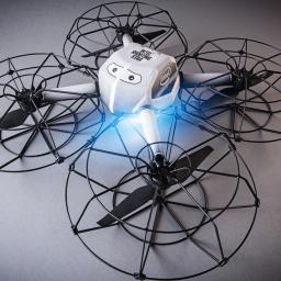
Intel is bringing the first drone light show to the Las Vegas Strip this week with nightly performances at the iconic Fountains of Bellagio during CES 2018. Audiences will experience the magic of Intel technology as a fleet of 250 Intel® Shooting Star™ drones light up the sky, integrated with the Fountains of Bellagio to […]
|
 |
by Press on (#3CS5Z)
Rich and accurate data sources will be vital for safe drone transportation In the Autonomous World, ground and airborne vehicle traffic will need coordination Soon it may not only be our roads that are congested. The growing popularity of drones, whether for recreational or commercial use, has highlighted the challenge of managing traffic in low-altitude […]
|
 |
by Press on (#3CS61)
ARE Corporation (American Rail Engineers), headquartered in Irvine, CA, has acquired Media Wing, LLC, a New England based UAV/Drone Data Collection, dba AirShark, and Video Production Company. The acquisition expands ARE’s industry-leading engineering, software development, bridge inspection services and nation-wide footprint to include unmanned flight operations, image analysis, GIS modeling and video rendering. Dave Anderson, […]
|
 |
by Press on (#3CQMH)
PTFS has officially launched Droneware™ on the Amazon Marketplace for both Hobbyist and commercial use along with a 90 day free trial. Droneware™ provides the ability for users to store, manage, and share their drone or cell phone photos and video in the Amazon Cloud, allowing them to be accessed from anywhere in the world, […]
|
 |
by Joshua Ziering on (#3CPKR)
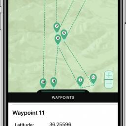
Consumer Electronics Show, LAS VEGAS – January 8, 2018 – Kittyhawk, the market leader in commercial drone operations software, today announced new features to its best-in-class platform. Kittyhawk is adding an automated flight system to its Flight Deck feature set to work in conjunction with its recently released secure live streaming feature. The new automation […]
|
 |
by Press on (#3CP57)
Companies working together to protect U.S. and allies against enemy drone threats Perth, WA and Columbia, Maryland USA: Department 13 International Ltd (ASX:D13) – a cutting edge developer of counter drone technology, is pleased to announce it has entered into a teaming agreement with Raytheon Company (NYSE: RTN), a leading technology supplier to global defense […]
|
 |
by Press on (#3CP59)
Crow1 is the civil model of the SkyStar 180 aerostat. The Crow1 aerostat will be used for civil security mission. RT LTA Systems Ltd, developer and manufacturer of aerostat systems, has recently completed the delivery of its first Crow1 aerostat system to a European customer. Crow1 is the civil model of the well-known SkyStar 180 […]
|
 |
by Gary Mortimer on (#3CP1R)
I wonder why this one missed Christmas? I don’t think it has a GPS, but some impressive sounding machine vision makes up for it. This is our lightweight future evolving. Ryze Tech, a drone start-up, has completed development of its first intelligent toy drone called the Tello, and will officially debut the new product at […]
|
 |
by Press on (#3CNXP)
Planet has again partnered with FarmShots to power a next-generation agriculture solution for Livestock Improvement Corporation (LIC). LIC’s Satellite Pasture and Cover Evaluation (SPACE™) service uses daily satellite imagery from Planet and field analysis software from FarmShots to measure pastures. We are very excited to collaborate with Farmshots on this innovative approach to pasture management. […]
|
 |
by Gary Mortimer on (#3CH9C)
Techcrunch reports that GoPro is to lay off 2-300 jobs largely in the drone section. Not quite sure how many people were working in the drones bit. Last we heard a handful of devs had been employed to start creating the Karma 2, but with no announce for this Christmas it was plain that was […]
|
 |
by Press on (#3CETE)
NEC Corporation (NEC; TSE: 6701) and Nidec Corporation (Nidec; TSE: 6594; OTC US: NJDCY) announces the successful joint development of a technology that enables highly precise, real-time remote control of Intelligent Motors (*1), motors incorporating microcomputers through a wireless network. As utilization of the Internet of Things (IoT) accelerates, there is greater need for robotic […]
|
 |
by Press on (#3CEQ5)
After a successful pilot program, Cross Texas Transmission, LLC (CTT) has engaged Think Power Solutions (Think Power) to develop a comprehensive vegetation management inspection application using Think Power’s lightweight suite of software services. Following the massive blackout that occurred in 2003 leaving over 50 million people throughout the northeastern US and parts of Canada without power for […]
|
 |
by Press on (#3CCQN)
Consortiq has not rested on its laurels over the festive period and has been busy working on rolling out several improvements to its award-winning CQNet drone management software. It has once again taken on customer feedback and added new features to better operators’ experiences, including the introduction of a first of its kind offline airspace […]
|
 |
by Press on (#3CBZX)
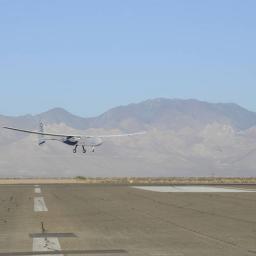
The U.S. Air Force has awarded a new $48 million contract to Aurora Flight Sciences for the continued development of the Orion Unmanned Aircraft System (UAS). Orion is a twin-engine high-performance UAS that can stay aloft over 100 hours at a time with payloads in excess of 1,000 pounds. Development of the Orion started in […]
|
 |
by Press on (#3CBY4)
Led by inventor and entrepreneur David Hall, Velodyne LiDAR – the world leader in 3D vision systems and advanced safety for autonomous vehicles – today announced a significant cost reduction for its VLP-16 Puck, which will spur hope and excitement for the development of safe autonomous vehicles that are accessible to all. Velodyne’s most popular […]
|
 |
by Gary Mortimer on (#3CBX2)
Word has reached me that Senior Vice President of Sales – Americas at Yuneec International David Morris resigned last week from Yuneec and has taken a position as a Senior Director at Intel. He will be responsible for the Falcon multirotor. Last September then Yuneec CEO Mike Khan resigned and moved to AEE technology. I believe this […]
|
 |
by Press on (#3CBVQ)
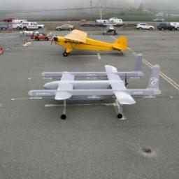
The most anticipated news in the aerospace industry each December holiday season usually involves a sleigh and some reindeer, but in 2017, even Santa has his eyes opened to Elroy Air. The team at Elroy is developing a large-format autonomous aircraft focused on shipping weights of up to 150 lbs as far as 300 miles. This intersection […]
|
 |
by Press on (#3CA41)
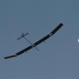
AeroVironment, Inc. (NASDAQ: AVAV), a global leader in unmanned aircraft systems (UAS) for both defense and commercial applications, today announced the formation of a joint venture to develop solar-powered high-altitude long-endurance, or HALE, UAS for commercial operations. This category of UAS is also referred to as high-altitude pseudo-satellites, or HAPS. The joint venture will fund the […]
|
 |
by Press on (#3CA0Y)
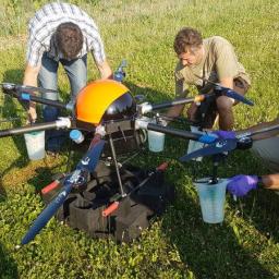
AgroFly developed – and patented – the first certified (in Switzerland, other countries pending) and assessed high-precision agricultural spraying UAV platform. Bringing the right amount of product at the right place on the crops doesn’t only protect plants efficiently but also in an eco-friendly manner. AgroFly’s target is to revolutionize plant protection treatments by bringing the right product, at […]
|
 |
by Gary Mortimer on (#3CA10)
Hands up all those that remember crowd funder Plexidrone, the Canadian quadcopter that became an octocopter. All really very good on paper, but now after multiple excuses, and three years late refunds are on the table for a lucky few. This is what the current missive from DreamQii says about the delivery situation, and excuse me […]
|
 |
by Press on (#3C9XZ)
The Property Drone Consortium (PDC), a collaboration that consists of insurance carriers, roofing industry leaders and supporting enterprises, announced today that it will sponsor and participate in the 2018 Public Safety UAS Conference to be held from March 5 – 7, 2018 in Crozet, Virginia (near Charlottesville). Charles Mondello, President of the PDC will present […]
|
 |
by Press on (#3C9TQ)
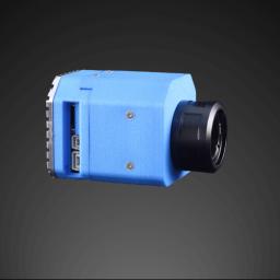
Designed for FLIR Tau 2 core range as well as FLIR UAS products (Vue Pro / R series), ThermalCapture IRnet brings Ethernet/IP to drone thermal imaging payloads. Since nothing satisfying was existing on a super lightweight base, TeAx today presents the leading solution to an increasingly global market request. WILNSDORF, Germany, 3rd January 2018 – TeAx Technology, an […]
|
 |
by Press on (#3C71A)
BELLEVILLE, Mich. – The International Drone Racing Association (IDRA) has announced that it has condensed its liability insurance for drone pilots into a single policy that has no drone limit, no deductibles, and maintains the worldwide coverage that has greatly benefited IDRA members. Starting January 1st, drone pilots can purchase the $1 million policy for […]
|
 |
by Press on (#3C6YX)
COPTRZ, the UK-based commercial drone specialist, has today announced the release of DRONE-FLX, an industry-first leasing solution that provides a cost-effective way for businesses and public bodies to enjoy the benefits of the latest drone technology. With costs spread over a three-year period, the latest drone hardware can be bundled with training and software to […]
|
 |
by Press on (#3C6SN)
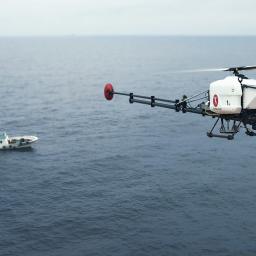
The Laurel Marine Survey team and Flying-Cam team announce the successful acceptance testing of the Flying-Cam Air Mag Survey Platform. The Flying-Cam SARAH e 4.0 unmanned helicopter was operated in automatic mode from a ship and scanned an area of 40Ha in the Eastern Chinese sea. The magnetic data showed exceptional quality: high precision Cesium […]
|
 |
by Gary Mortimer on (#3C6SQ)
Air traffic controllers are being corralled into the same building, no longer left to roam free and drink tea in that glass bit at the top of the tower. I do wonder if virtual towers will decrease local knowledge. If you are driving through the countryside in which aircraft get themselves lost to get to work […]
|
 |
by Press on (#3C6QK)
SALINA — Unmanned aircraft systems, more commonly known as drones, are popular gifts over the holiday season and a widespread hobby for flying enthusiasts. Many systems are sold and marketed as ready to fly; however, it is important that consumers are up-to-date with important regulations and safety practices. Kansas State Polytechnic is offering a free […]
|
 |
by Joshua Ziering on (#3BZW3)
It’s been a big year for the commercial drone industry. 2017 marks the first full year of FAA’s part 107 operators license being available. There are over 70,000 pilots flying commercially in all sort of applications. In fact, even the type applications opened up significantly. We saw the first “Flights Over People†waiver issued (Congrats […]
|
 |
by Press on (#3BXWP)
We build autonomous aircraft systems to deliver goods to the world’s most remote places. Our autonomous aircraft systems feature rotor-based vertical takeoff and landing (VTOL) and fixed-wing cruise flight with a hybrid powertrain for long range. We have designed a logistics system with integrated flight and ground operations that make our vehicles a safe, reliable, […]
|
 |
by Press on (#3BXTC)
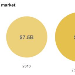
SolarDrone, established from the laboratory of National Taiwan University, teamed up with experts in photovoltaic and UAV technologies to tackle the enduring problem of drone flight time. The product will be showcased at CES2018 Eureka Startup Marketplace (booth#52105), where some of the newest technology trends are featured. SolarDrone’s solar-powered quadcopters have been re-designed, re-engineered, and […]
|
 |
by Gary Mortimer on (#3BVTN)
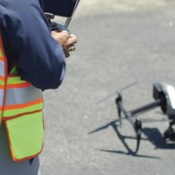
I am somewhat humbled at the response today after my bath based rant of last night. Thank you all those that have emailed to say that you keep reading and are in agreement! So there is a feeling that the best days are over out there as corporate greed comes to take away innovation! Noise […]
|
 |
by Press on (#3BVNM)
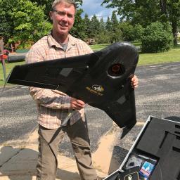
The N.C. Department of Transportation’s Division of Aviation is bringing back its popular series of drone workshops for 2018. In 2017, over 500 attendees at four free workshops learned about drone flight operations, data management and dozens of various applications for government and commercial users. Presenters also provided updates on the latest changes in federal […]
|
 |
by Press on (#3BV9A)
The USDA Forest Service and Michigan Technological University (MTech) are using unmanned aerial systems, or drones, to advise the Hiawatha National Forest’s land management efforts. Located in Michigan’s wild and scenic Upper Peninsula, the Hiawatha National Forest’s dramatic shorelines lie nestled up to Lake Superior, Huron, and Michigan – three of the five Great Lakes. This past summer, the Federal […]
|
 |
by Gary Mortimer on (#3BS58)
I have just jumped out of the bath to jot down some notes before today’s email goes out. A place holder if you will. What has prompted my disd ain? Some absolutely ridiculous forecasts for 2018 that I have just read whilst in the bath! President Trumps drone integration program is not going to make […]
|
 |
by Gary Mortimer on (#3BQY1)
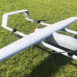
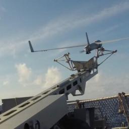
Off the shelf, hobby priced SLT’s I think this one will be popular, looking forward to the reviews. If you want an autopilot that can fly it easily don’t forget the Ardupilot Quadplane stack is the leader of the pack (and its free). The power train for this will not be cheap, I still struggle […]
|
 |
by Press on (#3BP31)
Ballard Power Systems (NASDAQ: BLDP; TSX: BLDP) today announced that the company has developed a next generation high performance fuel cell propulsion system to power unmanned aerial vehicles (UAVs) or drones. Ballard has also received a follow-on contract from Insitu, a Boeing subsidiary, for extended durability testing of the next-generation 1.3 kilowatt (kW) fuel cell […]
|
 |
by Press on (#3BP33)
Quaternium, a leading European brand of long-endurance multirotors, has flown for 4 hours and 40 minutes with their HYBRiX.20 fuel-electric quadcopter. They believe that this flight time beats any former demonstration ever made with an electric, hybrid of hydrogen multicopter HYBRiX.20 RPA was designed by Quaternium in 2014 and its first model was built in […]
|
 |
by Press on (#3BFMT)
Aireon enters 2018 with almost two-thirds of its operational space-based ADS-B system completed and receiving over 6 billion ADS-B position messages each month Aireon announced today the successful fourth launch and deployment of its space-based Automatic Dependent Surveillance-Broadcast (ADS-B) payloads hosted onboard the Iridium® NEXT satellite constellation. At 5:27 PM PST, a flight-proven SpaceX Falcon 9 […]
|
 |
by Press on (#3BFKG)
Insta360 today released the beta for Insta360 Pro V2.0, a package of major firmware and software upgrades for the Insta360 Pro, its industry-leading, pro-level 360° VR camera. Adding 12K super high-resolution photos, important improvements to image quality, and a range of new features, the update cements the Insta360 Pro’s status as the premier tool for […]
|
 |
by Press on (#3BEE6)
Mothership Aeronautics is using autonomous solar-powered blimps to disrupt long-distance aerial data collection. Mothership Aeronautics has raised a seed round of USD $1.45 Million to build and deploy its new TerraSoar Aerial Intelligence Airship. The round was led by Shatter Tech Venture Holdings and included Silicon Valley VC Draper Associates and Manila-based accelerator Cerebro Labs. […]
|
 |
by Press on (#3BEE8)
Salary range: circa. £80k + Share Options + Car Allowance (dep. on experience) Benefits: Pension, Perkbox, flexible working, training opportunities, and more! Location: Reading, Berkshire (UK) Reporting to: COO Altitude Angel is seeking an experienced Sales Director to join our growing company and based at our new headquarters in Reading, Berkshire. As Sales Director, you’ll manage our team of […]
|
 |
by Gary Mortimer on (#3BD6S)
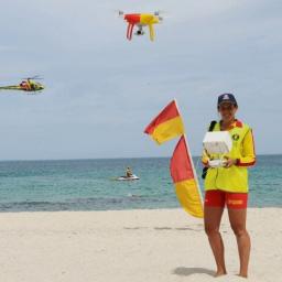
Surf Life Saving New South Wales Australia this week commenced RPA operational trials at 9 locations, using DJI P4P’s & M600’s and machine learning algorithms which analyse live video and generate an alert whenever it identifies a shark. Twenty seven Volunteer life savers and forty three professional life guards have cross trained to become RPA […]
|
 |
by Press on (#3BD5E)
The International Drone Racing Association (IDRA) has announced a new partnership with Heroes Dutch Comic Con for the 2018 Drone Racing Series. The IDRA will hold the first race of the professional series at the Jaarbeurs in Utrecht, Netherlands, during Heroes Dutch Comic Con on March 31st & April 1, 2018. Tickets will be available […]
|
 |
by Press on (#3BCYE)
Eight international teams have registered for DroneClash, the first counter drone competition in the world. During this competition the teams use their highly sophisticated drone(s) to take down as many other drones as possible, RobotWars in the sky as it were. Teams need to bring at least two drones per battle, but they can use […]
|
 |
by Press on (#3BA1S)
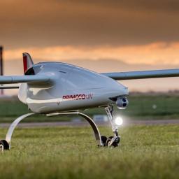
Czech company Primoco UAV SE, which develops, manufactures and sells the unmanned aircraft Primoco UAV One 100/150 soared to a sky high finish in 2017. “When I look at the results of the whole year, I consider the development, certification and contracts for the first sales of our aircraft in Russia and Malaysia to be a […]
|
 |
by Press on (#3BA1V)
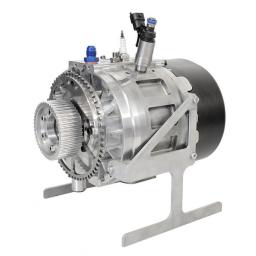
3W-International exhibited the new 3W-180 SRE hybrid Wankel engine at this year’s Xponential early in the summer of 2017. After half a year, CEO Karsten Schudt draws a positive balance relative to the new engine. The 3W-180 SRE hybrid is unique in the drive technology for UASs. The engine features 180 ccm and a short-engine […]
|
 |
by Press on (#3BA1X)
DJI, the world’s leader in civilian drones and aerial imaging technology, is introducing a knowledge quiz this Friday for all pilots who are operating drones in the UK airspace. The test comes prior to government plans to introduce a safety awareness test for drone users in 2018. A recent survey carried out by the Civil Aviation Authority (CAA) revealed […]
|
 |
by Press on (#3BA1Y)
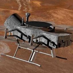
NASA has selected two finalist concepts for a robotic mission planned to launch in the mid-2020s: a comet sample return mission and a drone-like rotorcraft that would explore potential landing sites on Saturn’s largest moon, Titan. The agency announced the concepts Wednesday, following an extensive and competitive peer review process. The concepts were chosen from […]
|
 |
by Press on (#3B7BM)
A man has been jailed for five years today after being convicted of flying drones carrying £35,000 worth of drugs and contraband items into prison grounds. Michael Tovey, 28, was found guilty of using two drones to transport quantities of cannabis and psychoactive drugs, mobile phones, phone chargers, SIM cards and needles into the grounds […]
|