 |
by Press on (#3ZSEM)
Drone safety systems company, ParaZero Israel Ltd (ASX: PRZ), welcomed today the publication of the new standard for sUAS (small Unmanned Aerial Systems) parachutes. This is a significant step forward for the commercial drone industry. The new ASTM standard, also known as F3322, defines the requirements for the design, manufacturing and testing of sUAS parachute […]
|
sUAS News
| Link | https://www.suasnews.com/ |
| Feed | http://www.suasnews.com/feed |
| Updated | 2026-07-22 03:45 |
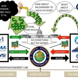 |
by Patrick Egan on (#3ZRP7)
The RC hobbyist has been abandoned and ultimately disenfranchised by a system and Federal Aviation Administration that has proven itself to be ineffectual in safely integrating UAS into the National Airspace System. Airmap, AMA, AUVSI, Amazon, DJI, Google, PrecisionHawk, et al. are apparently more interested in moving product and denying reality than in safeguarding the […]
|
 |
by Press on (#3ZQW8)
The Nations first U.S. Department of Labor Certified Unmanned Aerial Systems Apprenticeship Program launched on September 26 2018 in Dallas, Texas. A collaboration between the U.S. Department of Labor, FAA Southwest Regional Office, RMS Aerospace and Dallas County Community College District, the 12-month apprenticeship is the most comprehensive professional UAS training program outside the military. […]
|
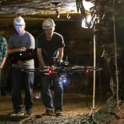 |
by Press on (#3ZQWA)
PITTSBURGH–A team from Carnegie Mellon University will compete in the systems track of the Defense Advanced Research Projects Agency Subterranean Challenge, a multi-year robotics competition with a $2 million prize in which robots will autonomously search tunnels, caves and underground structures. The Carnegie Mellon team, including a key member from Oregon State University, is one […]
|
 |
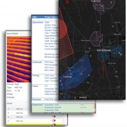
by Press on (#3ZQQG)
Infrastructure inspection applications include bridges, dams, tunnels, buildings, utilities such as power lines, wind turbines, cell towers, and more. The inspection industry is on path to become a $15B+ industry by 2025. More and more new tech adopters are utilizing UAV for inspection as an alternative to conventional methods for increased efficiency and higher safety. […]
|
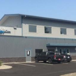 |
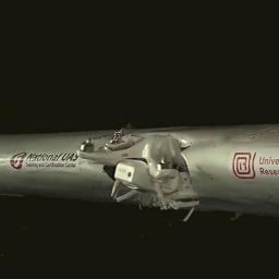
by Press on (#3ZQ9P)
Orbital Corporation Ltd (‘Orbital UAV’, ‘the Company’) has celebrated the official opening of its purpose-built operational facility in Hood River, Oregon, USA. This significant milestone marks the next step in the Company’s UAV-focused strategy, providing a base in the heart of the growing U.S. tactical unmanned aerial vehicle (UAV) market. The U.S. site offers a second […]
|
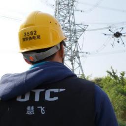 |
by Press on (#3ZNDC)
Empowering professionals and businesses in Europe to embrace drone technology DJI, the world’s leader in civilian drones and aerial imaging technology, has launched the UTC (Unmanned Aerial Systems Training Center) in Europe. The programme is designed to provide individual and commercial drone operators with professional training in the classroom and in the field. The European […]
|
 |
by Press on (#3ZN8X)
Speaking before an audience of aviation and military experts assembled at the National Press Club in Washington, D.C., Bell Helicopter, a Textron Inc. (NYSE: TXT) company, today unveiled the Bell V-247 Vigilant tiltrotor. The Bell V-247 tiltrotor is an unmanned aerial system (UAS) that will combine the vertical lift capability of a helicopter with the speed […]
|
 |
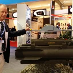
by Press on (#3ZN8Z)
MyDefence is developing next-generation anti-drone technology, which among other things include closer integration into soldiers existing equipment, so they can mitigate the threat of drones more effectively. Innovation Fund Denmark invests 425,000 USD (362,000 EUR) in the project, which will secure that MyDefence can continue the further development of anti-drone technology. Although commercial drones have […]
|
 |
by Press on (#3ZN91)
20% of men would fly without a pilot, compared to 6% of women 200,000 new pilots needed over the next decade and up to 790,000 needed in 20 years-time Advances in technology and artificial intelligence make commercial pilotless aircraft and the greater use of just one pilot inevitable More routes will be cancelled, and some […]
|
 |
by Press on (#3ZN1S)
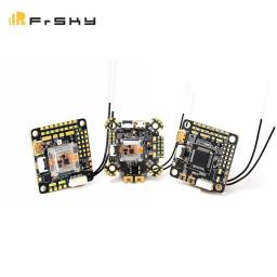
The FrSky RXSR-FC (OMNIBUS F4 V6) uses the MPU6000 over SPI for the stable flight performance. It is integrated with the RXSR receiver in onboard damping box, also onboard are a barometer and AB7456 OSD chip for the Betaflight integrated OSD. The RXSR-FC (OMNIBUS F4 V6) supports 3-6s Lipo direct input, and has 5 hardware […]
|
 |
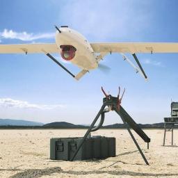
by Press on (#3ZMR0)
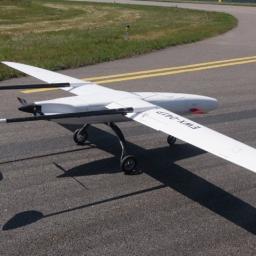
UAVOS Inc. has completed a series of test flights of a new Sitaria fixed-wing UAV. The new UAV is designed for patrol and observation missions, for aerial photography of terrain area with a radius of up to 120 km. Among other tasks, the unmanned aircraft is purposely designed to work with the LIDAR airborne laser […]
|
 |
by Press on (#3ZMKC)
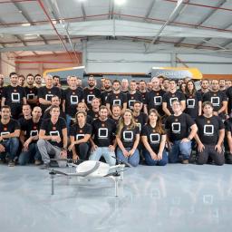
Leading Israeli automated drone startup Airobotics today launched its North American headquarters in Scottsdale, Arizona, where they will run all North America, South America and Central America operations. Airobotics has created the only data-driven, fully automated solution enabling a new dimension of data collection and insights. The company is headquartered in Israel and has offices […]
|
 |
by Patrick Egan on (#3ZKH7)
Including my tenure as Silicon Valley Chapter President (A Nostalgic Retrospective) When I took over the Silicon Valley chapter, it was about 5 or 6 people sitting around voting on what type of pizza we wanted for the next meeting. The only perk on the deal was that we would meet at the flight ops […]
|
 |
by Press on (#3ZKH9)
uAvionix Corporation, developers of the world’s smallest, lightest and most affordable ADS-B transceivers and transponders, today announced the release of its 1090nano, a 1090MHz ADS-B single chip solution for Unmanned Aircraft Systems (UAS) ADS-B transceivers and detect and avoid (DAA) applications. In early 2017, uAvionix introduced its T-UAT, a dime-sized 978MHz single chip which has become the cornerstone for all of […]
|
 |
by Press on (#3ZKHB)
IoT sensors detect unauthorized drone flights for military bases, venues, cities, enterprises, correctional facilities, and more. AT&T* and Dedrone, a San Francisco-based drone detection technology startup, are teaming up on a drone detection solution that helps protect military bases, venues, cities, and businesses, from malicious drones. As drones become more prominent, so does the misuse of […]
|
 |
by Press on (#3ZKC5)
New software, flight simulation technology and long-endurance aircraft keep Embry-Riddle the leader in UAS Training and Education DAYTONA BEACH, Fla. – Inside Embry-Riddle Aeronautical University’s Unmanned Aircraft Systems (UAS) Training Laboratory at the Daytona Beach Campus, new, cutting-edge flight simulation technology and software is being installed, assuring that the lab remains one of the most advanced unmanned […]
|
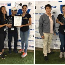 |
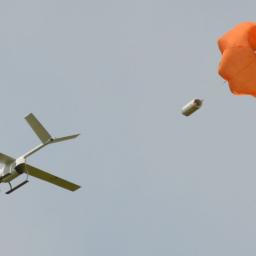
by Press on (#3ZJH8)
Day 3 of UAV Challenge Week saw the completion of the Queensland Government Airborne Delivery Challenge. The event was partially delayed yesterday due to bad weather but today was a beautiful day, from start to finish. The last six teams down the running order took to the field at 7.30am in ideal conditions. In the […]
|
 |
by Press on (#3ZG4S)
DJI, the world’s leader in civilian drones and image stabilization systems, has appointed French aerial photographer and film director Yann Arthus-Bertrand as DJI Master. For the first time ever, the legendary artist decided to deploy DJI drone and cinematic camera technology while shooting the film “Woman.†The DJI Inspire 2 drone with a Zenmuse X7 […]
|
 |
by Press on (#3ZFR9)
A quest to count vulnerable Australian sea lion pups using a remotely piloted aircraft (RPA) in the Great Australian Bight Commonwealth Marine Reserve has produced the most precise population survey to date. The trial RPA-based monitoring technique funded through the Australian Government and involving RPA consultancy Global Unmanned Systems and local Natural Resources Eyre Peninsula […]
|
 |
by Patrick Egan on (#3ZENB)
Are you people crazy? One thing that has become commonplace in what I will call “the integration routine.†The routine gets played every time the FAA needs to stall for a few years. It’s a bait and switch where the FAA pulls the prom date routine on the droners. They tell the collective mark how […]
|
 |
by Press on (#3ZDB1)
The Air Traffic Management – eXploration (ATM-X) project will transform the air traffic management system to safely accommodate the growing demand of new air vehicles to enter the airspace to perform a variety of missions. ATM-X also works on technologies to allow the traditional large commercial aircraft to fly more user-preferred routes with improved predictability, […]
|
 |
by Press on (#3ZBWR)
Exciting things are happening in the air above the Autobahn in Germany, where construction giant, Strabag utilized a Microdrones mdMapper1000DG for corridor mapping, Beyond Visual Line of Site (BVLOS). Microdrones was able to meet the German requirements for conducting BVLOS in uncontrolled airspace. In Germany, BVLOS is possible thanks to a unique relationship between Deutsche Telekom and […]
|
 |
by Press on (#3ZADJ)
By Pamela Gregg, Communication Administrator, UDRI Tests performed at the University of Dayton Research Institute show that bigger may not always be better in contests between manned aircraft and UAVs. When a large military helicopter collided midair with a small quadcopter last year, the helicopter sustained only minor damage and returned safely home; the drone […]
|
 |
by Press on (#3ZADM)
Precision XYZ, the only drone service provider focused exclusively on the solar sector, will formally launch and demo next week at Solar Power International (SPI). Former SunEdison executive Mark Culpepper and current Managing Partner will also present on IOT and mapping at the leading solar conference from September 24-27 in Anaheim, Calif. Almost two years […]
|
 |
by Gary Mortimer on (#3Z92M)
The commercial RPAS market is beginning to shake and settle. Twitter user @Dronenerder stated that staff have been let go this week. (Update 18:40 GMT) Earlier I reported that 40 people had been laid off, PrecisionHawk has since stated it was less but are unable to confirm the exact number) Lia Reich VP marketing and […]
|
 |
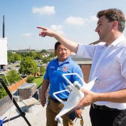
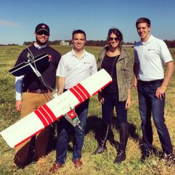
by Press on (#3Z8XW)
Aerospace Cornwall announced today it has partnered with Drone operator UAVAid to launch the first UAS flight from Cornwall Airport Newquay at a capability event in May 2019. UAVAid will showcase its humanitarian Hansard drone platform at the event, the first UAS flight from Cornwall Airport Newquay. This UK developed drone is designed to fundamentally improve the way aid agencies can respond to […]
|
 |
by Press on (#3Z8M9)
Every year the Theresienwiese in Munich is transformed into the largest public festival in the world for two weeks. The Oktoberfest attracts between 5 and 6 million visitors every year. So many people in a public place also place special tasks on the security authorities and emergency forces. The use of drones at such major […]
|
 |
by Press on (#3Z8DS)
Many industries have realized that they need better measurement data than what traditional photogrammetry provides. High-quality models and maps can be produced quickly and more affordably than when compared to manual methods. This workshop is designed to familiarize you in how to use the latest drone light detection and ranging (LiDAR) mapping technology to collect, […]
|
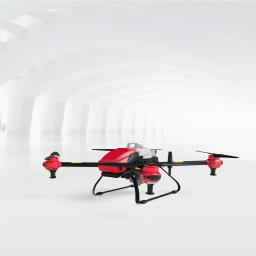 |
by Press on (#3Z8AZ)
Xinjiang China – XAG initiates large-scale cotton defoliation operation a second consecutive year, calling for over 1000 plant protection teams and 3000 units of P series plant protection UAS from across the country to join. The mission of this operation is to help cotton farmers increasing production and income, as well as improving the overall […]
|
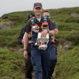 |
by Press on (#3Z80Z)
New Standards, Tactics And Protocols Will Help Save More Lives With Drones September 20, 2018 – Search and rescue teams found simulated victims faster when they used drones for help, a new study released today finds. The study concludes that drones offer enormous potential to help search and rescue (SAR) efforts, and rescue squads need to […]
|
 |
by Patrick Egan on (#3Z7YG)
Good news! The days of getting the waiver run around and or spending countless hours on the Internet for UASIO names and contact are over. This represents an ongoing effort being made by the sUAS News to help educate the public and drone end-user. Integrating UAS into the NAS and the only surefire way of […]
|
 |
by Gary Mortimer on (#3Z6CQ)
Jetoptera and GE Aviation have agreed to jointly demonstrate a 500-pound-force (lbf) class Fluidic Propulsion System TM leveraging a gas generator based on GE Aviation’s H-Series turboprop engine. This is the first step towards a fully customized gas generator which will lead to a Jetoptera 500 VTOL full flight demonstrator. Jetoptera’s revolutionary Fluidic Propulsion System is a remarkably simple approach to producing […]
|
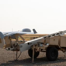 |
by Press on (#3Z5ZV)
Surrounded by a crowd of defence journalists at the Air Force Association’s annual Air, Space and Cyber Conference, Insitu leadership today announced Integrator Extended Range, a beyond line of sight, SATCOM-enabled small UAS capable of ranging modern combat theatres. The system delivers Group 4 and 5 capabilities in a Group 3 aircraft including: Extended range operations […]
|
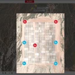 |
by Press on (#3Z5ZX)
Dedrone is excited to release DroneTracker 3.5, the drone detection industry’s response to understanding airspace activity and ensuring that protected sites are aware of all drone activity overhead, whether it be a single or orchestrated drone incursion. Drone swarms, or more than three drones in a single area, have been demonstrated in action in modern military […]
|
 |
by Gary Mortimer on (#3Z5FV)
DroneShield has today released an ASX announcement with regards to the U.S. Regulator approving a $3.2m order for 70 DroneGunsTM. The announcement is as follows: U.S. regulator has granted an approval for the sale of 70 DroneGun TacticalTM units for use by a Middle Eastern Ministry of Defence, as announced in June 2018. Deposit for the order […]
|
 |
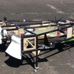
by Press on (#3Z3P5)
Hybrid Project LLC and Lucint Systems, Inc. are pleased to announce the successful test flying and excellent data gathering capabilities of a HP2 airframe carrying a Lucint12 Vision camera. Over multiple flights, the aircraft/sensor combination consistently mapped 400 acres (1.6 km²) in roughly 20 minutes, with 1 in (2.5 cm) resolution, while staying under the […]
|
 |
by Press on (#3Z3P7)
On November 1st 2018, Pix4D opens a new R&D office in Madrid. It is the company’s fifth office after Lausanne, San Francisco, Shanghai and Berlin. As a centre of innovation, research and development, Pix4D Madrid will continue to expand and develop Pix4D’s knowledge of photogrammetry and machine learning, with the goal of creating an entirely […]
|
 |
by Press on (#3Z3P9)
As Sensofusion continues to increase its worldwide user base with AIRFENCE, a counter-drone solution being used to protect armed forces, police, airports, prisons, and national guards, the company is unveiling its latest version. AIRFENCE 6.0 dramatically improves and upgrades Sensofusion’s capabilities to detect and safely negate dangerous and potentially life-threatening situations caused by rogue drones. Sensofusion has […]
|
 |
by Press on (#3Z3V2)
Virginia Tech collaboration with State Farm helps secure FAA waiver for drone operations over populated areas in states impacted by Hurricane Florence Insurer working with Mid-Atlantic Aviation Partnership as member of the FAA Integration Pilot Program on research to expand safe drone operations September 19, 2018 — State Farm has been granted a first-of-its-kind waiver for drone […]
|
 |
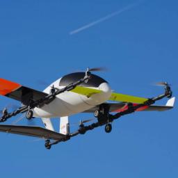
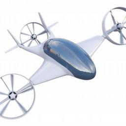
by Press on (#3Z3BF)
Aim is to demonstrate VTOL and hover flight for the Fluidic Propulsion System Jetoptera, Inc. has successfully commenced the VTOL test campaign of their proprietary Fluidic Propulsion System™ (FPS). A test bed of more than 50 kg (110 lbs) equipped with a new vectoring-capable version of the FPS design demonstrated in flight earlier in the […]
|
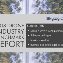 |
by Colin Snow on (#3Z257)
2018 study examines commercial and public sector growth, market share of major UAV and software brands, and refutes industry hyperbole REDWOOD CITY, CA, September 18, 2018 — Skylogic Research, LLC, the leading research and advisory services firm for the commercial drone industry and owner of Drone Analyst®, today announced the release of its third annual 2018 Drone […]
|
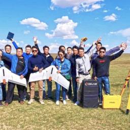 |
by Press on (#3Z1JA)
TOULOUSE, France and TIANJIN, China – September 18, 2018 – Delair, a leading global supplier of commercial drone solutions, today announced the opening of its first office in China. Based in Beijing, Delair will use it as a base to increase its presence in the rapidly expanding Chinese market and expand its network of local distributors. The office […]
|
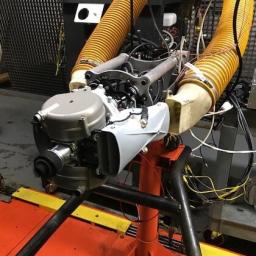 |
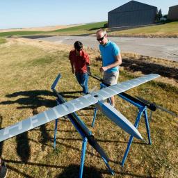
by Press on (#3Z1JC)
Northwest UAV has taken their newest engine – the NW-88 multi-fuel twin-cylinder UAV engine – from concept to running prototype with a successful test run in their on-site engine test cell. This marks the conclusion of the design phase of development and begins the test and qualification phase. Based on these successful initial test runs, […]
|
 |
by Press on (#3Z1DH)
Expert on Drone Security And Integration Will Support Drone Users’ Interests DJI, the world’s leader in civilian drones and aerial imaging technology, has hired aviation policy expert David Hansell as Public Policy Manager, helping guide the development of drone laws and regulations to ensure they help America take full advantage of the benefits of drones. […]
|
 |
by Press on (#3Z1DJ)
Aireon LLC, developer of the world’s first space-based global air traffic surveillance service has announced that Denise Olmsted recently joined Aireon as General Counsel. Olmsted will lead corporate governance, regulatory and compliance matters and international contracts for Aireon. “Denise is going to contribute immensely to Aireon as we transition into an operational service and beyond. […]
|
 |
by Press on (#3YK1C)
By Dr. Troy Mestler, CEO, Skyfront Tuesday, September 17, 2018 Electric propulsion has changed aircraft manufacturing. The reason is simple: wires bend. Shafts and gears do not. To build a helicopter engineers no longer have to design around a long mechanical shaft and heavy, failure-prone gearbox and clutch that spin to transmit power from the […]
|
 |
by Press on (#3Z14N)
This season, third-party trials conducted by growers and in collaboration with Aker are tracking plant health and yield results for Delaro®, a new corn and soybean fungicide from Bayer. As the season progresses, comparison images show the positive plant health benefits Delaro has on crops. After applying fungicide, Aker uses high-resolution drones to capture multiple […]
|
 |
by Press on (#3Z110)
BSHARK, an expert on hydrogen-powered drone research, has partnered with MicroMultiCopter (MMC)-a manufacturer of the first hydrogen-powered drone HyDrone 1550. BSHARK released a new hydrogen-powered drone Narwhal 2. MMC provided production service for BSHARK. The new drone is an upgraded hydrogen quad-copter with LTE module and 30 km video transmission range and is available on September 16. Upgraded core components Based on […]
|
 |
by Press on (#3Z112)
The world’s most advanced autonomous device, Skydio R1, is the easiest and funnest self-flying camera you will ever use. We are seeking a self-motivated Social and Community Marketing Manager to join Skydio, a rapidly growing company combining artificial intelligence and advanced robotics to bring a revolutionary product to market. We are looking for an individual […]
|